
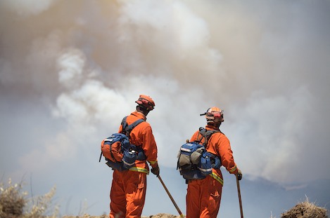
Fire Fighters Brace to Hold McKinley Ridge
Fire Crosses the Manzana, Enters New Phase

Late Sunday afternoon the leading edge of the Zaca Fire flared, burning more than a square mile of heavy brush in a bit under two hours. By this morning, reports from Forest Service officials indicate and additional 2,000 acres had burned overnight.
To a large extent, Santa Barbara residents have been sheltered from the effects of the fire. Thus far, wind patterns have moved smoke in an easterly direction away from the coast, making this an almost invisible fire. This may change today.
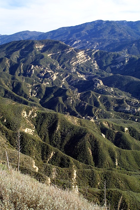
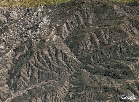
For the past week, while firefighters have concentrated resources on the west end to enable them to hold the Sisquoc River and Zaca Ridge dozer lines, on the eastern end, deep in the San Rafael Wilderness, the fire has continued to burn unchecked.
During much of the past week, flames have moved laterally across the steep south face of Hurricane Deck slowly burning through a series of narrow side canyons. Until yesterday, hand crews have been able to create enough of a break on the Deck trail to keep the fire from spreading north and heading down into the Sisquoc drainage. This has provided valuable time, allowing a network of dozer lines to be built north of the Sisquoc to protect the Tepusquet area.
However, once the fire burned past the steeper sections of the Deck and reached Lost Valley Canyon over the weekend (a mile upstream from Nira Campground) conditions began to deteriorate. The shape of a large bowl and filled with forty-year-old brush, conditions were ripe for a burnout in this area.
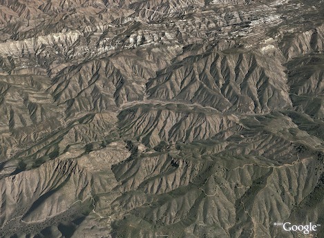
By Sunday, the fire had crossed the upper end of Lost Valley, followed a natural break in the topography into Sulphur Springs Canyon and by late afternoon, northeasterly winds caused the area between the two valleys to blow up, forcing the evacuation of all fire fighting personnel in the Nira area, including the hand crews up on the Deck.
More ominously, as the fire began to turn south and west, it began a steady advance down Lost Valley Canyon towards the Manzana, crossing it sometime in the night, placing the Santa Ynez Valley in some danger once again.
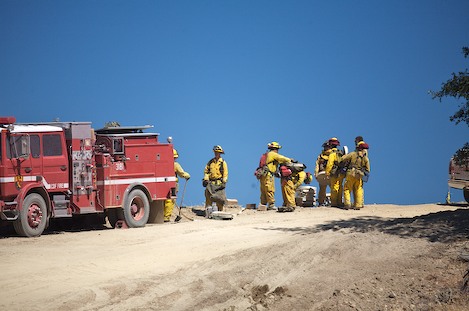
“The crews have been busy all night building additional dozer line,” Manny Madrigal, a spokesperson for the Forest Service told me. “We’ve fortified the Ranger peak area, added additional line down from McKinley Peak and build up dozer lines in the Santa Cruz Peak area as well.
“We don’t anticipate the fire crossing the McKinley Ridge but we’re prepared if it does.”
Today, every effort will be made to hold this ridge along a nine-mile stretch from Cachuma Saddle east to the wilderness boundary near San Rafael Peak. Hand crews will also be employed along Sunset Valley Road down to Davy Brown Camp in an attempt to burn out brush east of the road.
Holding the McKinley Ridge will be critical. Given the short, steep distance between the point where the fire crossed the Manzana near Fish Creek Camp and the ridge, resources are being focused here in anticipation the flames will reach the crest by the day’s end.
“This is all about defensible positions,” Eli Iskow, Public Information Officer for Santa Barbara County Fire, told me. “Once the fire crossed the Manzana near the Schoolhouse last week, there was almost no place inside the wilderness safe for firefighters.”
When I talked to Armando Rios, Battalion Chief for Cal Fire in Merced County, who is assigned to Contingency Planning, he agreed. “All of our planning is towards holding the ridgetop boundaries – which means the Sierra Madres on the north and the McKinley area on the south,” he explained. “Wilderness doesn’t give you a lot of choices.”
If there is one thing that has been extremely fortunate thus far, it has been the lack of wind. “Wind drives fire,” Iskow added. “Almost every historical fire we’ve had has been driven by the Santa Anas, making them unpredictable, intense, fast moving, and extremely dangerous.
“I’m hearing from fire fighters who’ve been working fires here for more than thirty years that things are getting very interesting. This is the thirteenth day of the fire and we haven’t had the heat or the wind you’d normally expect out of something this big.
“What you do have is brush that hasn’t burned since the mid 1960s, fuel so dry that it will burn under almost any condition. Uphill, downhill, sideway, wind or no wind – it doesn’t seem to matter – it just keeps on burning.”
Mark Monday, July 16 as the day that may turn out to be one of the most pivotal thus far as fire fighters shift towards defense of the high ground. Though Incident Command hasn’t said so publicly, it appears they are prepared to allow the interior sections of the San Rafael Wilderness to burn out.
Resources specialists seem to agree with this strategy. “Wilderness needs to burn,” one wildlife biologist commented. “There’s no other way to burn an urban wilderness than conditions such as this.”
Should the entire wilderness burn, this would multiply what is now a 20,000 acre fire by a factor of eight at a minimum – making this the largest fire in county history by size.


