
Zaca Fire Continues Its Eastward Spread
Fire Also Crosses South into Black Canyon

Over the past two days, the Zaca Fire has slowed considerably compared to the dramatic moments when the fire burst over the crest of San Rafael Mountain on Saturday night. Mostly this is due to an inversion layer that has caused higher temperatures and lower humidities but also slowed down the fire.
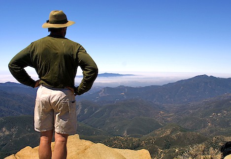
From the observation area along Highway 154 the views are dramatic. Though it is difficult to see what is happening on the far ridge near Mission Pine Basin, in the middle distances you can see the tendrils of flame slowly working their way down the steep south face of Black Canyon. Though it appears the fire is not far from the Santa Ynez Valley, topography and fuel loading favor the fire fighters should the fire continue directly south towards the Santa Ynez River.
Bull dozer lines are firmly in place, the country is more rolling hillside than thick brush-filled chaparral and winds still continue to want to move the fire eastward.
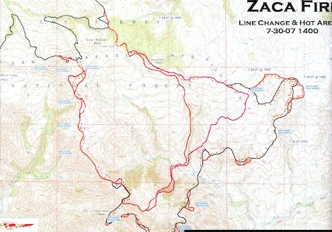
View Large Map to see a more detailed view of the fire spread. Note the fire’s path (see smaller version of the map above) almost directly follows the north and south boundaries of the West Fork Canyon. The “flame” symbols note areas of active burning. Initially the spread was more to the south but as it came up against the Santa Cruz ridgeline it began to turn more to the east but with sloop overs into Black Canyon which is off this map and to the south.
Though the smoke and occasional flare-ups provide lots of chatter at the observation point, in reality, what is happening on the fire line much further up the canyon will determine how things go over the next few days.
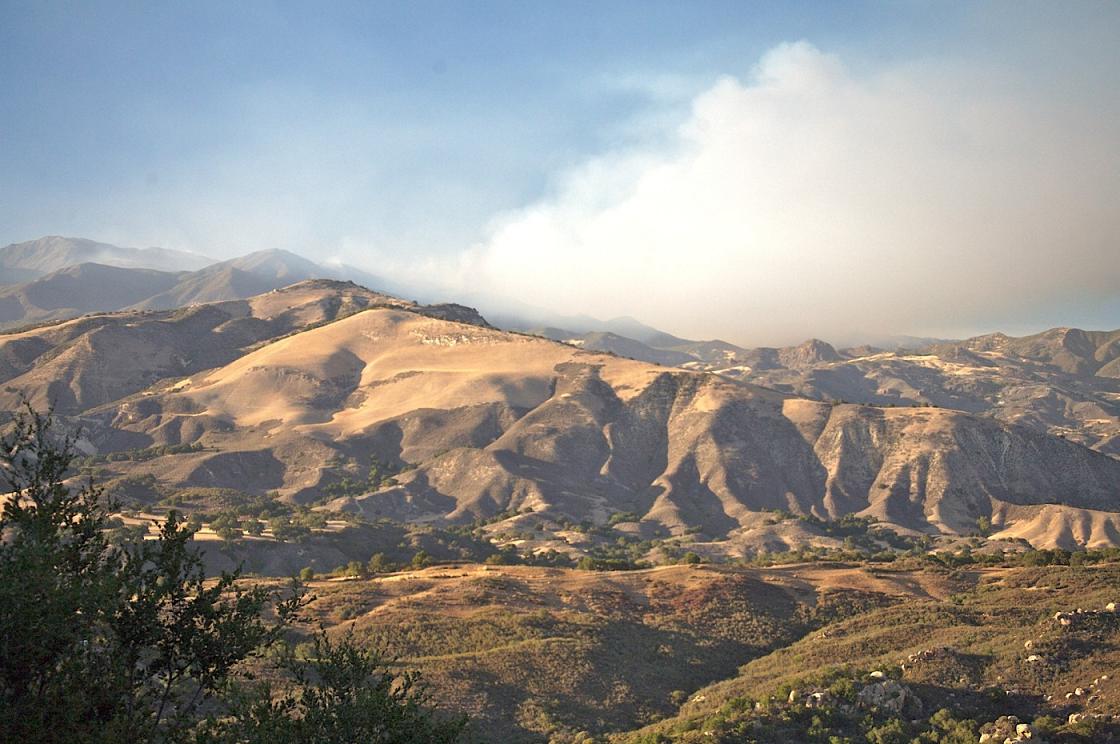
Immediately north of Black Canyon is the West Fork of Santa Cruz Creek. The upper drainage of the canyon is immense – more than five miles across from the saddle near Santa Cruz Peak to Bluff Camp on the far eastern edge of the San Rafael Wilderness. Behind the immediate drama unfolding in Black Canyon, the fire is continuing its relentless path to the east across the front face of the San Rafaels.
If there is something to be thankful for, it is that winds from the north have kept the flames from making a left turn, crossing over the ridge and heading back down towards the Sisquoc River. Hot shots have been able to follow the Mission Pine Trail east, more or less shadowing the fire’s movement and along with intense air attack they have been successful in keeping the fire contained to the Santa Cruz drainage.
Yesterday the fire did advance along the face below the Mission Pine Trail, burning past Mission Pine Springs and by this morning seemed ready to burn across the trail leading from Coche up to Mission Pine Basin. In air miles, in the past two days the fire has moved about three miles east in the upper canyon. Should this continue, in a day or two it will be advancing up towards Buckhorn Road at the location of a Forest Service admin building by the name of Bluff Camp. Named because it sits at the foot of 6,700 foot tall Big Pine Mountain, few fire fighters believe they will be able to hold the road should it hit this area.
In addition to the issues raised by the continued eastern movement across the upper end of the Santa Cruz drainage, there is a concern that once the fire reaches its mid-point in the drainage it will turn south and follow the canyon downhill. The issue isn’t so much that the fire will follow the canyon down into the valley but that at some point it will jump across the canyon and begin to spread up towards Little Pine and Alexander Peaks. It is this type of scenario that will threaten the Paradise area.
Tomorrow night, residents of Paradise, Rosario Park and Camino Cielo have been asked to come to a town meeting to be held at the County Schools Building near Highway 154 and Cathedral Peak to discuss their concerns.
It has been almost twenty years since the Paint Fire wreaked havoc to these communities and though distant in time, for many the scars are still fresh, the memories vivid.
More than likely it will turn out that the fire will continue east and the threat to these communities will lessen as they did with the Peachtree area. If so they will be blessed but if the fire does cross the Buckhorn, a whole another set of issues will need to be dealt with.


