Gusting winds continued through the night on the La Brea fire line, expanding the number of acres burned from 1,300 to more than 2,500 acres. “The fire seemed to want to burn in all directions,” fire information officer Vicki Collins said. There is no word of exactly how far the perimeter has expanded yet, but Collins said that the weather forecast calls for light winds coming out of the west today.
Map by Ray Ford
Overview of the La Brea fire zone shows the remote nature of the country in which fire fighters are heading. Though smoke will be seen from many locations, it currently is not a threat to any communities.
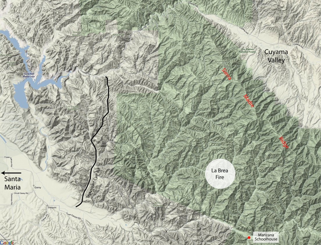
If the forecast holds, this will be good news to those who live in the Tepusquet area, but perhaps not so good news for wilderness enthusiasts. Immediately east of the La Brea Canyon area where the fire is burning is Horse Canyon and from there it is less than five miles upstream along the Sisquoc River to Manzana Schoolhouse.
Los Padres Forest issued an emergency closure order in response to the fire, closing the forest from Highway 166 on the south, all of the Sierra Madre Ridge east to McPherson Peak, and to the south, portions of the San Rafael Wilderness down to the Sisquoc River. For now, the section of the Sisquoc from South Fork Station to the Schoolhouse will be closed to use, though Collins wasn’t sure if the Manzana Creek Trail would be as well.
Map by Ray Ford
Map shows the south fork of La Brea Canyon in more detail. The Sierra Madre Ridge is highlighted to the north.
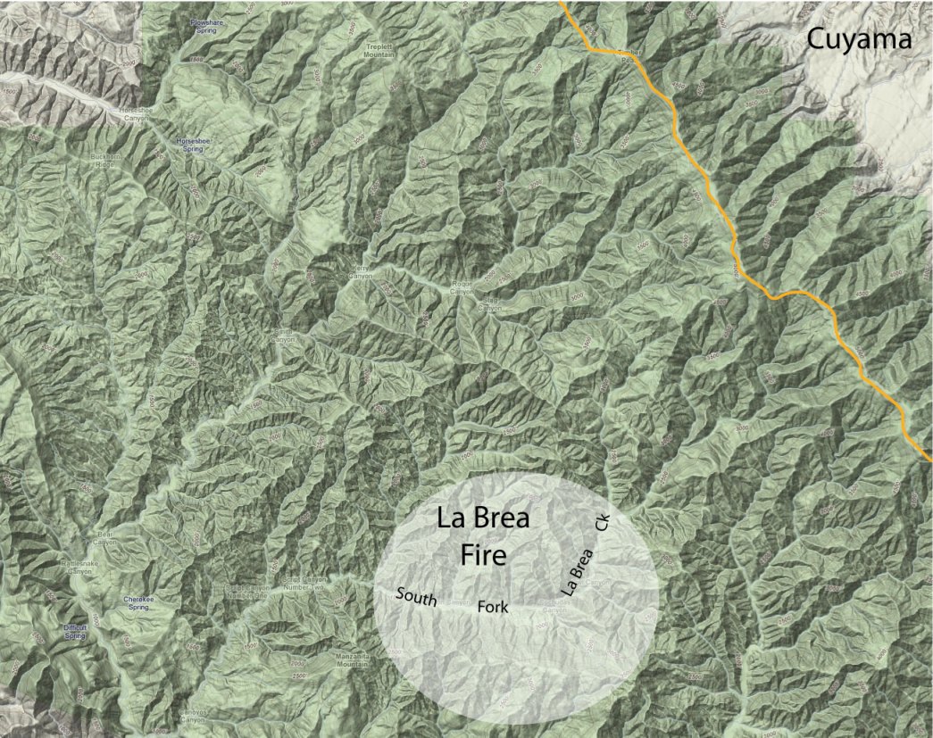
It appears that the La Brea Fire will be another of those fought more from the air than the ground. All of the area east of the fire perimeter is within the San Rafael Wilderness. This not only restricts the use of mechanized equipment but the steep terrain makes it almost impossible to create the type of anchor points and safety zones firefighters need before they enter on foot.
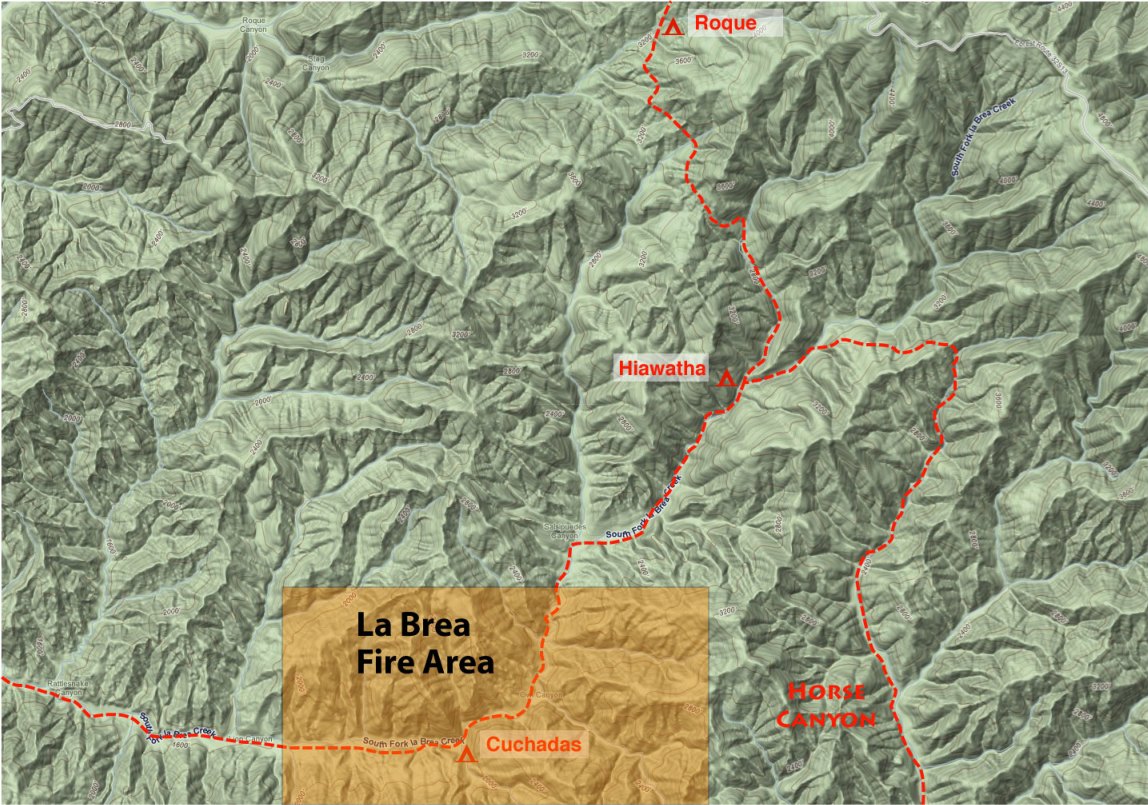
While there are no roads within a mile of the area where Forest Service officials believe the fire started, the origin appears to be somewhat near a backcountry camp known as “Cuchadas,” which is located along the south fork of La Brea Canyon. Historically, the route has connected La Brea Canyon, the Sierra Madre Ridge, and the Schoolhouse area via a network of trails, though in recent years the trails in this area have been so overgrown as to be almost impassable.
Map by Ray Ford
Close up of the upper canyon notes the trail network and camps in this part of the San Rafael Wilderness.
Though there is still no word of the fire’s cause, it should be noted there were no reports of lightning in the area, today was to be the official start of hunting season for portions of the area, and that many of the camps in the area were filled to capacity with those waiting for the season to begin.


Print friendly
E-mail story
Tip Us Off
Comments
Share Article
Myspace


Previous Month


Comments
This fire area hasn't burnt since 1955 and needs a good burn. What good is old rutted brush that don't hold any water back and is just sitting there waiting for someone to start a fire or lightning to strike.
All this area is used by the landowners buddy's private hunting and they probable started it. They should be the responsible party.
Taxpayers shouldn't be paying for this if we can't use it.
BillofSM (anonymous profile)
August 9, 2009 at 4:03 p.m. (Suggest removal)
Well...we can see the sun covered by smoke here in Goleta. A familiar picture from the year of Zaca.
GoletaResident (anonymous profile)
August 9, 2009 at 7:16 p.m. (Suggest removal)
Dear BillofSM,
To put things into perspective, old-growth chaparral is not "old rutted brush" that fails to provide important watershed values. It is in fact an incredibly important natural resource that is slowly disappearing because of too many fires rather than not enough. Old-growth chaparral is one of the most effective vegetation types to allow water to slowly percolate into the soil, permitting the aquifers to recharge. With all the fires SB County has experienced over the last couple years, the challenge now is to keep fire OUT of these areas for at least 30-45 years to allow the chaparral ecosystem to properly recover. If not, then these important vegetation communities will disappear and be replaced by flammable, non-native weeds.
If you want to learn more about the relationship between fire and chaparral, what the best way is to protect your home from wildfire, and why chaparral is a valuable natural resource, please visit the California Chaparral Institute's website. They have a lot of great info.
Chaparralian (anonymous profile)
August 10, 2009 at 3:49 p.m. (Suggest removal)
It's Just. So. Dry. Do we need desal plants and planes to drop water on it once in awhile then? :) I hope we are not in a climate change pattern, but we could be.
Beep (anonymous profile)
August 10, 2009 at 11:21 p.m. (Suggest removal)
when the humidity drops, why can't the back country be off limits to people?
HiAll (anonymous profile)
August 12, 2009 at 8:45 a.m. (Suggest removal)