
Thursday Morning, La Brea Fire
Another 10,000 Acres Gone, More Ranch Evacuations

[Morning report from Los Padres Forest Headquarters, 8 a.m. Thursday]
Evacuation Order: Effective at 4 a.m. Thursday, August 13, 2009, an Evacuation Order was issued by the Santa Barbara County Sheriff’s Office for the following area due to fire activity of La Brea Fire:
• Northern Boundary: Pine Canyon Road (Forest Service Road 11N04) from Highway 166 to Horseshoe Springs Campground
• Eastern Boundary: Forest Trail 31W12
• Southern Boundary: Buckhorn Canyon Road (Forest Service Road 11N06)
• Western Boundary: Highway 166
Fire and Sheriff officials have already contacted the 10 residences affected in this area.
An Evacuation Order is defined as moving the public out of a defined area due to the immediate threat to life and property from an emergency incident.
The New Cuyama High School is staffed by the Santa Barbara County Chapter of the American Red Cross for use as a temporary shelter. Small animals will be allowed to be co-located at the shelter. A large-animal shelter has been established at the Santa Maria Fair Park, 937 Thornburg. Animal information is available at (805) 681-4332.
—
Yesterday, crews on La Brea Fire were very successful in holding the line on the Treplett fuel break and south along the upper portion of the Sierra Madre Ridge. Crews will continue construction of contingency lines west of the fire. Direct line is being constructed on the eastern side of the fire where it has reached flat terrain. The fire continued burning south approximately one mile down Horse Canyon but has not entered the Sisquoc River area. Winds throughout Wednesday were 8-12 mph with gusts up to 20 mph out of the northeast.
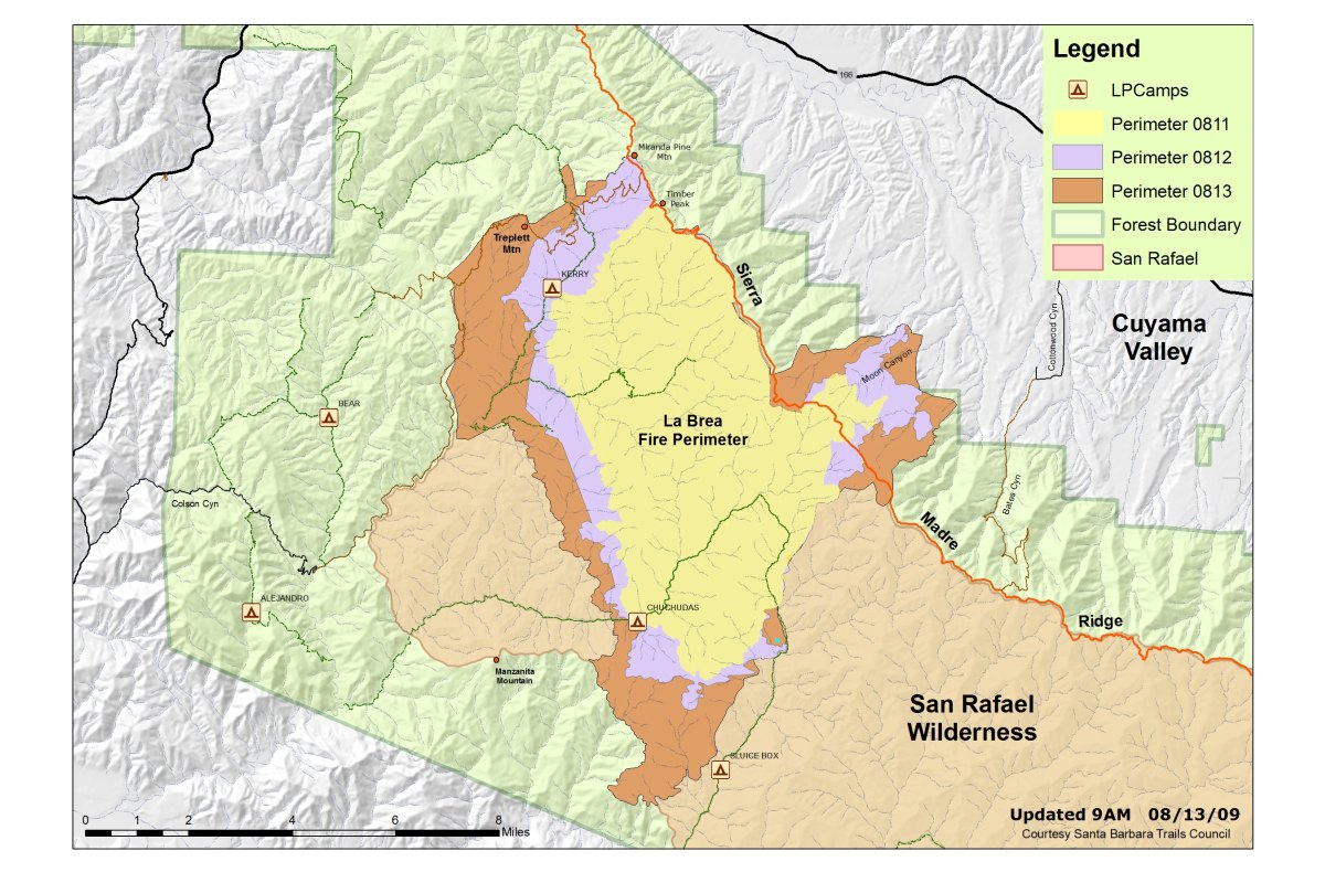
Today, firefighters will focus on the northwest and northeast flanks of the fire. Firefighters will continue to hold and mop up along Sierra Madre Ridge. Direct fire line will be constructed along Horse Canyon, and dozer line will be constructed on the southwest flank of the fire. Three helibases still support the fire, one at Santa Ynez Airport, one at Santa Maria Airport, and a supply helibase at the Incident Command Post. A retardant base is located at Spanish Ranch in Cuyama Valley, and a portable retardant plant is being set up in Pine Canyon. Structure protection resources are positioned near the homes that are under the Santa Barbara Sheriff’s evacuation orders.
The fire is now estimated at 36,108 acres.
An evacuation order is still in effect for the 14 threatened residences on Foothill Road and the seven residences on the Buckhorne Ridge. An evacuation warning was issued via Reverse 911 to the 104 residences in Cottonwood Canyon.
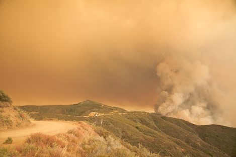
Firefighting conditions remain difficult due to the steep and inaccessible terrain, dry dense chaparral, low relative humidity, and erratic winds. Extreme fire behavior has been observed since the fire began. The northeast portion of the fire area has not burned since 1922. Due to emergency vehicle traffic and congestion on Highway 166, the public is urged to seek an alternate route and to use extra caution when traveling the highway.
There will be another community meeting on Friday, August 14, at 6:30 p.m. at the Benjamin Foxen Elementary School, 4949 Foxen Canyon Road, in Sisquoc.
Fire Investigation Tip Line: The Fire Investigation Team is asking for the public’s assistance to help establish the cause ofLa Brea Fire. If you have any information regarding La Brea please contact Forest Service Fire Investigators at (805) 686-5074. Investigators have spoken to witnesses, but are still seeking additional information that may assist with the ongoing investigation.
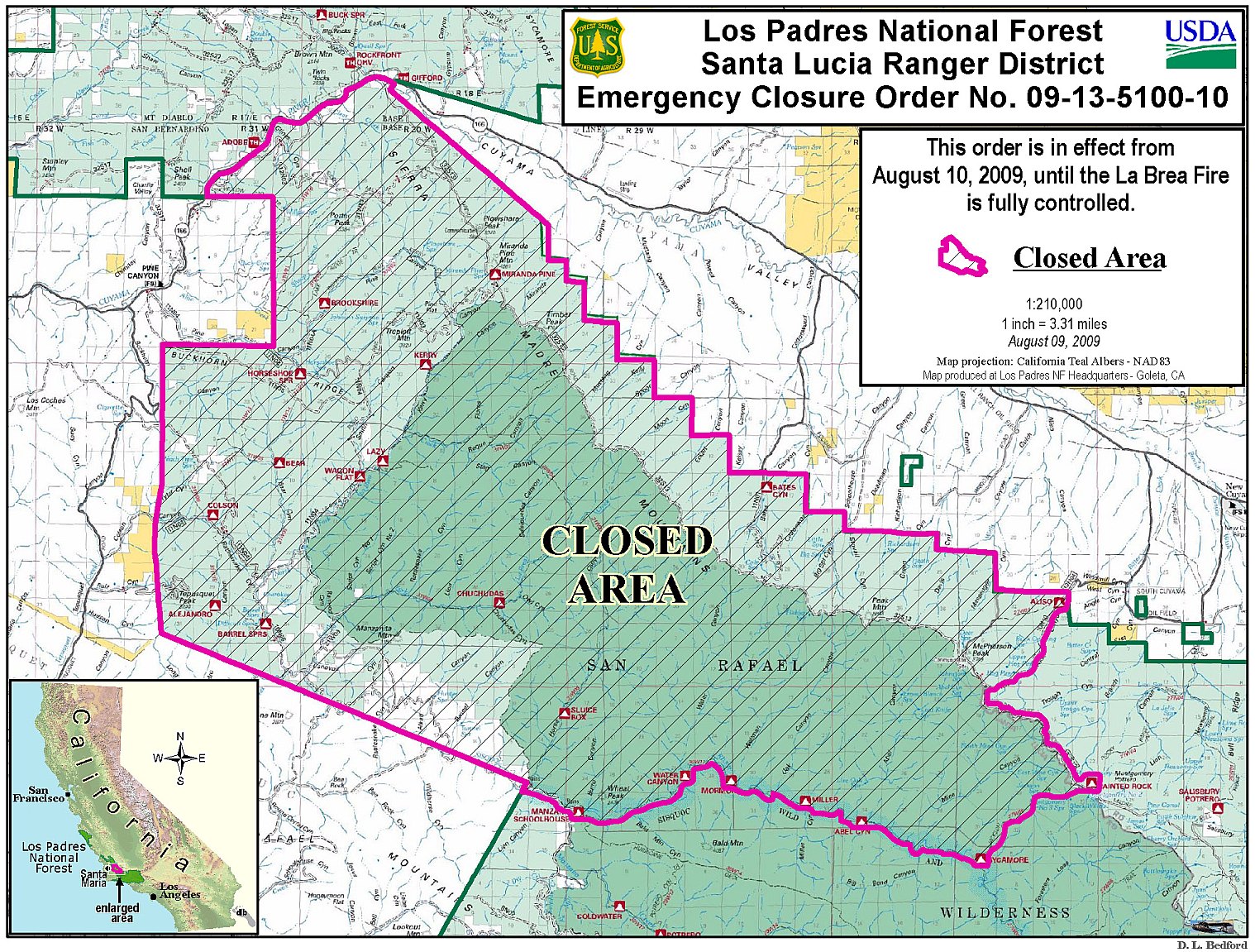
Closures: An emergency closure order is in effect for portions of the Los Padres National Forest in and around the fire. For more information, please contact Fire Information at (805) 961-5770 from 6am-10pm
Flight Restrictions: Temporary flight restrictions have been put in place over the fire area.
Resources:
Engines: 89
Crews: 57
Dozers: 28
Helicopters: 10
Total personnel: 1,641
Basic Information
Incident Type: Wildfire
Cause: Under Investigation
Date of Origin: Sunday, August 9, 2009 approx 02:50 p.m.
Location: 26 miles east of Santa Maria
Incident Commander: Pincha – Tulley / Lewin
Current Situation
Total Personnel: 1,641
Size: 36,108 acres
Percent Contained: 10%
Fuels Involved: Primarily Chaparral with with areas of grass and timber.
Significant Events: Crews continue to hold the line on the Treplett fuel break and south along the upper portion of the Sierra Madre Ridge. Resources are continuing construction of line west of the fire. Construction of contingency lines west of the fire are underway. Direct line is being constructed on the eastern side of the fire where it has reached the flat area of the canyon. Evacuation orders are still in place areas of Moon and Eckert Canyons and evacuation warnings are still in effect for the areas bounded by Cottonwood Road and Wasioja Road between Highway 166 and Sierra Madre Road. Forest Service closure order no. 09-13-5100-10 is in effect for areas in and around the fire.
Outlook
Planned Actions:
Crews will hold and mop up on Sierra Madre Road and continue to construct direct line along Horse Canyon.
Growth Potential: Extreme
Terrain Difficulty: Extreme


