
Sunday La Brea Fire Report
Success on Saturday Improves Suppression Efforts

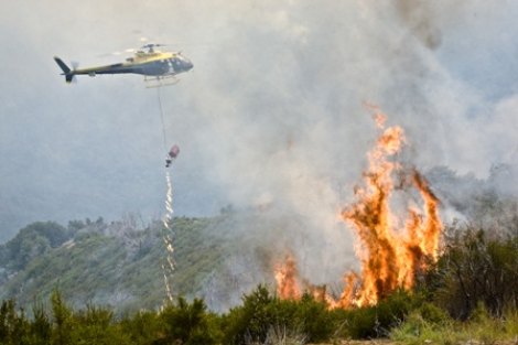
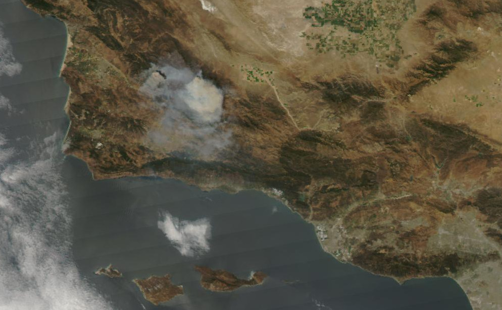
The geographical focus of La Brea firefight remains the west side and increases on the east. Containment lines have now been constructed around a majority of the fire. Fire managers will continue to watch and evaluate as those lines are tested by the wind. Firefighters suppressed flare-ups in the Colson Peak area last night. Several snags, standing dead or burned trees, were cut down to eliminate the potential of them falling across the fire line and causing an escape. Confidence in the containment line’s ability to hold fire increases with time as firefighters continue to search out and extinguish hot spots on the west side.
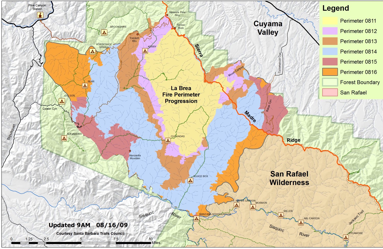
The conditions will be a bit tougher on the east side. The effort to improve fire line built southward from Schoolhouse Canyon to Sierra Madre Ridge continues. Firefighters will be dealing with the possibility of adverse, gusty winds, temperatures in the 90s, and dry air. Together, these factors will challenge suppression efforts.
The Santa Barbara County Sheriff’s Office and California Incident Management Team 3 are coordinating the change to evacuation advisories. A final decision will be based on fire conditions.
Day Operations Plan: The focus on the east side of the fire will be improvement of the Schoolhouse Canyon containment line. Elsewhere, crews continue mop-up and monitoring of the fire’s perimeter, and structure protection will continue.
Weather: South of the Sierra Madre Ridge, higher humidity levels and lower temperatures will aid in suppression efforts reducing intensity of any active fire. North of the Sierra Madre Ridge and at elevations greater than 2,000 feet, the fire will remain active as temperatures settle in the mid 90s and humidity drops.
Evacuations: Evacuation Orders are still in effect as issued by the Santa Barbara County Sheriff’s Office. Based on the progress made yesterday and last night, the current evacuation areas will be re-evaluated for the west side of the fire to determine when it will be appropriate for residents to return to some of the evacuated areas.
Fire Investigation: After a week long investigation by the U.S. Forest Service Special Agents, the Santa Barbara County Sheriff’s Office and fire investigators, it has been have revealed that La Brea Fire was started by a cooking fire at a marijuana drug trafficking operation. La Brea Fire Tip Line is still open, and anyone with additional information helpful to this ongoing investigation is urged to contact (8050 686-5074.
Caution: Due to emergency vehicle traffic and congestion on Highway 166, the public is urged to use extra caution when traveling the highway.
Closures: An emergency closure order is in effect for portions of the Los Padres National Forest in and around the fire. For more information, please contact Fire Information at (805) 961-5770 from 6 a.m.-10 p.m. or Inciweb.
Resources:
Engines: 141
Crews: 59
Dozers: 29
Water Tenders: 54
Helicopters: 14
Fixed Wing: 5


