Climate Hazard Group Predicts
Long-Range Weather Modeling Could Forestall Human Disasters
“A little bit of suffering now can open up doors for the rest of your lives,” advises Prof. Chris Funk to students struggling with science courses. And one of the doors the UCSB geography professor is opening is food security in third-world countries that are experiencing random weather alterations, possibly due to climate change.
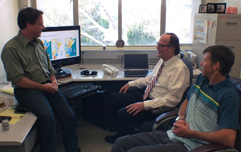
Imagine a world where you could predict natural disasters — where starvation and poverty could be prevented by using technology to foresee drought. In 2003, Drs. Funk, Gregory Husak, and Joel Michaelsen launched the Climate Hazards Group (CHG), which uses satellites to track precipitation patterns associated with long-term trends in climate change, primarily in sub-saharan Africa. Dr. Funk explained that the droughts hitting East Africa are caused by changes in ocean temperature similar to those that are making it dry in the Southwestern United States. The fluctuations in temperature may be a sign that many of these droughts are linked to global warming.
When unusual weather conditions hit, communities in arid environments are often left with even less or no rainfall. Poor rainy seasons make it difficult to sustain cattle and grow crops. According to Funk, as many as seven billion people may face acute, persistent water shortages by 2050. In the face of potentially increased malnutrition and a lack of clean water, satellite technology and long-range weather prediction can help governments, agencies, and people formulate solutions and strategies.
Using satellite data provided by the U.S. Geological Survey and NASA, climate data is sent to the U.S. Agency for International Development, the United Nations, and African governments so that officials can develop emergency plans and acquire equipment for disaster response. The huge advantage of these predictions is the ability to diversify and store food in advance. Dr. Funk explained, “We are trying to advise governments to intensify agriculture in climate secure areas and limit expansion into dry regions.”
The CHG uses satellite visuals to plot rainfall data and weather trends that predict weather months ahead. Soil moisture is evaluated, too, which helps CHG scientists identify places that are likely to receive snowmelt and scarce rains. This comparison between areas of recurring rain and snow to areas continually experiencing drought helps decipher between less obvious climatically stable and unstable locations in the world.
CHG scientists are stationed in regions where the program is focused. As they teach and train colleagues and students in Africa, they can substitute travel to Africa with contributing a lasting asset to these communities. “We like to work with African scientists to improve things in Africa,” Dr. Funk explained. The CHG is part of a unique cooperation between the USGS and UCSB. Each year, the United States spends billions of dollars on humanitarian assistance, and a small portion of that fund supports this kind of research at UCSB.
Dr. Funk believes that science and geography “might be a challenge … [but] they can help you pursue fascinating questions. Looking back at some of my friends who took the easy path in college, they sometimes ended up in careers that were boring in 10 or 15 years. That’s one of the greatest advantages about science.”
Karen Housel is a fourth-year undergrad studying Environmental Science at UC Santa Barbara. She is interested in marine biology, sustainability, ecotoxicology, and restoration, and hopes ultimately to improve air and water quality in urban and rural areas.