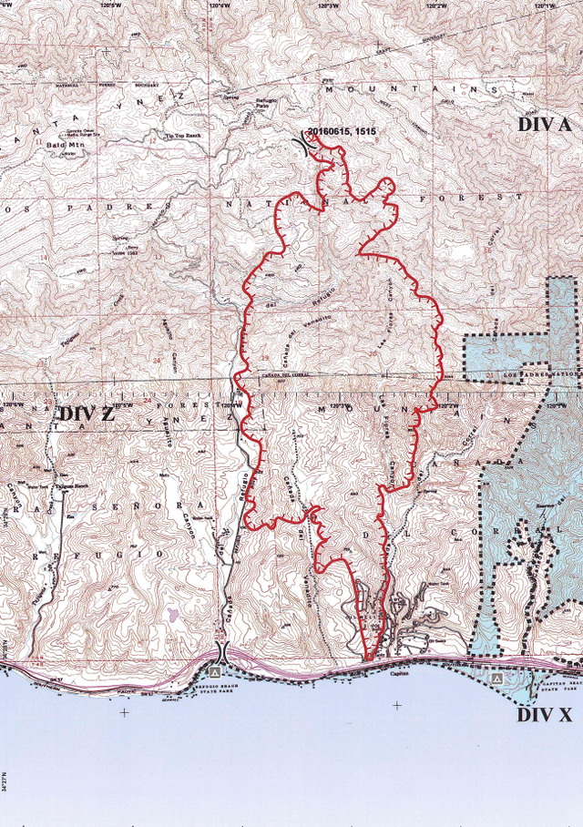
Map of the Scherpa Fire

As of 11 a.m. on Friday, June 17, the Scherpa Fire is burning approximately 4,000 acres of rugged Gaviota Coast terrain. It’s at five percent containment, meaning five percent of the entire loop around the fire is secure, held by cut fire breaks and/or water hoses. Below is a topographic map of the fire’s perimeter provided by incident commanders, who will brief the media shortly with an update. Check back here for more information.