
Ode to Carrizo Plain
California’s Serengeti

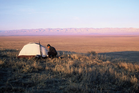
Heading west into the Caliente Mountains, I held no expectations for what lay ahead. For miles, grassy green rolling hills loomed in front of me. Dense stocks of fiddleneck raked against my legs, and dew drops clung to each purple bush lupine. Anticipation mounted while ascending each peak. What would I see in a wilderness that possesses more endangered species than any one place in California?
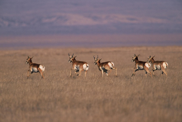
The last hill offered wide-open views of the vast Carrizo Plain National Monument. Below me, two dots moved slowly across the sweeping grasslands, a pair of pronghorn antelope bulls browsed the valley floor. Would they reach the jagged scar that’s the San Andreas Fault at the base of the Temblor Mountains to the east? Something told me they’d have their fill before that and bed down in the middle of California’s Serengeti.
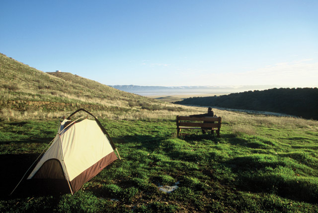
What happens when where you are converges with where you want to be? That question is answered every time I hang a left off Highway 166 onto Soda Lake Road, and I’m swallowed up in the silence of this remote wilderness. The national monument turned 10 years old in April, the last of California’s historic grasslands clinging to the protection set forth by former president Bill Clinton, who deemed the region a national monument in 2001. “It’s a unique, beautiful area,” said Johna Hurl, resource manager of the Carrizo Plain. “It’s a place where you can go without seeing or hearing anyone.”
Natural Wonders
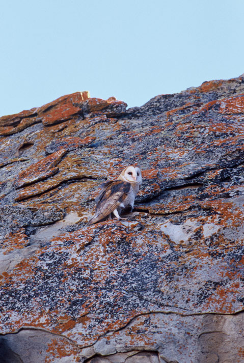
Every time I come out here, I see something I didn’t see the time before. Late last winter, my wife, Lori, and I saw two barn owls roosting inside an alcove of a sandstone cathedral. They flew over to the sunny side of the outcropping to ward off the morning chill. They landed on a slab of sandstone covered in a montage of crimson and auburn lichen the same shades as the owls’ wings.
Another time, after heavy winter rains, we were driving on Simmler Road on the eastern fringe of Soda Lake. We were moving slowly, careful not to get stuck in the mud, when Lori spotted a baby black-tailed jackrabbit. It was alone, separated from its mother and cold, huddling in a muddy rut. Its mottled fur was wet from the previous night’s rain, and it was shivering. I pulled it out of the mud and held it close to my chest facing the morning sun. It was weeks from growing into its gangly feet, and it needed a lot of luck to survive marauding coyotes and San Joaquin kit foxes. It was tough leaving it behind, but it was nature’s way.
On several trips to the Carrizo Plain, I’ve gone without seeing another soul, so it came as a surprise when I learned that the national monument sees anywhere between 40,000 to 60,000 visitors per year — especially when a gas station or market is 50 miles away in any one direction.
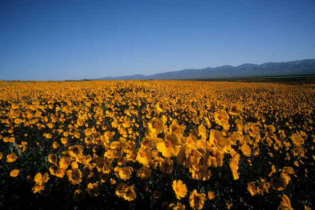
“It’s totally dependent on wildflowers,” continued Hurl, who has worked on the Carrizo Plain for 17 years. “April is the busiest month. Last year was a banner year for wildflowers.”
It’s true. Soda Lake Road runs for 50 miles through the Carrizo Plain, and last year the Temblor Mountains to the east and most of the grasslands were splashed in purple, yellow, pink, and gold.
Golden Hour
It was a lung-busting ascent at dawn, rising above the floor of the Carrizo Plain, achy legs churning my mountain bike to San Luis Obispo County’s highest summit at 5,106 feet. I left the sweeping grasslands and lost myself in the oak woodlands, pedaling up Caliente Ridge for a perspective of California as it appeared 200 years before.
Aside from old cattle ranching roads and remnants of ranches dating back to the 1940s, the Carrizo Plain suffers from very little human impact. In fact, many raptors have taken over those weather-beaten man-made structures and made them into their own. Old windmills, water tanks, and teetering barns are fair game for annual nest sites.
My eyes were tearing up in the frigid 20-degree temperatures, and my lungs burned with each deep breath. It was silent except for my huffing and puffing. Gratefully, I pulled up to a natural overlook to catch my breath, shadows retreating across the plain.
As I neared the summit at the top of the ridge, I spooked a majestic golden eagle roosting in an oak tree. It swooped over me and continued east out over the plain, vanishing against the stark landscape of the Elkhorn Plain. What would take me half a day’s ride the raptor had already covered.
Soda Lake
The flock of American avocets skimmed the surface of Soda Lake, maybe a millimeter separating their wings from the shimmering shallows. They gathered inside a tiny cove, sharing it with a bevy of sandpipers and long-billed curlews.
Soda Lake is the largest natural alkali lake in California and during wet winters attracts migrating sandhill cranes. During the dry season, Soda Lake becomes a blindingly white, 3,000-acre salt pan, the midday glare seen from miles away. But at sunset, the edge of the lake is one of the more tranquil places of the Carrizo Plain. It’s a place to wander and reflect. It’s also a good time to see some of the 180 bird species that frequent the national monument.
The best place to do this is along the boardwalk that meanders along the west shore of the lake, a good place for setting up a spotting scope or scanning with binoculars. Shorebirds and geese fly in by the hundreds, Soda Lake being part of the Pacific Flyway, the lonely, wide-open expanse a safe haven for flora and fauna alike.
Being back on Highway 166 unfortunately signaled the end of another Carrizo Plain experience, leaving behind the grasslands, soothing silence, and too many natural wonders to count. That is until once again I feel the tug inside to pack up my truck and climb Highway 33 to return once more to California’s Serengeti.


