
Tequepis Dayhike
Verdant Trail Named After a Chumash Village

Name of hike: Tequepis Dayhike
Mileage: 8.0 miles, a vigorous half-day of hiking, bring water and a lunch
Suggested time: about 6 hours (includes drive to Rancho Alegre turnoff on Highway 154); suitable for children who enjoy hiking 4 hours; bring water, snacks, long pants, and long-sleeved shirt, a cool head, and a keen heart
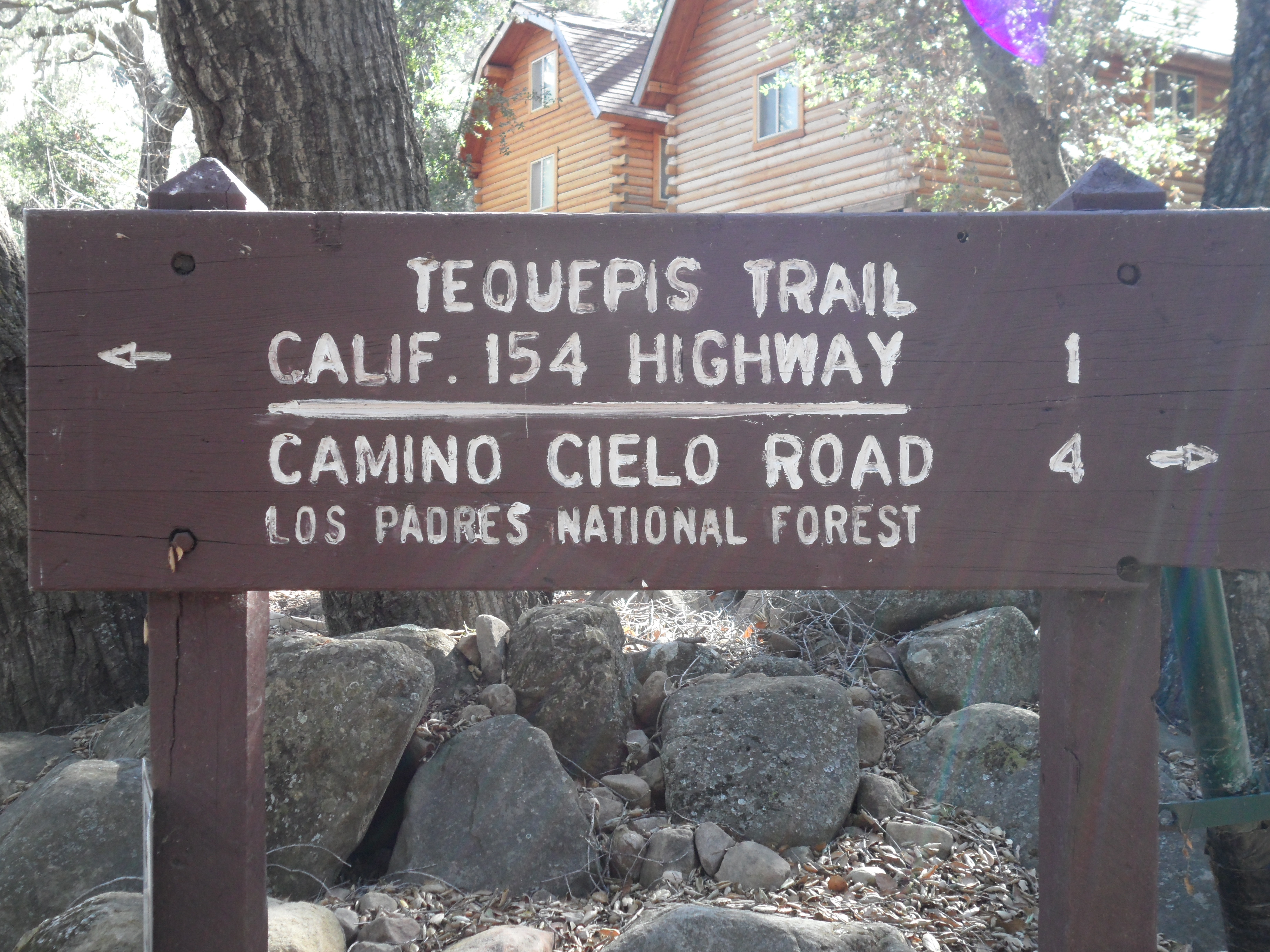
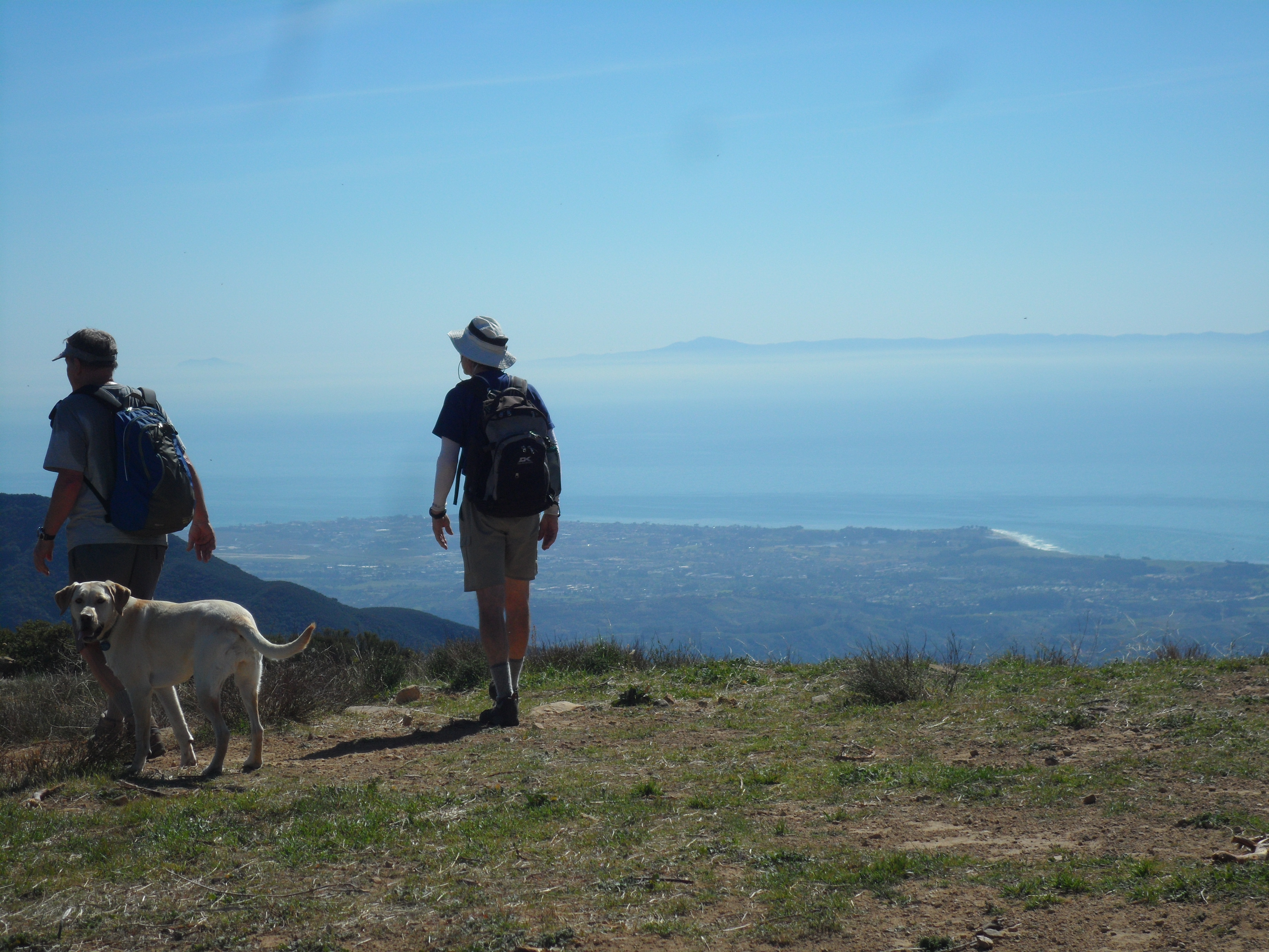
The easy driving access from Santa Barbara, and the profusely beautiful north-facing flora along the Tequepis Trail (pronounced te-KAY-piss) combine to make this wilderness dayhiking experience rather unique. Once you begin the hike it ascends directly to the top amid long switchbacks – but finding the turnoff from Highway 154 to get to the trailhead in the first place is a bit trickier.

To drive to the roadhead, take Highway 154 (aka Chumash Highway) and drive over San Marcos Pass; pass by the Paradise Road exit to the Santa Ynez Recreation area, and look for the first “Rancho San Alegre” sign on your left —do not take the first such sign but wait a few minutes to encounter these three road signs, also on your left: Rancho Alegre (again), Camp Whittier, Circle V Ranch. Turn left here, in the short left-turn lane provided.
Drivers often miss this tricky left on the dangerous Chumash Highway (154), and if you do, you will almost immediately see the large entrance to Lake Cachuma State Park on your right. Drive into the park, turn around, make a left back onto 154, and turn right at the three signs mentioned.
Having successfully made this turn, take the main dirt road veering left and basically drive to the end; later this road becomes pavement. After driving slowly for about 1.2 miles you see the large “log cabin” two-story dormitories of the St. Vincent de Paul Camp, with a large dirt parking lot to your right. Park in this lot and begin your trek by boldly hiking straight into the camp.
I do not recommend driving to the Tequepis roadhead on the dirt road during or after significant rain due to the muddy conditions (despite the white gravel they’ve added).
Passing through the usually empty camp, past the swimming pool, you hike onto a broad path, even road, in dense riparian woodland foliage for at least a half-mile. Then, trudge the next 3.5 miles, ascending about 2000 feet to the crest. Amid the intense and lovely fragrance emanating from the flowering ceanothus giants, you will continue to shoulder through heavy plant growth most of the way.
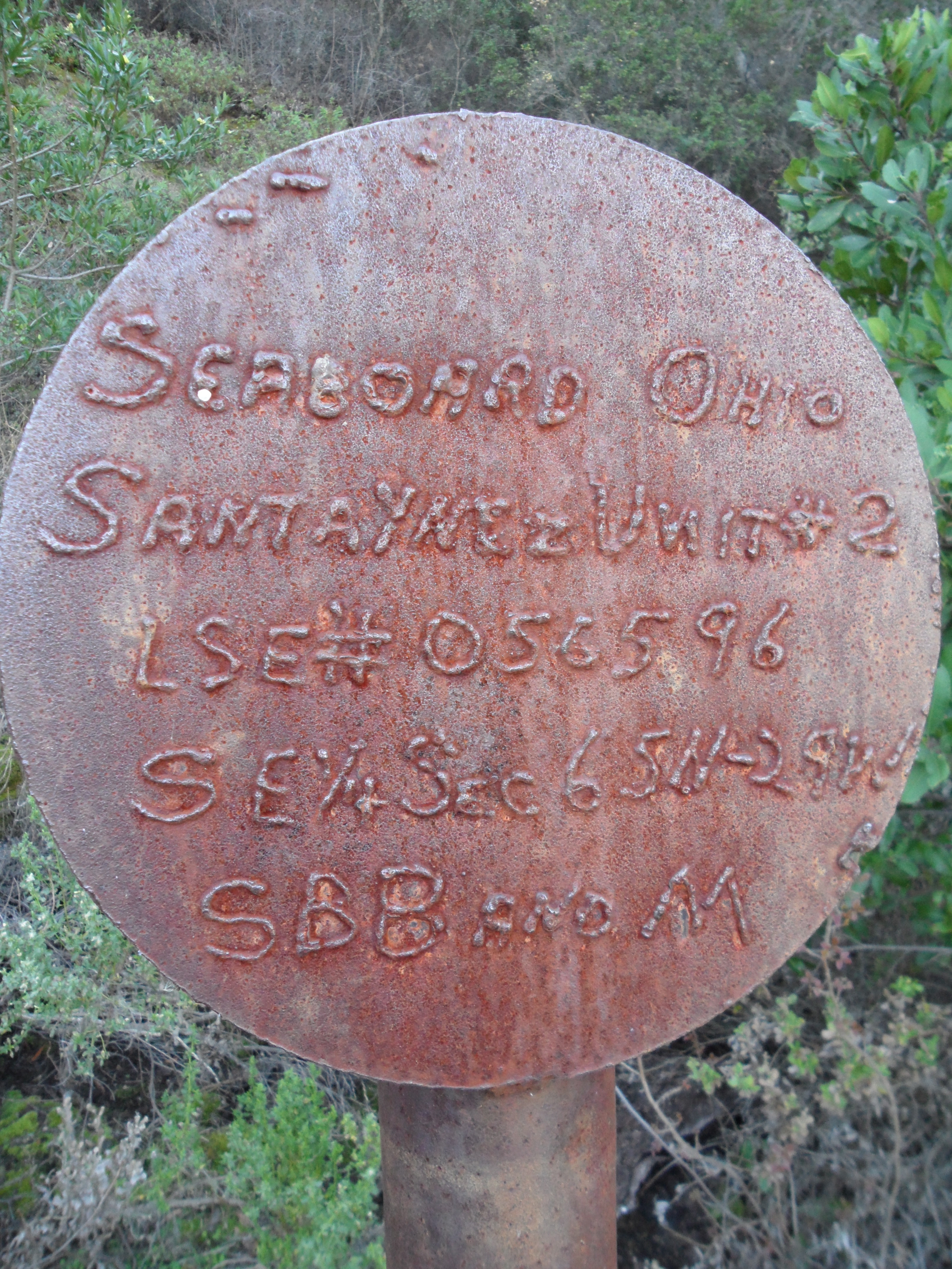
Early on, you pass through a signed remnant of the oil drilling once allowed in this area, now part of Los Padres National Forest. This was Santa Ynez Unit #2. Los Padres National Forest, land of many uses indeed.
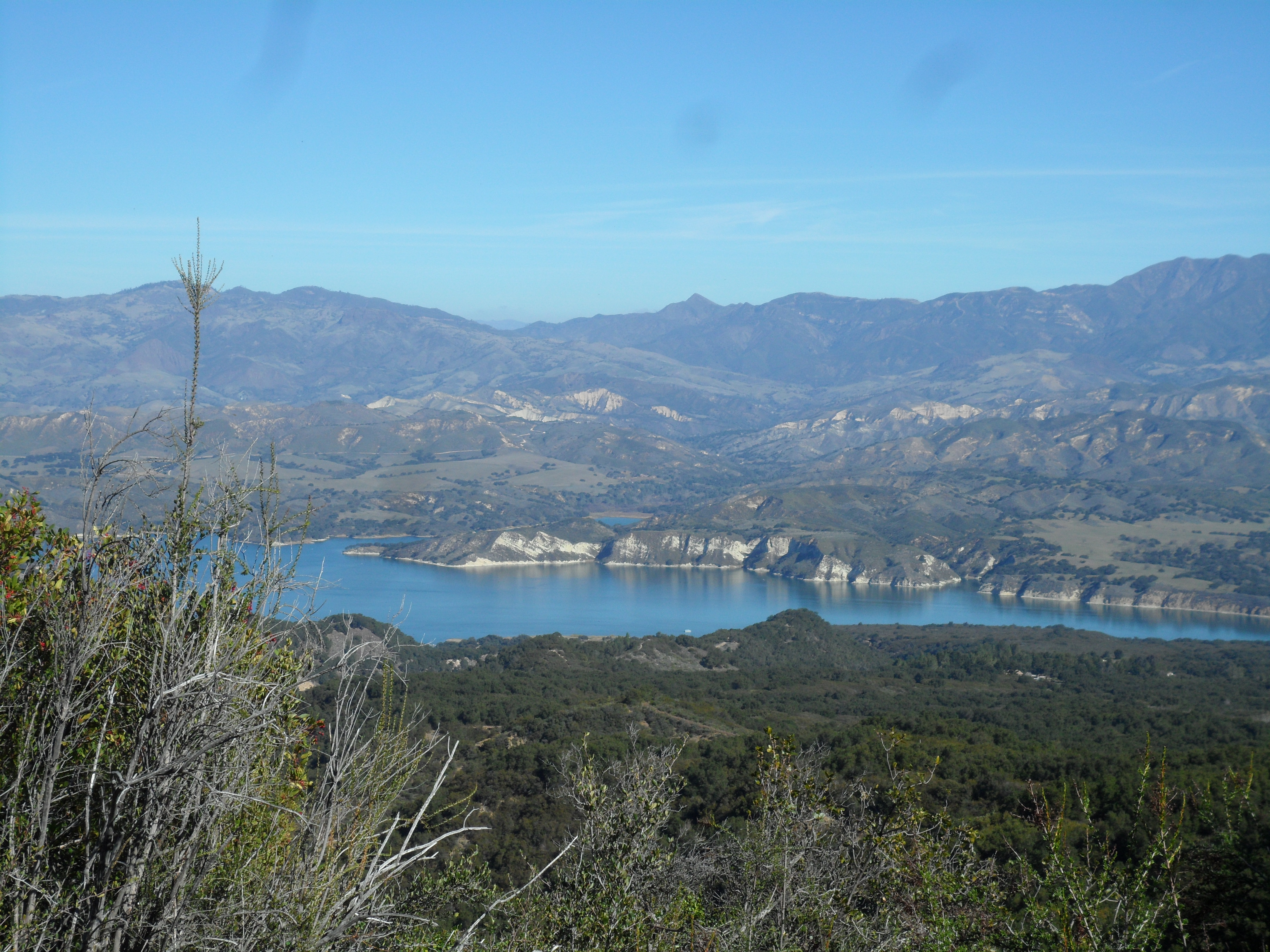
From half-way up, on the long languid switchbacks of the Tequepis Trail, you can enjoy many fantastic views back toward Lake Cachuma and Bradbury Dam, views you never get from the Chumash Highway. Above the lake you win glorious vistas of the Santa Barbara backcountry: You can see Peachtree, Mt. San Rafael, and Big Pine Mountain (6750 feet).
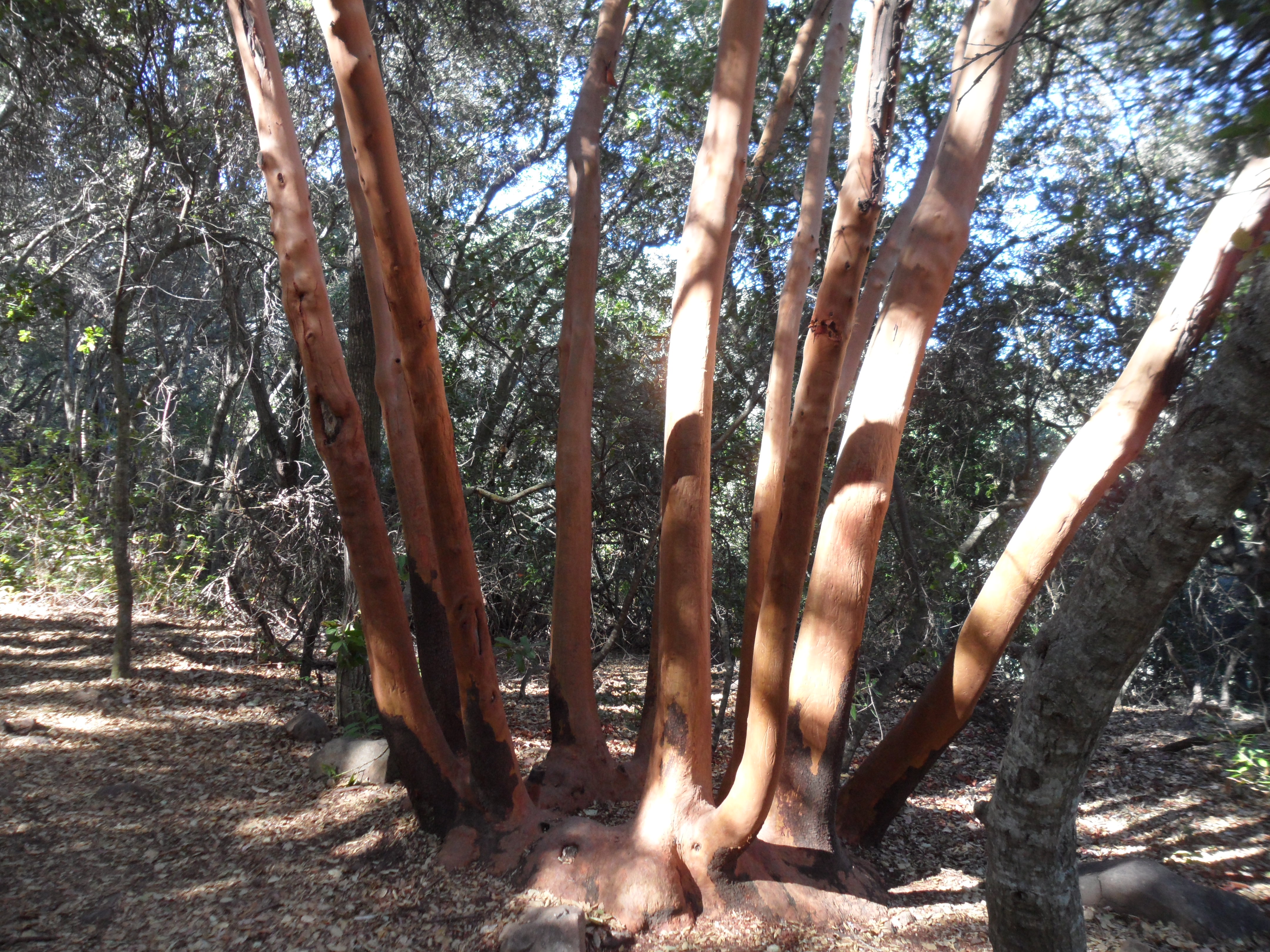
Approaching the crest you encounter more madrone trees (Arbutusmenziesii, commonly known as the Pacific Madrone). This type of arbutus tree, with beautiful golden bark, isn’t found south of Santa Barbara County, so we’re at the end of its range, which begins in British Columbia.
At the top of the ridge you’re on Telegraph Peak, which is pretty bare, and you are also on a dusty spur road from West Camino Cielo to nearby Broadcast Peak with its array of antennae. From here you have stupendous 360-degree views of the front country and backcountry.
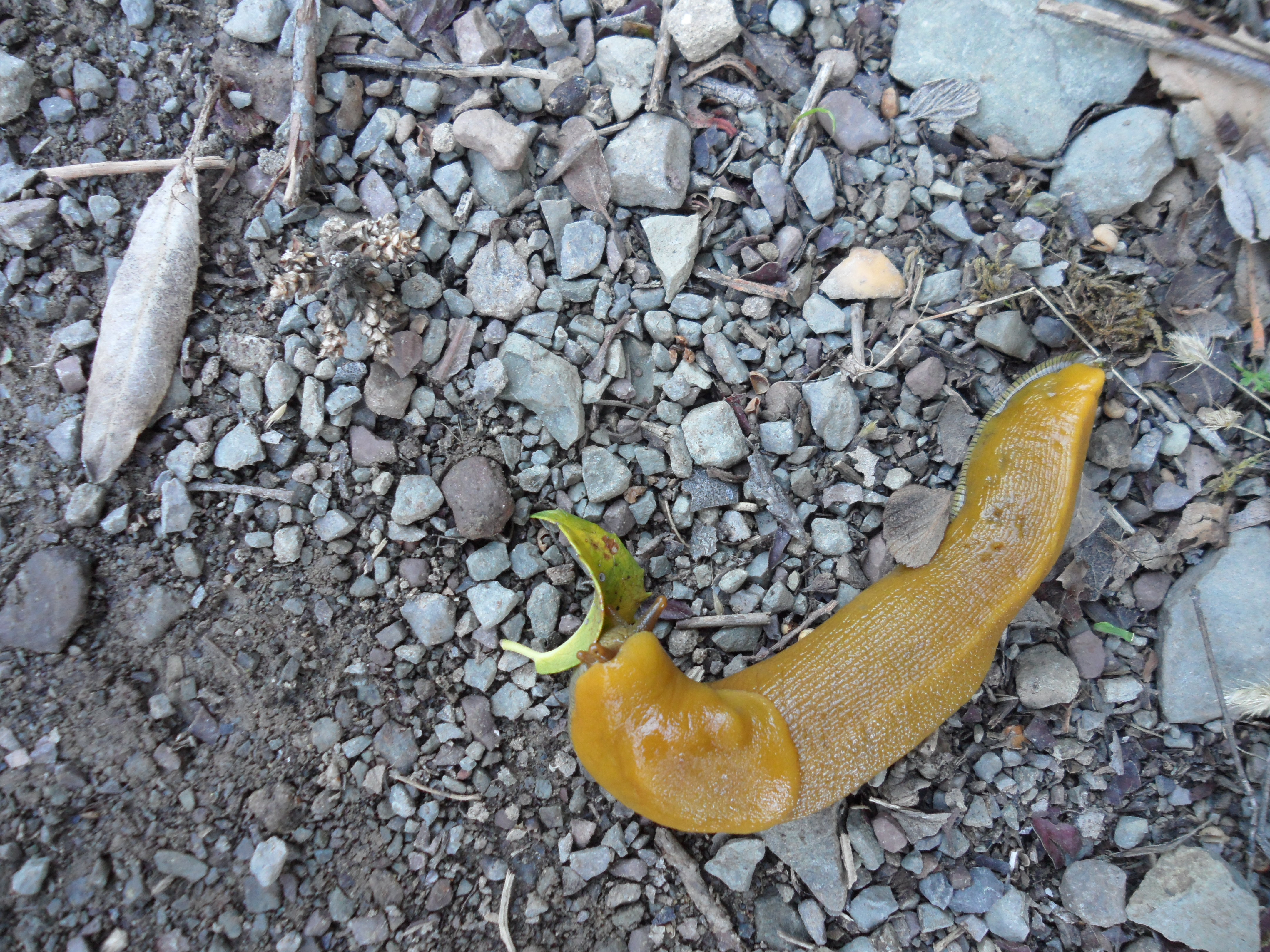
While we saw the scat and tracks of various animals, the main life forms observed were a few banana slugs in the trail. The pleasure of doing this hike in late winter is how cool it remained most of the way. We were usually hiking in shade, and the flying insects which can plague one in spring and summer were not present.
On our leisurely return trip, we met three different hiking groups of what looked to be 7th-graders on a sojourn with the noted Outdoor School. The students were happy, not grumbling, and obviously enjoying their time in this outdoor paradise. (When Woodrow Wilson wrote, “The West has been the great word of our history. The Westerner has been the type and master of our American life,” I’m not quite sure what he meant.)
Here along the edge of the American West we find ourselves hiking a verdant trail named after a Chumash village that is supposedly near here. When Frederick Jackson Turner proposed his audacious “end of the frontier” idea in1893, many Americans thought that wildness had disappeared from our land. It certainly hasn’t, although our metaphoric frontier seems to have moved into the “cloud.” At around the same time Turner wrote about “The Significance of the Frontier in American History,” at least three prominent East coasters from the 1% turned West to get over emotional turmoil in their own heads. Teddy Roosevelt fled to a Dakota ranch for three years to get over the simultaneous deaths of his mother and beloved wife; one of his Harvard classmates, novelist Owen Wister, went West to recover his health; and the artist Frederic Remington fled west to escape his domineering mother. Wister’s daughter said he had “freed himself from what was to him a deadly life,” a career as a Boston businessman.
The rough frontier is still right there, available to us, less than 25 miles to the Tequepis Trail roadhead. You may not escape your career in finance and write a bestselling novel like Wister’s famous The Virginian (1902) – still considered the most influential of all western novels – but a day spent on a trail like the Tequepis will refresh your nerves, restore your faith, and help get you out of your “cloud.” If TR, Remington, and Wister were alive today they too would be very concerned about “the extinction of experience” afflicting our young. What happens to a species that loses touch with its habitat? Grab your children, drive 35 minutes to the second Rancho Alegre sign, and begin pushing into an intense experience on the Tequepis Trail.


