On the Rey Fire Line Saturday in Santa Barbara Backcountry
Major Progress Made in Containment; Concern Shifts to Northeast Corner

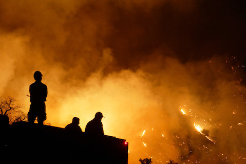
In a surprising development on Saturday, fire officials shifted their concern to the northeast perimeter of the Rey Fire when the wind shifted in the late afternoon to a more easterly direction, pushing the fire down into the Upper Oso Campground area. With more than 50 engine crews on hand, firefighters scrambled to backfire off the edge of the campground as dozers cut line within the camp itself.
One firefighter described the fire as “chunking its way” down from the steep headwall toward Oso Canyon where only the day before the fire had taken off to the west, rapidly burning through Red Rock and Windsor canyons within Rancho San Fernando Rey and over the north crest of the ranch into the Santa Cruz drainage. In the process, the fire expanded the acreage burned dramatically. As the wind shifted to the east, the pockets of fire above the campground began a strong push downhill and onto the canyon walls. By 8 p.m. several of the smaller blazes joined together near a number of horse corrals to create a massive firestorm with flames 40-60 feet in length.
Several firefighters with drip torches and hand-held flares began burning the grasses on the west edge of the Aliso Trail to eliminate any fuel that might allow the flames to jump the canyon. By 9 p.m., it appeared the campground area was safe, but it was not clear if this will be enough to keep the fire from jumping the canyon further to the interior where it the walls are extremely steep and narrow.
There is also concern that the fire may move further north in the Little Pine area, but at dark there was too much smoke to determine where the fire had burned in northeast corner of the fire perimeter. Though mostly consuming territory away from the river and even further from Santa Barbara, the fire may have the opportunity to move further east if the more easterly winds continue. That would head it into the Buckhorn and Indian Creek drainages, which could pose a major complication.
Major Progress Made
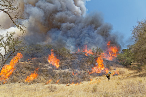
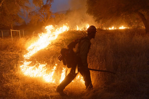
The good news on Saturday was that firefighters made major progress on the south, west, and north perimeters of the fire; the numbers rose dramatically in the percentage of containment. Late Friday night and continuing throughout Saturday, a major burnout operation took place that for the most part was successful in stopping the westward march of the fire. Beginning on Friday night, just after dark, two dozers cut a line along the upper part of Horse Canyon known as “the horn” to create a direct connection to the ridgeline separating Horse and Santa Cruz canyons, allowing the firefighters to begin burning out this corner of the fire.
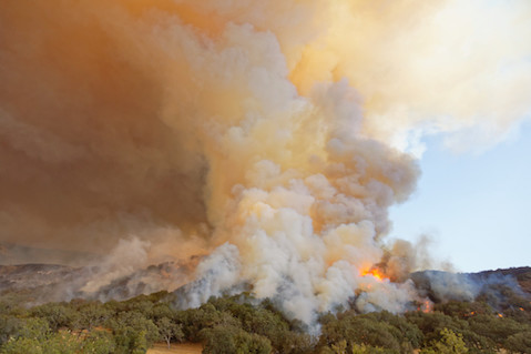
In mid-morning on Saturday, with engine crews, water tenders, and several hundred hand-crew members alongthe road, burnout operations continued down Horse Canyon to secure the west edge of the fire line. From viewpoints on the Santa Ynez Mountains, one of the largest plumes of smoke to be seen in years began to rise as the burnout expanded, providing a dramatic visual statement. Later in the day, as the wind began to shift, the plume became visible from downtown Santa Barbara and as far away as the Conejo Grade, raising concern the fire might be worsening. However, a drive down Horse Canyon at about 6 p.m. made it clear that the west edge of the fire had been contained. All that remained was for the firefighters to monitor the edge of Horse Canyon’s road to ensure none of the smoldering coals escaped to the other side.
Interior Concerns
A major worry for most who cherish the backcountry wilderness was the impacts along the northern perimeter of the fire where it had burned over the ridge separating the main part of Rancho San Fernando Rey from the Santa Cruz drainage. Clearing smoke made it possible to drive up Horse Canyon to the saddle where the road drops down into Santa Cruz Canyon and also follows the ridge to the east to Old Man Mountain and Alexander Peak.
Several things were clear. One, the fire did not reach the intersection or burn down into the lower part of Santa Cruz Canyon. But within a quarter mile, blackened vegetation appeared and continued at the way to Old Man Mountain, a distance of more than three miles. The black not only cut over the ridge, but the clearer visibility made it apparent the fire had backed all the way down to the bottom of the canyon. Amazingly though, because of the steepness of the canyon walls and sparseness of the vegetation, there was no sign of active fire, and it appears that much of the north perimeter of the fire line is secure as well.
On reaching Old Man Mountain, the scene was one of utter devastation, of a fire that had burned so hot that virtually all of the vegetation was gone, leaving bare rock and blackened soil. Further east, Alexander Peak hid any view of the Little Pine area from view, but given the smoke in the distance, it appeared there was fire activity in that vicinity so the backcountry is not yet out of danger.
Lower Perimeter Briefly Threatened
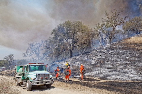
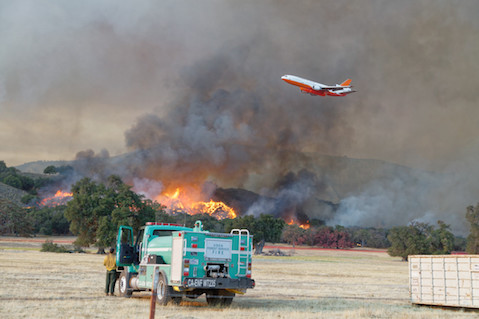
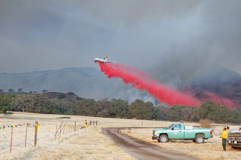
The drive back down Horse Canyon showed evidence of the incredible job firefighters had done burning out the canyon. Once out of the canyon and driving east back to the ranch entrance, one of the larger jet tankers circling above came in for a drop along the south edge of the foothills where the fire had reversed course when the winds shifted to the east and was burning back onto itself. As a precaution, a mile long line of retardant was laid down just below the fire activity.
While pockets of fire were still somewhat active within a line of thicker brush and oak trees near the foothills, there was little danger that the fire would break containment or reach the Santa Ynez River given the number of engine crews monitoring the fire and the wide swath of meadow area between the activity and the river.
Saturday’s Conditions
Unlike Friday, Saturday was a good day on the fire line. The big box, as fire officials like to call it, was starting to have more firm sides. With luck, now that much of the north perimeter, all of the west perimeter, and most of the south perimeter were now in mop up mode, the focus will be on holding the Oso Canyon area and securing the upper northeast corner near Little Pine Mountain.
What the wind does today could determine if the box is completed, and we can rest a little easier tonight.