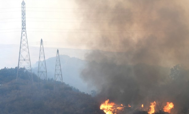
Rey Fire Closes Large Part of Santa Barbara Backcountry

Hundreds of hunters, campers, and hikers customarily trek the wilderness areas affected by the Rey Fire, but portions of Los Padres National Forest are now closed to public access, forest officials announced today. Stating the closure was for safety’s sake and also for the rehabilitation of burn areas, Forest Service officials said the area will remain off-limits until Rey Fire is fully contained and controlled.
As well as inaccessible terrain and tinder-dry vegetation that has grown and died over decades, the firefight has also had to deal with drones reported in the area on Thursday. One of the sitings was called in by a member of the public, said Andrew Madsen, spokesperson for Los Padres. In another drone incident, “evidence has been collected,” Madsen indicated, and civil and criminal charges are being pursued.
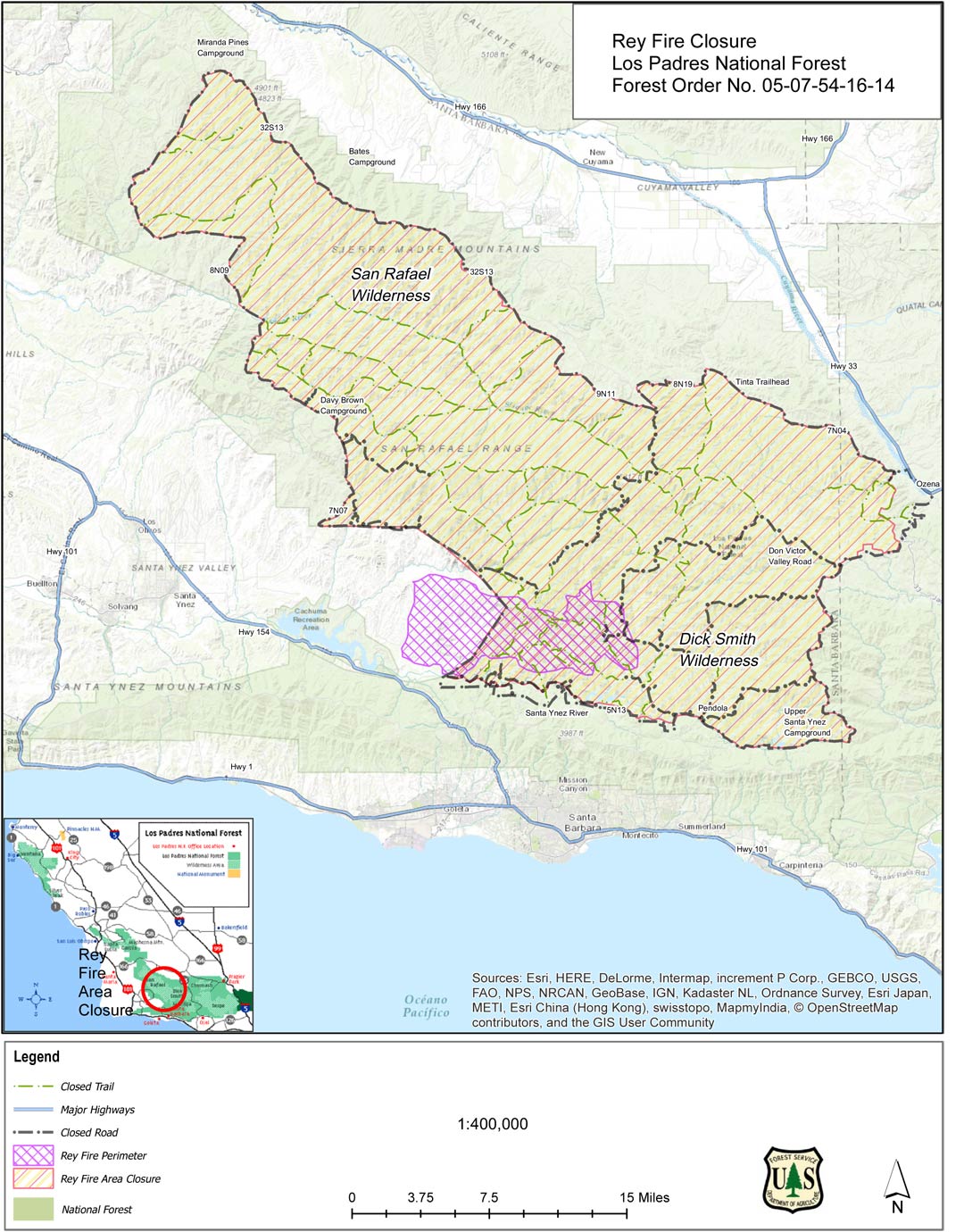
An enlargeable map of the closure area is to the left, and it includes parts of the Dick Smith and San Rafael Wilderness areas. The description is as follows: “The Rey Fire Closure Area begins at the intersection of the Santa Ynez River and the Forest boundary and continues east along the Santa Ynez River to its intersection with the Potrero Seco Road, then continues north along Potrero Seco Road to its intersection with Don Victor Valley Fire Road. The closure extends northeast along Don Victor Valley Fire Road to its intersection with Jacinto Reyes Scenic Byway and continues north along Jacinto Reyes Scenic Byway to its intersection with California State Highway 33. The closure then extends west along Highway 33 to its intersection with Forest Road 7N04, and continues northwest along Forest Road N704 to its intersection with the gate at Tinta Trailhead. It then continues west along Tinta Trail to its intersection with the gate at Forest Road 8N19 and extends west along Forest Road 8N19 to its intersection with Forest Road 9N11. The closure then continues northeast along Forest Road 9N11 to its intersection with Forest Road 32S13 and extends northeast along Forest Road 21S13 to its intersection with Forest Road 8N09. The closure continues south along Forest Road 8N09 to its intersection with Forest Road 7N07 and extends south along Forest Road 7N07 to its intersection with the Forest boundary, and then continues southeast along the Forest boundary back to the starting point as shown on the attached map.”