Here’s Exactly How Far the Thomas Fire Has Eaten into Montecito, Santa Barbara

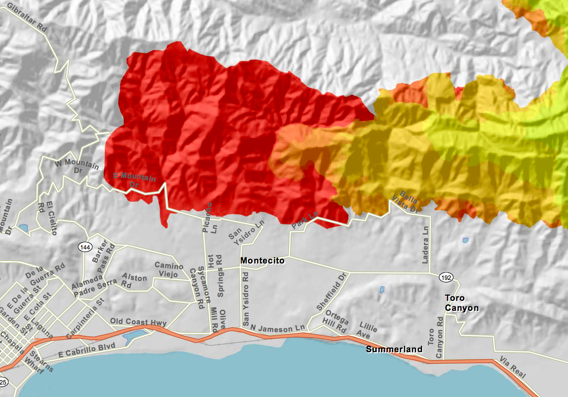
Every night since the start of the Thomas Fire, when temperatures cool and hotspots stand out best, a low-flying Cal Fire surveillance plane equipped with heat-sensing cameras has swooped over the entirety of the now 269,000-acre inferno and plotted its boundaries. The resulting maps are the most accurate daily assessments of the massive and ever-unpredictable blaze.

Saturday evening’s map, seen above, reveals the Thomas Fire’s western flank has swelled to reach Gibraltar Road close to Rattlesnake Canyon Park. Despite reports Saturday, it does not appear to have entered Parma Park. The fire’s southern edge now runs along East Mountain Drive and Park Lane in Montecito. To the north, it’s skirting the edge of East Camino Cielo.
View the high-resolution version of this Cal Fire map and others, which allow users to zoom in and search locations in greater detail, by visiting inciweb.nwcg.gov.
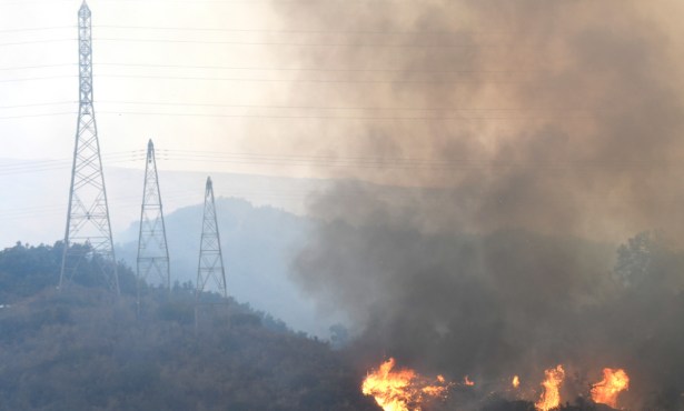
Incident commanders said Sunday morning that the fire had grown approximately 11,500 acres over the course of Saturday, when early morning gale-force winds ― with gusts reaching up to 60 and 70 miles per hour ― fanned flames southwest from the foothills into neighborhoods. The winds died down late Saturday and early Sunday, and are expected to remain relatively calm over the next few days. As of noon Sunday, they were blowing 5 to 10 miles per hour with gusts up to 18.
The map below illustrates how far the Thomas Fire has spread over the last four days, which each day represented by an increasingly darker shade of yellow, orange, and red.