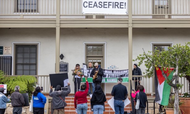
County Leaders Tackle the Hard Facts of Montecito’s Future
Unstable Mountains Remain Dangerous
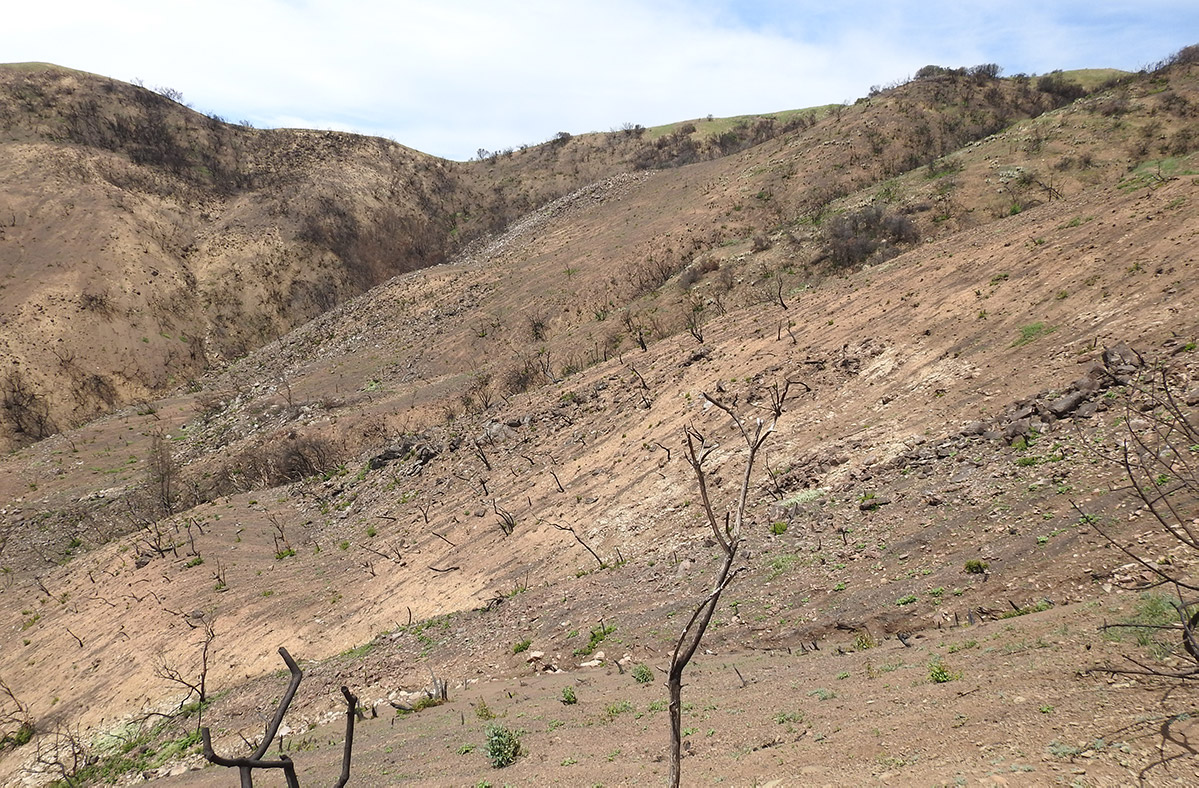
Fifty scientists, engineers, and emergency officials met Monday at the Santa Barbara County Office of Emergency Management (OEM) for an all-day symposium to evaluate the 1/9 Debris Flow — and what they had to say was not reassuring. The worst news came from Kevin Cooper, a U.S. Forest Service biologist who served on the Burn Area Emergency Response (BAER) team for the Thomas Fire. New vegetation covers only 5-10 percent of the bare mountainside above Montecito, he said, and not much more rain is expected this season. “It’s a combination of a late fire, very dry soils, late rains, loss of soil, and [poor] germination,” Cooper said during a debriefing with a reporter on Monday. “In these cases, we have to wait for nature to take its course.”
Shrubs with deep roots are sprouting a little new growth, but, crucially, the grasses have not come back, he said. By comparison, a year after 2009’s Jesusita Fire burned 8,700 acres above Santa Barbara, upward of 80 percent of the vegetation had returned, including grasses four feet high. What the poor vegetation recovery means, said OEM Director Rob Lewin, is that the county will keep the current rainfall threshold for evacuations, 0.5 inches of rain per hour.
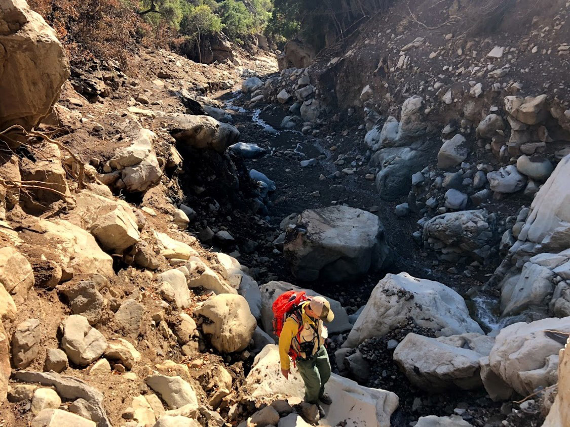
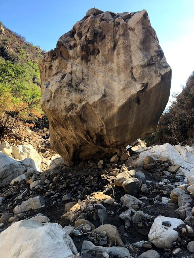
The county also wants to know when it will be safe to shrink evacuation zones, Lewin said, based on the creeks and debris basins that have been cleared and the amount of mud and rocks still remaining above Montecito. The scientists said they may have some answers by summer’s end. Montecito, they said, now faces a lower risk for a significant debris flow — no one knows how much lower — than the Carpinteria Valley. That’s because a much larger mass of rock and mud came down from above Montecito than Carpinteria. But Montecito is still at risk of another big — and potentially deadly — debris flow, they added. The danger of flooding in both communities has been heightened, too, because water can easily slide off the charred surface of the soil in the burn area. (By definition, debris flows have a mud content of more than 60 percent.)
“A watershed with no vegetation will shed tremendous amounts of water compared to a watershed with vegetation,” Lewin said. “We have a potential for two kinds of disaster: a repeat of a debris flow, and flooding that in a normal watershed may not be a flood. And this is not a Montecito problem. We know that this could occur in all of these canyons on the South Coast.”
The longer it takes the vegetation to recover, the more likely it is that more loose rocks and dirt will collapse into the canyons, ready to deploy downstream if it rains enough, said Jeremy Lancaster, coleader of the state Watershed Emergency Response Team (WERT) for the Thomas Fire. “It’s easy to say we’ve removed a lot of sediment and therefore there’s less. But you can’t predict the rainfall. We have to deal with the risk of a rainfall event like the one this year, and then all bets are off.”
Mark Jackson, a meteorologist in charge at the National Weather Service in Oxnard, said that scientists are a “long, long, long way” from being able to pinpoint where rain will fall hardest. It was an extreme rainfall of 0.5 inches in five minutes above Montecito, followed closely by several more extreme bursts, that triggered the catastrophic debris flow in January. “The predictability of these events is very small,” Jackson said. “A week in advance, we can say we’re expecting a big storm with four to six inches, and that’s about all we can say. We don’t know where it’s going to occur.”
Tom Fayram, director of the county Flood Control District, said the county plans to apply for $6.75 million in state funding to expand the debris basins on Cold Spring, Santa Ynez, and Romero creeks. The county would pay $2.25 million toward the work, making a total of $3 million available for each basin. But Fayram said nobody is contemplating basins as large as the one on Santa Monica Creek in Carpinteria, adding that Montecito residents may not want dams 100 feet high in the foothills or concrete creek channels all the way to the ocean. At the same time, he said, there may be ways to modify dams so that they let mud through while trapping more rock, as has been done in the Gobernador Creek debris basin. “We’re trying to find the sweet spot,” Fayram said. “The last thing I want to do is trap fine-grained sediment, like sand. We want the rocks.”
Finally on Monday, Lewin had a word of caution for Montecito residents waiting for the Federal Emergency Management Agency (FEMA) interim recovery map. Expected in June, the map is designed to guide the safe reconstruction of destroyed and damaged residences. But residents should not disregard evacuation orders even if they build more resilient homes, Lewin said. “Just because somebody can rebuild because of the new map doesn’t mean they are going to be safe in their homes,” he said. “Those maps are to protect homes. They’re not to protect lives. We still don’t know where the rocks are going to end up.”
More Questions
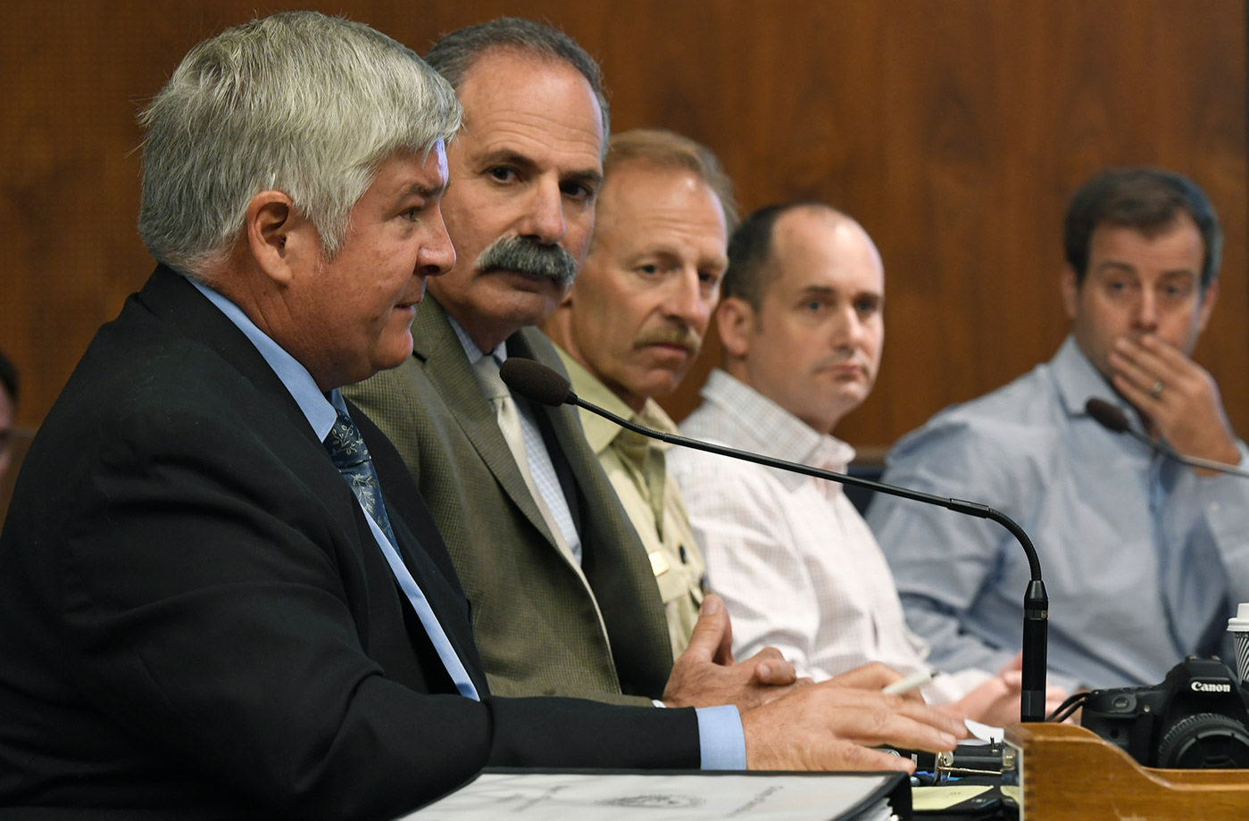
On Tuesday, county supervisors — after hearing a boiled-down presentation of the scientists’ collective assessment — struggled to identify preventive action that might make a difference should the South Coast get pelted by intense rain in the near future. Supervisor Das Williams asked whether the hillsides could be stabilized with hydromulching or an aggressive seeding program. Part of the problem, said Cooper, is the steepness of the hillsides. Any plant-based stabilization effort, he said, would be quickly washed away by heavy rains, given that most of the hillsides above Montecito have slopes in excess of 60 degrees.
Supervisor Peter Adam suggested that controlled burns might help keep future fires from getting out of control by creating a checkerboard of breaks. Cooper replied by stating the obvious, “It’s very difficult and very hard to control.”
Supervisor Williams suggested Supervisor Adam was not aware of just how much controlled burning still takes place, prompting Adam to respectfully disagree with Williams. “There’s hardly any being done,” he insisted, suggesting a program of 3,000-acre checkerboards be ignited via “heli-torch.” Controlled burns typically have taken place in cooler months, but with fire season expanding nearly year-round, Williams suggested the opportunity for controlled burns has greatly diminished.
Supervisor Joan Hartmann asked whether new debris basins were needed. Fayram replied that the U.S. Army Corps of Engineers was currently assessing that very issue, but he cautioned that debris basins are “very difficult” to site — they’re large, unsightly, expensive, and fraught with environmental vulnerabilities. According to all assessments, the county’s battery of debris basins — most installed higher up in the foothills in the wake of a 1964 fire-and-flood combination that triggered a serious debris flow — helped blunt a significant amount of the fury.
Supervisor Janet Wolf asked whether K-rails could be installed upslope to redirect any future debris flows. That idea was considered, she was told, but rejected. Given that Montecito was built atop a network of successive debris-flow deposits, geologists cautioned that it’s exceptionally difficult to predict which path future debris flows might take. One geologist described a debris flow as a “bouldering surge” carried rapidly along by “rolling concrete.” To the extent such force could be anticipated, he said, K-rails would be useless in stopping it.
Despite the exceptional nature of this year’s disaster, supervisors were warned that debris flows are an inevitable outgrowth of the region’s fire-and-flood rhythm. There have been 63 major fires since 1913 and seriously destructive debris flows in 1964, 1971, 2017, and 2018. This year’s was, admittedly, “a maximum magnitude event,” said Cal Fire’s Drew Coe, but less-than-maximum events are fully capable of destroying homes and killing people.
With the county strapped for cash, a group of wealthy, civic-minded Montecitans — calling themselves The Partnership for Resilient Communities — donated $140,000 to the county to help cover the cost of consultants to explore possible strategies for coping with hillsides rendered deadly with the addition of intense rains. The group includes attorney Joe Cole, who currently chairs the Montecito Planning Commission (and is the former publisher of this newspaper); former Santa Barbara City Fire chief Pat McElroy; political consultant Mary Rose; and entrepreneur Brett Matthews, among others. They have already hired one emergency response planning consultant assigned to the county’s Office of Emergency Management as well as the services of James Lee Witt, who was the FEMA director during the presidency of Bill Clinton.
The county supervisors approved spending $104,000 to reestablish 70 land survey monuments — critical to determine exact property lines — that were destroyed in the fire and debris flow. Lastly, the supervisors approved a contract with a private law firm in preparation of filing a lawsuit against Southern California Edison on the grounds that its negligence was responsible for the Thomas Fire, which in turn created the preconditions for the 1/9 Debris Flow. SoCal Edison has been sued by multiple parties — including the City of Santa Barbara — on similar grounds. SoCal Edison has responded to all such claims that the cause of the fire is still under investigation.