Utilities May Cut Power During Extreme Fire Weather
Both SoCal Edison and PG&E plan to shut off the power when fire weather criteria warrant it. Already, the City of Lompoc is warning its citizens of possible power shutoffs, and in Kern County’s Lake Isabella region, where temperatures reached into the 90s amid extreme fire conditions on Tuesday, a Public Safety Power Shutoff advisory would have cut electricity to more than 3,000 customers.
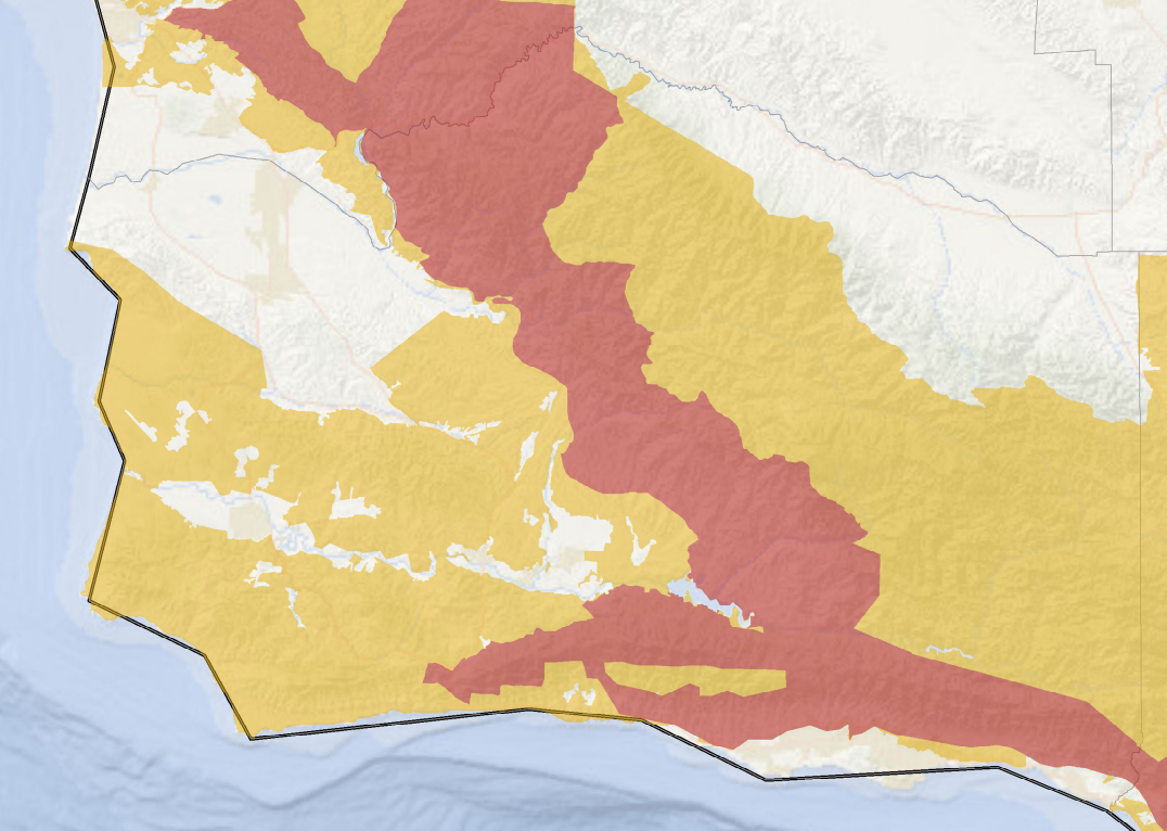
In Santa Barbara County’s northern half, Lompoc is normally a cool and foggy locale, but the PG&E high-power transmission lines that serve the city run across mountain regions that are identified as “elevated” and “extreme risk” by the California Public Utilities Commission (CPUC) at its fire-threat map. A similar situation affects cities throughout the state, and for Santa Barbara’s South County, power comes from only one set of Southern California Edison transmission lines along the mountain ridges.
The Public Safety Power Shutoff (PSPS) program has been in place in Santa Barbara for about a year — receiving some negative feedback from customers during sweltering summer days last year — and has been used a handful of times across the state, spokespersons for the companies said. Both utilities are being sued for major fires allegedly sparked by power-company equipment in 2017 and 2018, and citing lawsuit liabilities, PG&E filed for Chapter 11 bankruptcy protection in January 2019. PG&E spokesperson Jeff Smith said the power shutoff program was more of a response to the dramatically increased wildfire dangers in California caused by a changing climate.
For customers, signing up to receive early notifications by text, email, or phone is important, said Sally Jeun, an Edison spokesperson. The first set go out two days before an expected fire weather event, and the last when power is restored, which can sometimes take several days. Weather reports, meteorologists, webcams, and people on the ground combine reporting resources to advise the companies of when a power-off is necessary, Jeun and Smith said. Some of the metrics include the CPUC fire-threat map and fire criteria such as high wind, low humidity, and vegetation moisture. (For more information about Public Safety Power Shutoffs, see the Edison and PG&E webpages.)
The National Weather Service has a “heat risk” product in development to aid in issuing advisories, said Mark Jackson, an NWS meteorologist. The map currently shows the Cuyama area to be headed for a “very high” heat risk period of 98-100 degree weather Friday through Sunday, with overnight temperatures at an uncomfortable 73-74 degrees.
In the Midwest and East Coast earlier this week, during a record-breaking heat wave that combined with extreme humidity to feel like 110-degrees-plus, officials established cooling centers. Locally, the county’s Public Health director, Dr. Van Do-Reynoso, said they were verifying the availability of cooling shelters, which would open based on National Weather Service heat alerts. When the electricity is out, Public Health works with home health providers to check on vulnerable or fragile patients, as they had during a heat wave in 2017, she said.
For its part, the Red Cross suggests that people stay hydrated during hot weather, exercise only when it’s cool, check on family and friends without air conditioning, and remember that pets suffer from heat, too.