
Work on Alisal Fire Turns to Flood Control
Burn Scar Will Be Hit with Heavy Rain Monday Morning
The hardest rain from the storm headed for Santa Barbara could occur during Monday’s morning commute along the Gaviota Coast. The worst of the weekend’s storm is expected to fall between 4 and 8 a.m. on October 25, said meteorologist Mark Jackson of the National Weather Service, with one to two inches expected in the weekend storm, though higher elevations would receive more. As a result, an evacuation warning started at 6 p.m. on Friday due to the likelihood of flash floods or debris flow in the Alisal Fire burn scar. The warning is for the area between Las Flores and Mariposa Reina, from West Camino Cielo to the Pacific Ocean. A warning means residents should get ready to leave. More urgent is the evacuation order, which means get out now.
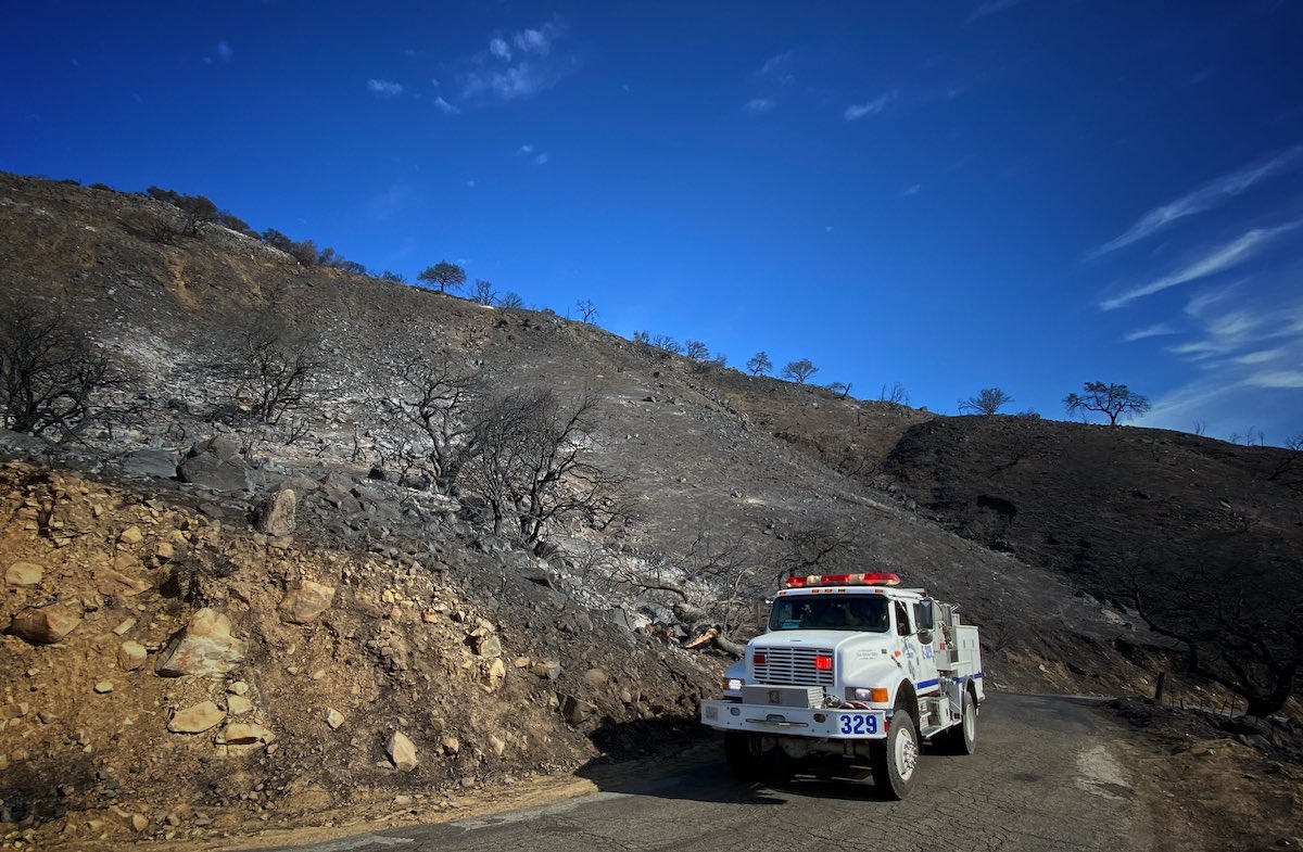
All this information came during a press conference called by the county on Friday afternoon to warn residents in the Alisal Fire footprint of potential danger from the storm. Refugio Road has been the focus of visits by Search and Rescue volunteers and Sheriff’s deputies, letting residents of the 300 homes up there know that if an order to evacuate is made, they should leave or be prepared to be stuck for several days. When the rain hits, the streams that cross the road will rise, and rock and burned vegetation will likely sluice down with the rain-slick soils. County Flood Control has been working with Lash Construction to clear 1,500 feet of channel, said Chris Sneddon of the Public Works Department, which includes six places where the road crosses creeks. They removed 600-800 cubic yards of material to keep the very narrow channels open, he said.

The earliest notices of warnings and orders will come through the county’s notification system. ReadySBC.org has information on how to sign up for alerts and advice on preparing for floods and debris flows. Kelly Hubbard, who leads the Office of Emergency Management, said any text, email, or phone alert would identify the location to be evacuated. “The Wireless Emergency Alerts target cell towers,” she said. “So depending on who’s in the area and who their carrier is, people around the zone can get an alert that bleeds over into their area.” People can email Hubbard’s office at oem@sbcoem.org or call (805) 681-5526 if they have trouble registering or have questions.
County Fire Chief Mark Hartwig advised staying off the road and remaining indoors during the worst of the rain. “Flash floods happen very fast,” he said. “You can’t get ahead of it in your car or outrun it.” Interior walls or the highest part of a home were the safest place to be, he said, if you have to shelter in place.
Though the road warnings were for Refugio Road, Captain Mike Logie of the California Highway Patrol said that if the 101 became impassable during Monday morning’s rainstorm, the same roadblocks would likely go up at Highway 1 outside Lompoc and at Winchester Canyon Road in Goleta until the blockage could be removed.
The corollary to that advice was not to drive through standing water because it could be deeper than it looks. “Turn around; don’t drown,” several speakers said.
The source of the concern, the Alisal Fire, was at 97 percent containment, said Chief Hartwig. A total of 298 people were now on the fire, and the acreage had dropped to 16,962 with more accurate mapping.
All eyes are on the storm as it approaches from the north. Jackson said the timing of the heaviest rain will be more accurate as Monday draws nearer, but so far the storm was behaving as the models have forecast.
Support the Santa Barbara Independent through a long-term or a single contribution.


You must be logged in to post a comment.