
Rain Soaks Santa Barbara County
Reservoirs up Slightly, No Damage Reported in Alisal Fire Footprint
[Update: Dec. 14, 2 p.m.] The evacuation order for the Gaviota area has been lifted, but Refugio Road is open only to residents. Crews continue to clean up in the area.
[Original story] The cold Pacific waters that cause a La Niña system are controlling the weather this rain year — as well as feeding tornadoes in the Midwest — but last night’s rainfall totals were astonishing. At San Marcos Pass, 7.58 inches fell, and 5.65 inches at Gibraltar Dam — the two highest recorded by the county hydrology gauges for the storm.
Gibraltar Reservoir’s current capacity nearly doubled from 3.8 percent on December 13 to 6 percent on December 14. Though the creeks ran well at the height of the storm at around 4 a.m., the precipitation is soaking into the thirsty soil. Lake Cachuma — which is fed by the Santa Ynez River — increased slightly by about 612 acre-feet, raising current storage to 92,106 acre-feet out of a possible total of 193,305. Gibraltar’s dryness, watershed, and relatively small size accounted for the numeric increase, and Cachuma’s level went up mostly thanks to direct rainfall, said Shawn Johnson, senior hydrologist for Santa Barbara County.
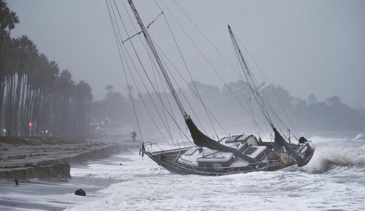
The rain along Gaviota was described as “super gentle, through and through” by Guner Tautrim of the Orella Ranch, who noted they got about two inches along the coast and more than five inches at the top of the ridge at Refugio. A few landslides dropped mud and rock on the road, and high winds sent a sailboat into the beach in Santa Barbara. But very little damage was reported by both fire and law enforcement officials, apparently caused by the wind: a downed wire off Foothill Road, broken tree branches, trees that damaged a structure and vehicle in the city. The day after, however, has been one of sporadic power outages downtown.
Just four months into the rain year, which runs from September to August, this storm puts the county at 127 percent of its normal-to-date rainfall, but at 25 percent for the normal-water-year rainfall countywide. La Niña systems are typically drier, and the long-range forecasts point to a drier, hotter 2022. “We still have January and February to go, which on average are wetter than December,” said Mark Jackson with the National Weather Service. “We can at least cross our fingers that the long-range outlook is off this season.”
Beach goers take notice of a sailboat that washed ashore during the evening storm. | Credit: Erick Madrid 
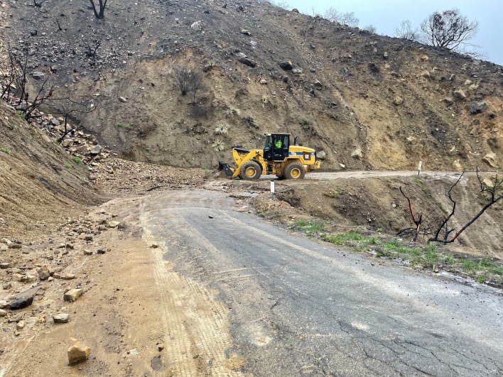
The burn scar from the Loma Fire. | Credit: Erick Madrid 
A woman walks underneath the Arlington Theater marquee durning a rain storm. | Credit: Erick Madrid 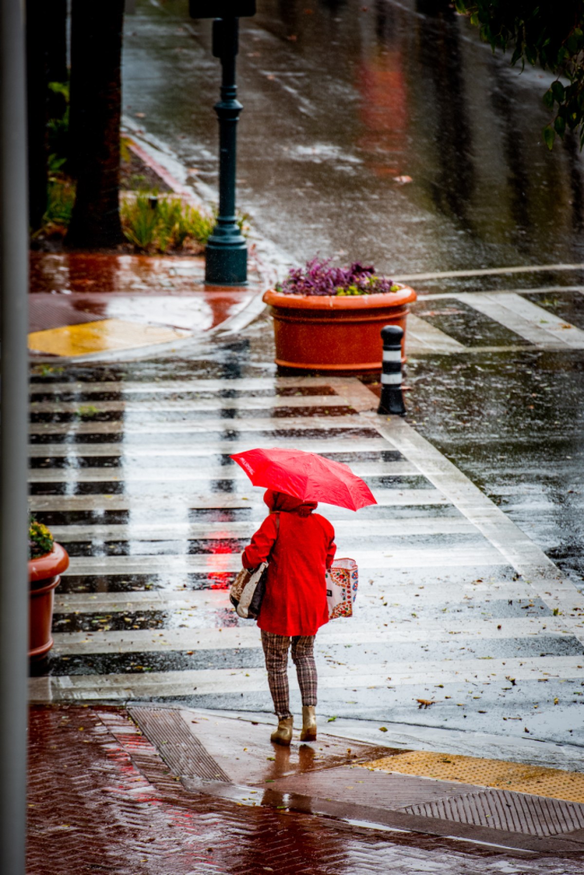
A woman waits in the rain to cross the street at State St. and Canon Perdido. | Credit: Erick Madrid 
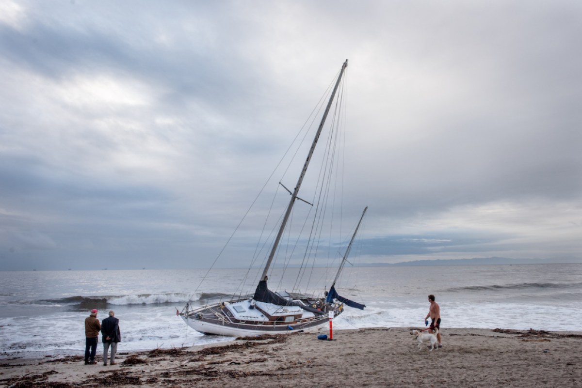
Beach goers, take notice of a sail boat Tuesday morning, that washed ashore during the evening storm. | Credit: Erick Madrid 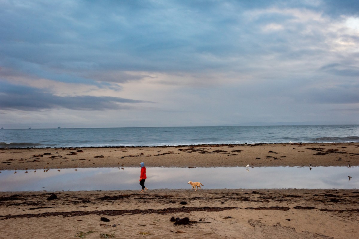
Elaine Kelly walks her dog, Elle, at Leadbetter Beach, where high tides and heavy rain have made a large puddle along the beach. | Credit: Erick Madrid 
A bicyclist rides down State St. early Tuesday morning after an evening of heavy rain storms. | Credit: Erick Madrid 
A bicyclist rides down State St. early Tuesday morning after an evening of heavy rain storms. | Credit: Erick Madrid 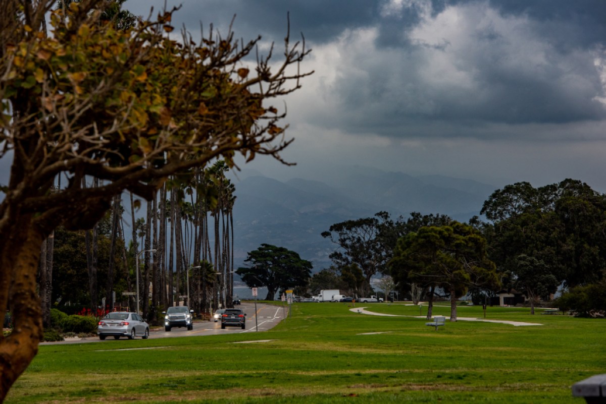
A look from Shoreline Park, as storm clouds loom over Santa Barbara. | Credit: Erick Madrid
Correction: Thanks to our astute readers, we correct this story to state it is colder waters welling up in the eastern Pacific that cause a La Niña condition as the warm waters stream to the west.
Support the Santa Barbara Independent through a long-term or a single contribution.


You must be logged in to post a comment.