
Shoreline Park Beach Walking
The closest place to go for a secluded beach walk.

BEACH WALK INFORMATION
Distance-1.25 miles east to Stearns Wharf; 2 miles west to Mesa Lane; 3 miles west to Arroyo Burro County Beach.
Topo-Santa Barbara
View Photo Gallery
DIRECTIONS
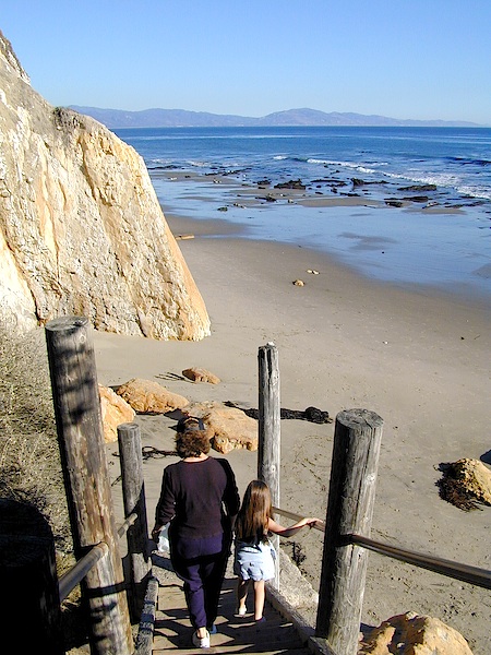
Shoreline Park is located a mile west of Stearns Wharf on the bluffs just past Ledbetter’s Beach. If you can’t get around Santa Barbara Point due to high tides, there are steps leading down to the beach from the park’s mid-point.
A CAUTION
There are several points along the way to Arroyo Burro which you can get caught in between at high tide.
THE WALK
The park is long and thin, encompassing almost a mile of the bluffs just west of Santa Barbara Point. There are plenty of places for picnics and barbecues, equipment for the kids to play on, and a stairway leading down to the beach, where you can enjoy a quiet walk along the cliffs, all the way to Arroyo Burro Beach if you choose.
Surprisingly, given the proximity of downtown Santa Barbara, once you make the turn around Santa Barbara Point it is almost as if you have been transported to a remote beach. With the exception of a glimpse here and there of a clifftop house, you see nothing of the city.
There are a series of points and small coves for the next three miles to Hendry’s Beach. Usually, if you can get around the point you will have clear walking for the next several miles though you should know whether you are on a rising or falling tide before you venture too far. At the lowest tides this is one of Santa Barbara’s best walks. A long series of rocky shelves are exposed and you can walk in and out of the tide pools almost all the way to Mesa Lane.
If you can’t make it past the point, try walking up to the park. Follow the cement path along the edge of the cliff until you reach the stairs leading down to the beach. These bypass the point.


