Seven Falls
Another Great Off-Trail Adventure for Those Ready for the Challenge

PLEASE NOTE: Due to damage caused by the recent fire, access to the Seven Falls area is currently closed. Please refrain from using the fire-damaged trails until they re-open.
TRAIL INFORMATION
Distance-1.5 miles to Seven Falls; 1.5 miles to Mission Falls
Elevation Gain-400 feet to Seven Falls; 1,750 feet to the intersection Tunnel Trail at Mission Falls
Difficulty-Easy to Seven Falls; hard core to Mission Falls
Topo-Santa Barbara
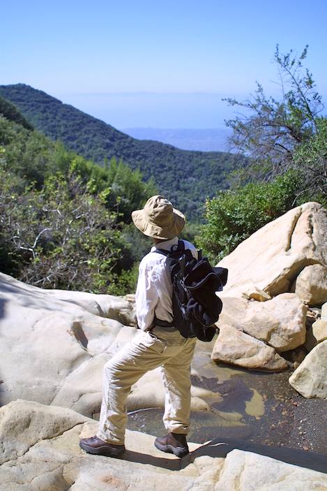
Perhaps you’ll have better luck than me at spotting each of the separate falls, but for the life of me I’ve not been able to count all seven of them. Nevertheless, Seven Falls is as advertised: one of the great canyon retreats to be found in the mountains immediately behind Santa Barbara.
To reach the falls you’ll follow the paved road past the locked gate at the end of Tunnel Road for 3/4 mile until you reach the bridge crossing the west fork of Mission Creek. If adventurous you can follow the creek upstream from here or continue on the road (it turns to dirt in a few hundred yards), follow it west past the turnoff to Tunnel Trail. Not too far past the Tunnel turnoff Jesusita Trail begins. Where the trail drops down into the creek turn right and head upstream. For the next 1/4 mile you’ll be doing a combination of creek hopping and following short sections of trail until you reach the narrows that mark the start of Seven Falls.
Most will opt to hang out here at the top of the first of the drop offs. The spot is perfect for sunbathing, a picnic, and a dip in the pools as has been the occasion for more than a century. Seven Falls was as much admired in the 1800s as it is now. In Geography of Santa Barbara, which Francis W. Conrad wrote in 1899, he wrote:
“The music of falling water comes at intervals upon the ear. The uneven trail winding around huge rocks, upon the edge of precipitous banks or plying through the slippery stones at the bottom of the creek, gives just enough elements of beauty, danger, grandeur and loneliness to make a ride here thoroughly enjoyable. Near the head of the canyon is what is known as ‘Seven Falls.’ The water here falls into seven stone basins in succession. The rocky banks are broadcast with delicate maidenhair ferns and are green with moss.”
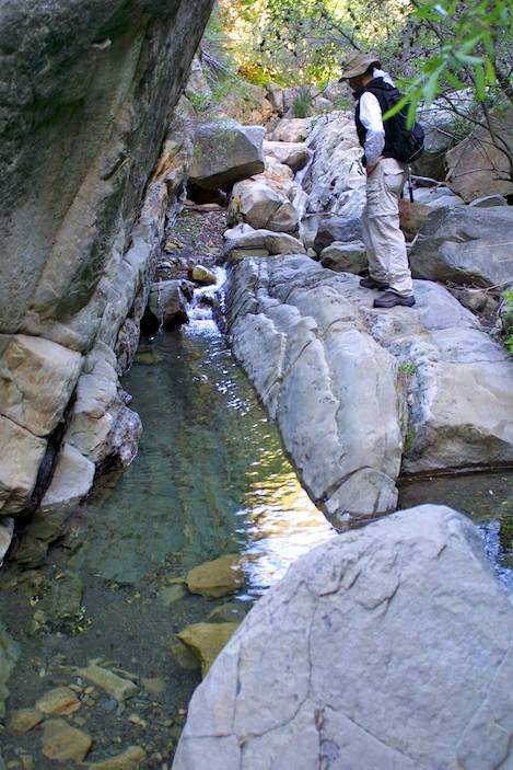
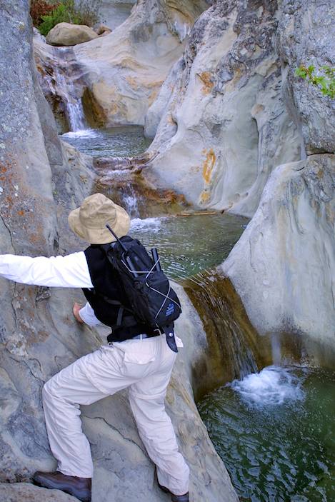
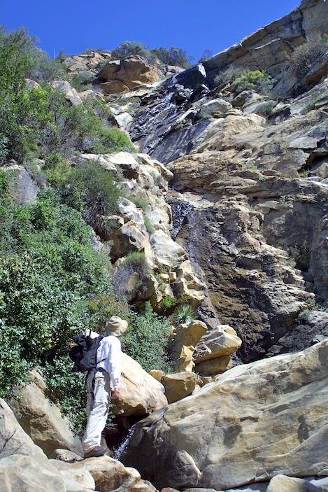
I’ve coaxed my friend Paul into exploring the mysteries found in the upper part of the canyon that lie beyond Seven Falls. The problem, as Paul discovered, is in the dicey moves one needs to make while skirting the left side of the steep canyon walls. The drop isn’t far, just a few feet, but a slip here means plunging waist deep into the cold mountain water.
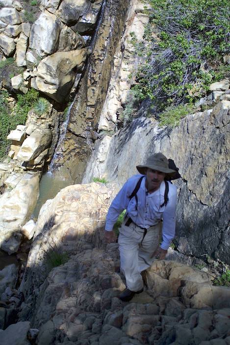
With a sure-footedness that tells me Paul has done this before, he makes the last leap up onto the apron of the last pool and is on his way upstream. The last rains have been just enough to prime the pools and get them running, though not by much. A few more storms and the falls should be running full tilt for the rest of the winter and into early summer.
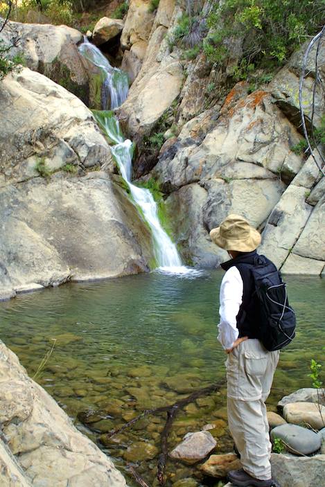
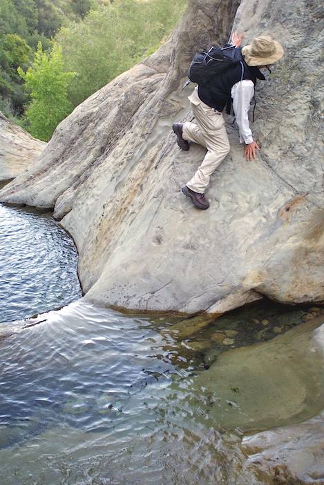
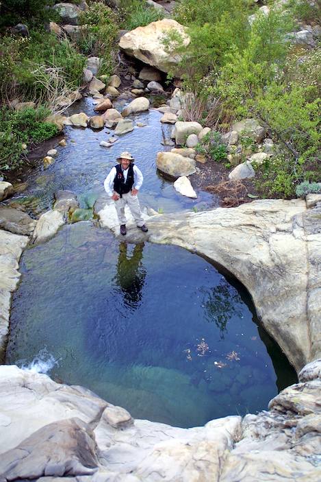
Though there is not much water in the creek just above the falls, miraculously, the flow begins to pick up as we head further upstream. For whatever reason that the titled geology dictates, there is always water running year-round a half mile up from Seven Falls. While I’m stopping to take photos, Paul scrambles on. He’s totally into the hike, which is actually more an alternating series of creek crossings, quick climbs, and lots of rock hopping. Another quarter mile and the canyon narrows and we reach a 25-foot set of falls with a large (though shallow) pool at its base – almost but not quite the great swimming hole. But just upstream from that at a point where the creek makes a sharp right turn the entire canyon levels out and turns into solid bedrock. “Yes!” I hear Paul exclaim. He’s found the next pools – the ones that make the perfect spot to spend a quiet afternoon.
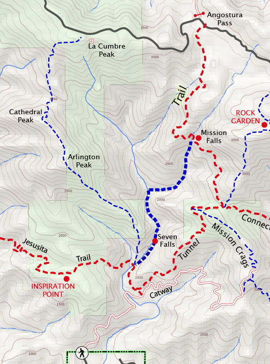
But I’ve got other plans for Paul. “You know, we can follow the creek all the way up to the top of Mission Falls and come back down Tunnel Trail,” I tell him. His eyes light up and I can tell he’s up for the challenge. Another hundred yards beyond the bedrock pools, the creek turns sharply back to the left and splits into two. The intersection is impossible to miss: a huge patch of prickly pear covers the corner separating the two drainages. Continuing straight ahead is not really an option. For many years after the 1964 Coyote Fire, it was possible to follow this fork up to the saddle separating Cathedral Peak from La Cumbre but it is way too overgrown to make it now without thrashing yourself. Though we both talk of wanting to open the route up to the saddle enough to make it a fun loop route, that’s for another day.
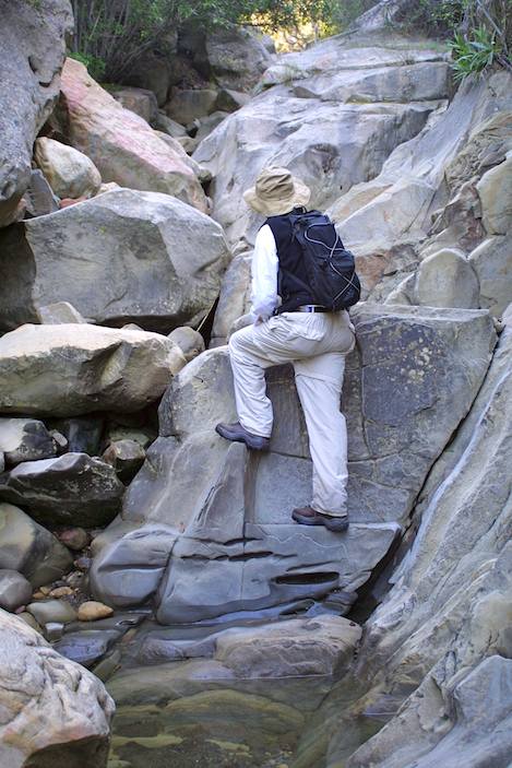
We turn right at the prickly pear and head due north up toward Mission Falls. The creek is relatively open and easy to follow though we do start gaining some serious elevation as we climb up a series of cascading sections of rock. Paul’s having way too much fun. I can tell because I can’t keep up with him. He’s practically running up the creek. Did I mention that Paul did the John Muir Trail last summer and is in the kind of shape I can only dream about being in? In his haste to move out, Paul didn’t hear the one last thing I’ve yelled up to him: “Stay left if you come to any intersections in the creek,” I shout, “or you’ll dead end.”
In a few minutes I catch up with Paul at one of those intersections. He’s figured out this out for himself. Fortunately though, the upper half of the canyon climb is pretty straightforward until we reach what looks like a vertical wall. “That’s Mission Falls,” I explain to Paul. “Tunnel Trail’s right at the top.”
What looks like an impossible climb is actually not too bad. On the right side of the canyon there’s a gully that is steep but takes you up to the trail. It’s a one-at-a-time kind of climb up as there’s no way to make it up without dislodging a few small rocks.
We scramble up to the trail and head the few yards over to the small side trail that takes you to the top of the falls. The ledge is wide and flat: another great spot for a picnic with great views, and after a rain a bit of flowing water to keep you company.
Before we leave and head back down the trail I point up the drainage. “It’s not too easy to do it,” I tell Paul, “but if you continue up the creek beyond the falls it will take you all the way up to the Rock Garden.” We haven’t enough time left to add that to the day’s adventure, but I can tell Paul is intrigued by the idea of being able to follow a canyon like the West Fork of Mission Creek all the way to the top of the mountains.
As we make our way down the trail, our hearts are singing. It’s been a great morning and we both know we’ve got another great adventure awaiting us another day.