
Sunday Evening La Brea Fire Report
Slow Growth, More Containment, Evacuation Changes

There will be a community meeting on Monday evening at 6:30 p.m. at the Cuyama Valley High School, 4500 Hwy 166, New Cuyama, to provide a fire update and plans for completing containment of the fire.
Today: Fire activity was minimal on the west, north, and northeast flanks of the fire with only an approximate 1,000 acre increase. Containment lines were mopped up and patrolled by crews. The fire was most active in the southeast section, specifically the Schoolhouse Canyon area.
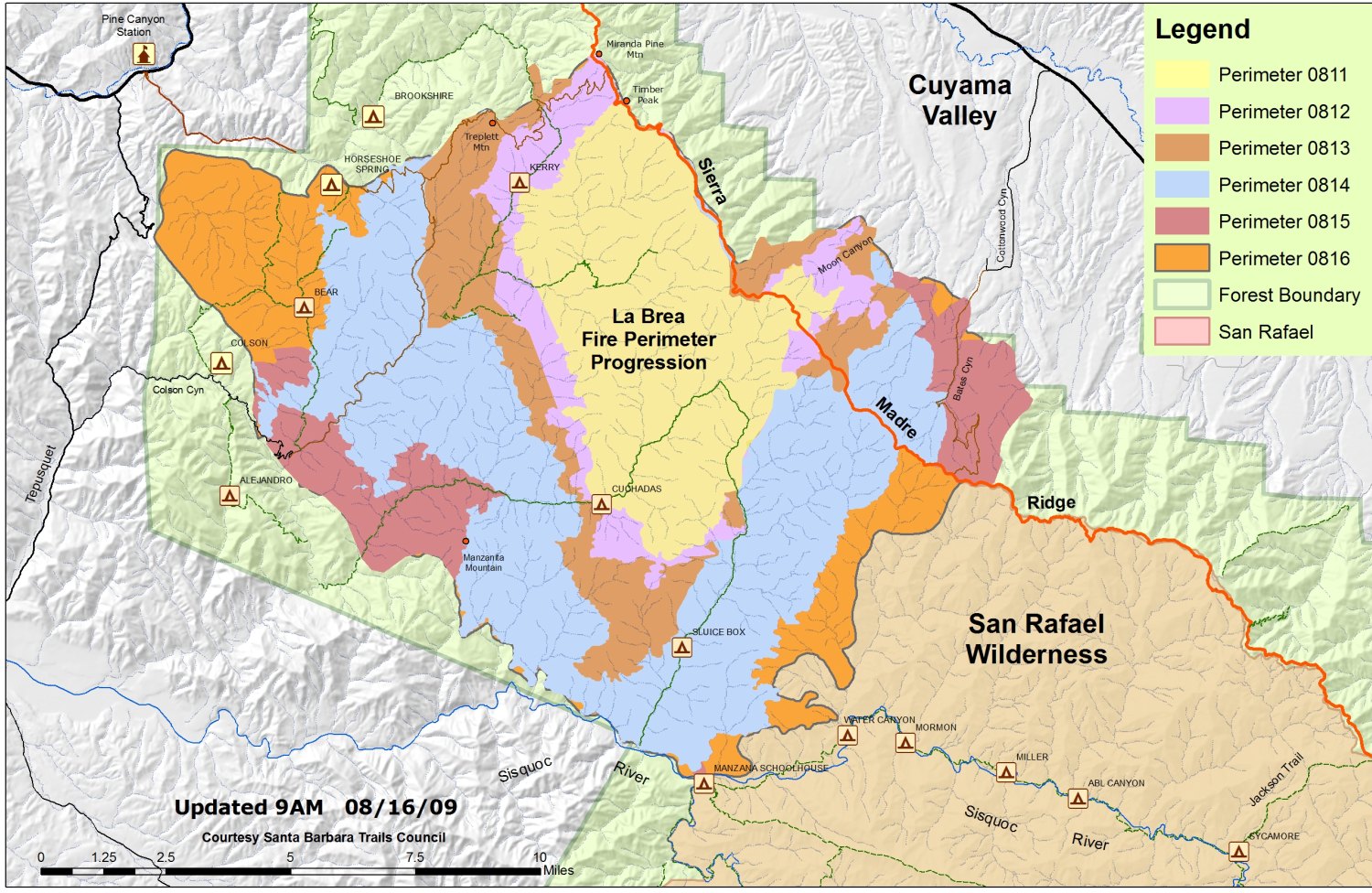
Fire activity along the south flank, from the Sierra Madre Ridge southwest toward the Sisquoc River, has slowed as the fire has entered into an old burn area. Firefighters are taking this opportunity to try to contain the fire by use of thermal infrared imagery to identify hot spots for targeted helicopter water bucket work.
The Santa Barbara County Sheriff’s Office and California Incident Management Team 3 coordinated the change to evacuation advisories and continue to evaluate the Cuyama Valley area for a reduction in fire risks to homeowners.
A final decision will be based on fire conditions.
Night Operations Plan:The focus on the east side of the fire will be improvement of the Schoolhouse Canyon ‘dozer containment line. This area represents the last of uncontrolled fire line east of the Sierra Madre Ridge. Firefighters’ goal is to push the active fire from the Cuyama Valley to the ridge and constrict it to the San Rafael Wilderness. Dozers and crews will continue to work on improving the fire lines and plan to conduct firing operations throughout the night if the weather permits this type of operation. Elsewhere, mop up and monitoring of the fire’s perimeter will continue.
Weather: The marine inversion will return much as last night around 1800 feet in elevation. On the west side of the fire, relative humidity (RH) recovery will approach 70-90 percent, which will hamper spotting potential outside of the fire lines. On the east side, drier conditions will create the potential for more active fire behavior.
Evacuations: As of 12 noon today, the Evacuation Order for the Tepusquet Canyon area was downgraded to an Evacuation Warning and residents were allowed back to their homes under advisory to be prepared to leave should the warning status change. This downgrade to a warning includes all Tepusquet Canyon, from Santa Maria Mesa Road to Highway 166, Colson Canyon, Blazing Saddle Drive, Ruiz Canyon, Buckhorn Canyon Road and Pine Canyon Road. All other standing Evacution Orders and Evacuation Warnings remain in effect.
Fire Investigation: U.S. Forest Service Special Agents, the Santa Barbara County Sheriff’s Office and fire investigators determined the La Brea Fire was caused by a cooking fire at an illegal marijuana drug trafficking operation within the forest. The La Brea Fire Tip Line is still open, and anyone with additional information helpful to this ongoing investigation is urged to contact 805-686-5074.
Closures: An emergency closure order is in effect for portions of the Los Padres National Forest in and around the fire. For more information, please contact Fire Information at (805) 961-5770 from 6am-10pm or http://www.inciweb.org/incident/1803/.
Resources:
Engines: 126
Crews: 56
Dozers: 30
Water Tenders: 59
Helicopters: 14
Fixed Wing: 5


