Rey Fire Jumps Mono Containment Lines Thursday
Fire Pushed Toward Agua Caliente Canyon


Late Thursday afternoon, a week after the Rey Fire took off into Rancho San Fernando Rey, and just when it appeared firefighters might contain the south edge of the fire along Mono Creek, embers blew east over the creek and into a canyon leading directly up to the ridge separating Mono and Agua Caliente canyons.
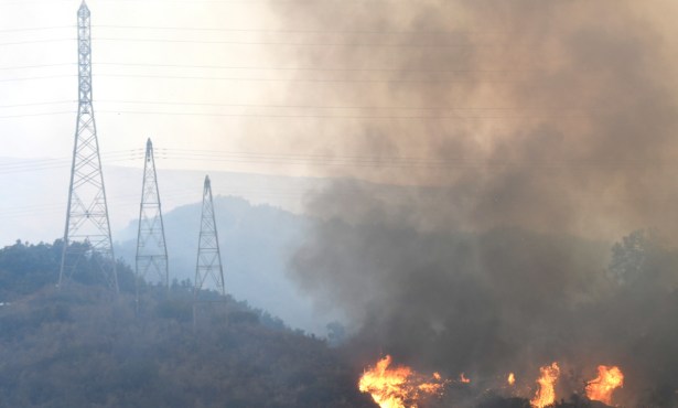
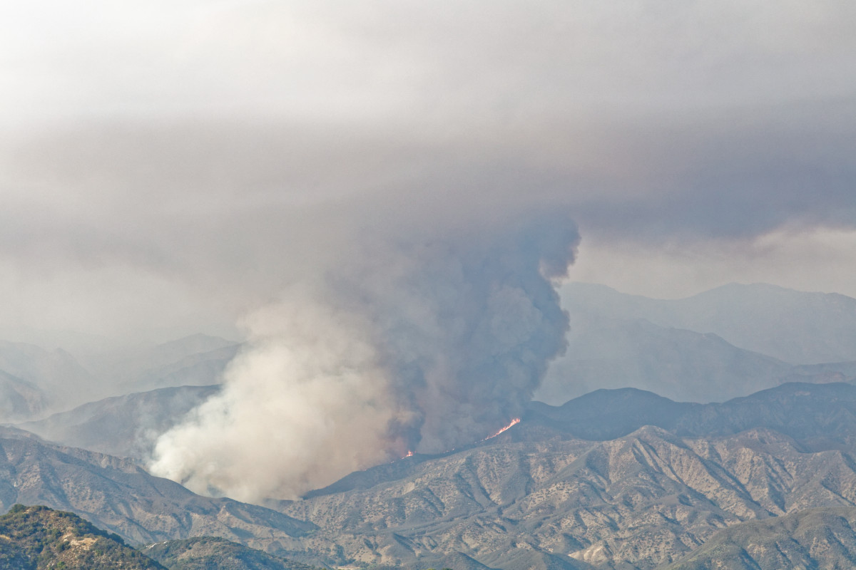
By 4 p.m. a 10,000-foot column of smoke began to build in the canyon, and within minutes it was clear that the efforts to keep the fire west of Mono Creek had failed. By 4:30 p.m., pushed by 10-15 mph winds and temperatures in the low 90s, a three- to four-mile stretch of Mono Canyon was fully involved, with the fire also jumping across the canyon further north in the vicinity of Ogilvy Ranch. There were reports that one building at the ranch may have burned or been damaged by the fire.
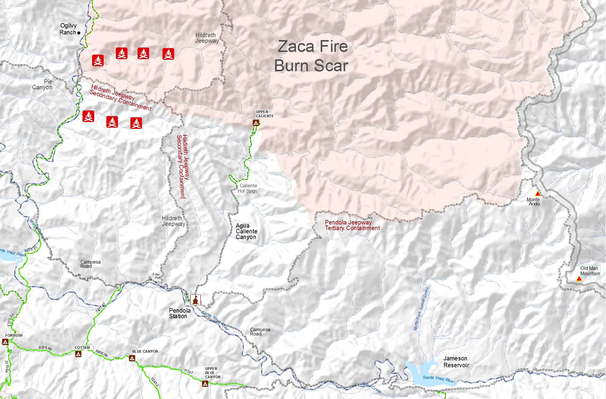
The biggest concern to fire officials was that the initial spot where the fire crossed Mono Creek was north of the secondary containment line leading from the canyon up to the Hildreth Jeepway and from there south to P-Bar Flat Campground. In addition, as the fire continued to burn further south in the canyon, it also crossed Mono Creek about two miles above Camuesa Road and was moving east.
By 5 p.m., the fire had burned at least halfway from Mono Creek up toward the Hildreth Ridge. At least a dozen retardant drops were made ahead of the advancing flames to slow its progress. By nightfall, as the fire began to “lay down,” it appeared the worst of the advance had stopped. With the number of smaller spots burning both north and south of the main containment line, it appeared the fire would reach Hildreth Ridge at some point and had the potential to cross over and into the Agua Caliente watershed.
Future Trends
Friday morning, firefighters will be facing stretches of fire along several miles of the Mono Creek drainage that have the potential of pushing the fire further to the east and to the north. Much more of the Mono Creek drainage, a major source of water for Santa Barbara — and cause of siltation in Gibraltar Reservoir after the Zaca Fire — will have burned than firefighters had hoped.
With the line of fire continuing its eastward path north of the secondary containment line, the night crews were tasked with making improvements to the next containment line along the Pendola Jeepway, which leads from Pendola Station at the bottom of Agua Caliente Canyon to the 6,002-foot top of Monte Arido on the ridge separating Santa Barbara and Ventura counties. This line was crucial in stopping the advance of the Zaca Fire in 2007, and it is possible firefighters will be required to make a stand along the ridgeline once again.
Today could determine how much more of the upper watersheds in these drainages will burn and what the impact will be on Santa Barbara’s vital water resources.