
Santa Barbara 1925 – 2025: A Portrait in Maps
**Events may have been canceled or postponed. Please contact the venue to confirm the event.
Date & Time
Thu, Sep 11 12:00 PM - 4:00 PM
Address (map)
15 E. De la Guerra Street
Venue (website)
Casa de la Guerra
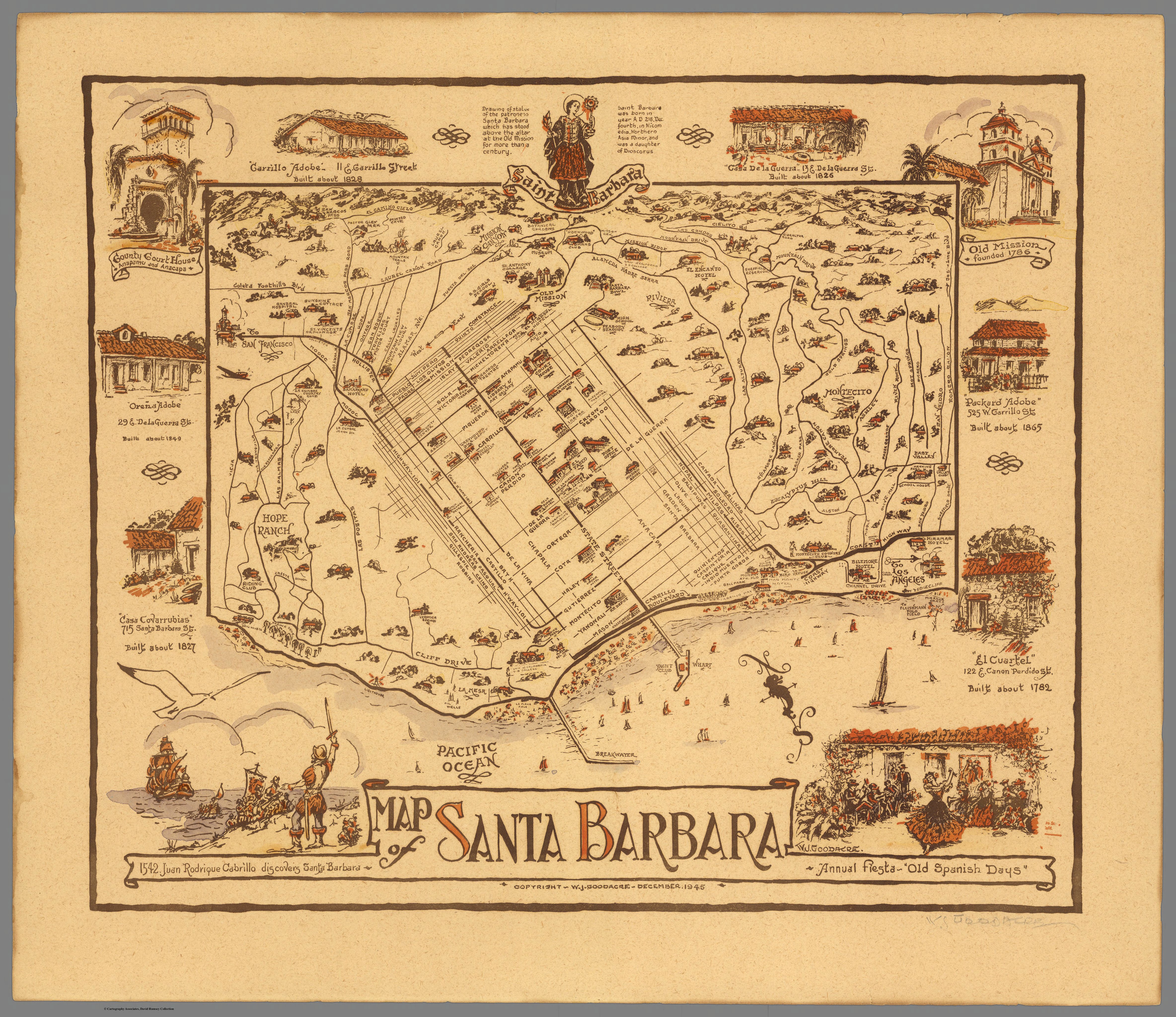
Using maps from historical archives and contemporary City and County documents, this exhibition tells the story of Santa Barbara’s development since the earthquake. These maps reveal dramatic changes in downtown Santa Barbara, for example, the creation of the harbor breakwater, and the construction of the 101 freeway. They also illustrate what has remained constant over the past 100 years: Santa Barbara’s identity as a special place set between the ocean and the mountains, blessed with a beautiful climate and a rich history. Maps remind us that the natural environment, like the urban environment, has a history and document the changing natural as well urban environment of Santa Barbara. The 100th anniversary of the earthquake offers a unique opportunity for Santa Barbara to learn from our past, reflect upon our present, and plan for our future.
Santa Barbara 1925 – 2025: A Portrait in Maps is part of a larger community-wide commemoration of the 1925 earthquake that shook Santa Barbara awake early on the morning of June 29, 1925.
