

Last Updated: August 17, 2007 7:00 am
Date/Time Started: July 4, 2007 10:53 am
Administrative Unit: Los Padres National Forest / Santa Barbara County Fire
County: Santa Barbara
Location: 15 miles NE of Buellton
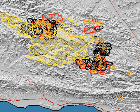
Acres Burned: 143,212 acres
Containment: 59% contained – 143,212 acres. Full containment expected on September 7, 2007.
Structures Destroyed: 1 outbuilding destroyed
Threatened: 483 homes and 112 outbuildings threatened
Evacuations: Please call 805-961-5770 for current information on evacuations.
Injuries: 29
Cause: Human
Cooperating Agencies: Santa Barbara County Fire, Los Angeles County Fire, Ventura County Fire, California Highway Patrol, American Red Cross
Total Fire Personnel: 2,852 (838 CAL FIRE)
Fire crews: 82 (38 CAL FIRE)
Engines: 226 (110 CAL FIRE)
Airtankers: 8 CAL FIRE
Helicopters: 23
Dozers: 57 (30 CAL FIRE)
Water tenders: 101
Costs to date: $76.3 million
Major Incident Command Team: Unified Command
Conditions: The fire is burning in extremely steep and rugged terrain with continuous heavy fuel loading.
The Paradise Road is under an evacuation warning, open to residents only. The Santa Ynez River Recreation Area remains under an evacuation order.
People looking north from the Santa Barbara area will see a huge towering column of smoke. This column results from active burning on the Zaca Fire. The actively burning area is in the Judell and Logan Canyon area, approximately 25 miles from the South Coast communities. The fire is burning away from the South Coast and represents no current threat to these communities. Citizens can expect to see more of these columns as the interior of this fire continues to burn for the next week or more. There has been no movement toward the Santa Barbara area for several days and the southern edge of the fire is currently secure.
The evacuation order for residents of the Paradise Road community, Los Prietos Boys Camp, Paradise Store and the Rancho Oso Guest Ranch has been downgraded to an evacuation warning effective Sunday, August 12 at 7:00 p.m. The Lower Santa Ynez River Recreation Area campgrounds, day use areas and trailheads will remain closed.
PLEASE CALL 805-961-5770 FOR THE MOST CURRENT EVACUATION AND FIRE INFORMATION.
Phone Numbers: (805) 961-5770 (Zaca Fire Information)
—————————————————–
Updated 12:00
Current Situation:
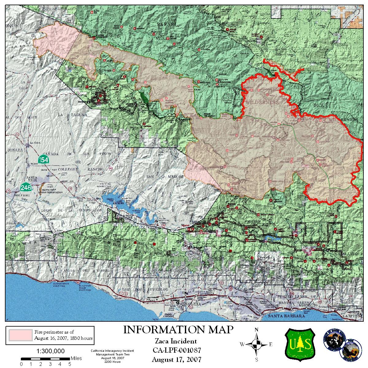
On the northern perimeter, firefighters have successfully completed 20 miles of backfiring to remove vegetation between the indirect fireline and the active portion of the fire in Sisquoc, Cliff and Sweetwater Canyons. Today, firefighters will continue to construct line on Sweetwater Ridge towards Sisquoc Canyon in order to stop the northwest progress of the fire in the San Rafael Wilderness. On the east perimeter, the fire is well established in Mono Canyon and continues to burn towards the Matilija Wilderness. A backfiring operation will begin near Three Sisters Peak. The active fire on the east perimeter is still 20 miles from Ojai and is burning within the indirect fire lines that the incident commanders have established to contain this fire.
Hwy 33 between Ojai and Cuyama and the Lockwood Road may close Saturday while firefighters conduct a firing operation to secure the fireline on the eastern perimeter of the fire. The decision to close the road is dependent on fire activity. Incident Commanders are working with the California Highway Patrol in conjunction with Santa Barbara and Ventura County Sheriff Offices on a traffic closure plan.
The fire is established in the Agua Caliente and Diablo Canyon drainages east of the Ogilvy Ranch and south of the Hildreth Jeep Trail. This has prompted fire officials to execute predetermined plans to utilize firing operations in the eastern area of the fire near the Ogilvy Ranch area. These firing operations are designed to keep firefighters ahead of the fire to remove unburned fuel. Contingency lines in the areas of Paradise Road, Camino Cielo Road, Camuesa Road, the Sierra Madre Ridge, Pendola Road, and the Matilija Wilderness are completed. These fuel breaks provide potential containment and may be used for firing operations in the event that changing conditions warrant such actions. Additional contingency efforts include improving the following fuelbreaks: Romero, Toro, Rincon, Oil, Santa Monica, Snowball, Chismahoo, and Rice-Wills. These fuelbreaks run west to east from Romero Canyon to Lake Casitas.
Forest, Road and Area Closures:
Happy Canyon Road is closed at Los Padres National Forest boundary.
Figueroa Mountain Road is closed at the Los Padres National Forest boundary.
East Camino Cielo is closed between Painted Cave Road and Gibraltar Road due to fire equipment traffic.
Paradise Road is within the Evacuation Warning Area and is currently open to residents only.
The Zaca Fire Area Closure in Los Padres National Forest has been expanded to include additional lands in Santa Barbara, Ventura and Kern Counties. The expanded closure now encompasses approximately 888,000 acres including the entire San Rafael, Matilija and Chumash Wildernesses, a portion of the Sespe Wilderness and adjacent national forest lands. Detailed information on the closure can be found at HYPERLINK “http://www.fs.fed.us/r5/lospadres” http://www.fs.fed.us/r5/lospadres or HYPERLINK “http://www.inciweb.org” http://www.inciweb.org or your local Forest Service Office.
Headlines:
There will be an informational meeting on the Zaca Fire, tonight, August 17 at the Halfway Cafe near Ventucopa on Highway 33. The meeting will begin at 7 pm.
Evacuations:
The EVACUATION ORDER for Paradise Road residents, Los Prietos Boys Camp, and the Rancho Oso Guest Ranch has been downgraded to an EVACUATION WARNING.
The Santa Ynez River Road campgrounds, day use areas and trailheads remain closed.


