

A heavy dose of rainfall came through Santa Barbara County on Sunday night, forcing a flash flood warning Monday morning along with the closure of the Santa Barbara Airport and several roadways. The National Weather Service forecasts more rain this coming week.
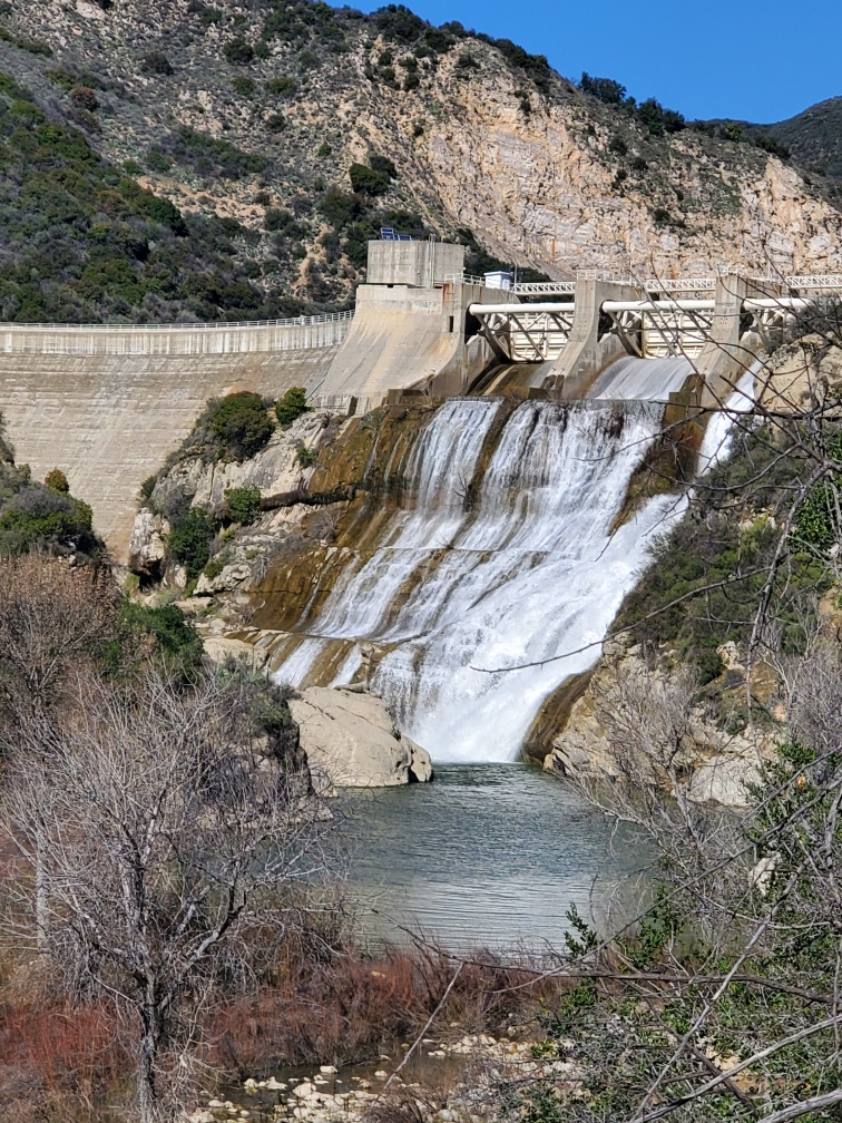
As of 8 a.m Monday morning, county rainfall gauges showed nearly nine inches of rain at San Marcos Pass and just more than four inches of rain in the City of Santa Barbara over a 24-hour period. Rainfall meters in Goleta and Carpinteria each registered around three and a half inches. Cachuma, Gibraltar, and Jameson reservoirs are 96-105 percent full, and the county as a whole is at 149 percent of its “normal-to-date” rainfall amounts.
In addition to the flood watch (effective through 10 a.m. Wednesday, February 21) and flash flood warning (which expired 10:30 a.m. Monday morning), the National Weather Service issued a coastal flood advisory and high surf advisory, both of which will remain in effect until 9 a.m. Tuesday.
While the rain is expected to slow down Monday afternoon, another storm system is expected to return on Tuesday. Erosion and soil saturation continue a threat of flooding, hillside slumping, falling trees, and power outages throughout the region.
As with the previous storm in early February, the Santa Barbara Airport announced that it would close on President’s Day due to flooding, and all commercial flights were canceled until further notice.
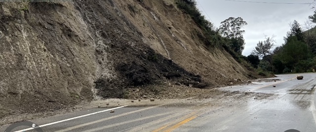
Fallen trees and mudslides have forced the closures of several county roads, including Sycamore Canyon Road, East Camino Cielo and Gibraltar Road in the hills of South County; Refugio Road, Harris Grade Road, Drum Canyon Road, and San Miguelito Canyon Road in Central and North County; and Maria Ignacio Bike Path, San Rossano Drive, and Cathedral Oaks Road between Winchester Canyon and Calle Real in Goleta.
In the City of Santa Barbara, authorities closed West Cota Street between De la Vina Street and Bath Street after emergency crews responded to reports of a fatality near Mission Creek. Sergeant Ethan Ragsdale confirmed a body was found in the creek near Bath and West Cota streets around 9 a.m. on Monday, and an investigation is ongoing.
An evacuation warning is still in effect for several areas in Santa Barbara County, including: properties along waterways associated with the Thomas, Cave and Alisal burn areas; properties in the vicinity of Sycamore Creek, from Stanwood Drive down to parts of Niños Drive in the City of Santa Barbara; and properties in the vicinity of Mission Creek, from Cota Street to Highway 101, and between Chapala Street and Castillo Street in the City of Santa Barbara.
To check if you live in the evacuation area, visit the county’s interactive incident map.
For all storm-related updates, Santa Barbara County’s emergency information website — ReadySBC.org — offers links to alerts, readiness tips, roadway conditions, sandbags, and more:
Resources:
· Storm readiness tips: http://www.readysbc.org/StormReadiness 
· For status of highways: https://roads.dot.ca.gov/roadscell.php 
· For status of County roadways: https://www.countyofsb.org/2116/Road-Closures 
· For County sandbag filling locations: https://www.countyofsb.org/2219/Sandbags 
Sign up for ReadySBC Emergency Alerts: https://member.everbridge.net/index/892807736723794#/signup 
Detailed weather forecasts are available at https://www.weather.gov/lox/. 
Update Information: This story was updated on February 19 with the most recent information on the body found in Mission Creek.

You must be logged in to post a comment.