

Independent.com is harnessing the great technology provided by Google to provide detailed information about the Gap Fire via Google maps.
We can now display the perimeter of the burn, and also important reference points to help provide readers with as much information as possible. The points including the point of origin for the fire, other nearby points such as Lizard’s Mouth, the Winchester Gun Club, and major canyons in the area.
As information comes in to us we will be able to provide a much clearer picture of where the fire is in relation to Goleta and San Marcos Pass. When the fire expanded so rapidly late yesterday (Wednesday) afternoon and evening, we couldn’t provide the emerging picture; we now can update accordingly.
The Google technology is amazing; you can scroll around, zoom in and out and change from satellite view to Map or Terrain views – all from within the story itself. As a life long mapper, I’m impressed.
To view a full size copy of the map, click on “View Larger Map” takes you straight to a customized version of the Fire Map. Further clicking for the curious will take you to the Google map page this map was created on, which allows you to customize the map for your own use. Once you’ve used Google maps for a while more than likely you’ll be looking for a larger monitor to view them. It’s that good.
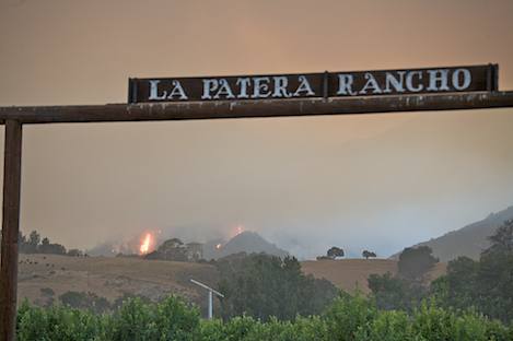
One of the things that the map should help provide is a much better understanding of how close the lower fire line is threatened areas. For those watching the fire burn down to the lower part of the Santa Ynez Mountains last night, it appeared that the fire was almost within striking distance of houses just across from Cathedral Oaks. A quick check of the map, however, shows that there is a major buffer of from one-to-two miles of ranch lands between the fire perimeter and the road – land that is much easier for fire fighters to defend than the heavy brush and steep mountain wall up above.
While this may not be completely reassuring, what it means is that you will now have the power to view the fire area in as much detail as you want. A suggestion: bookmark the large Google map so you can visit it often. The map is interactive, which means that as we update it the changes are posted to it automatically so you will always be viewing the latest information.
Look for the Independent to make use of further use of this technology to build maps of other parts of our local area.


