
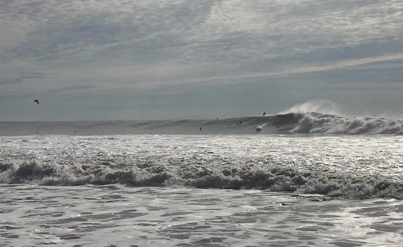
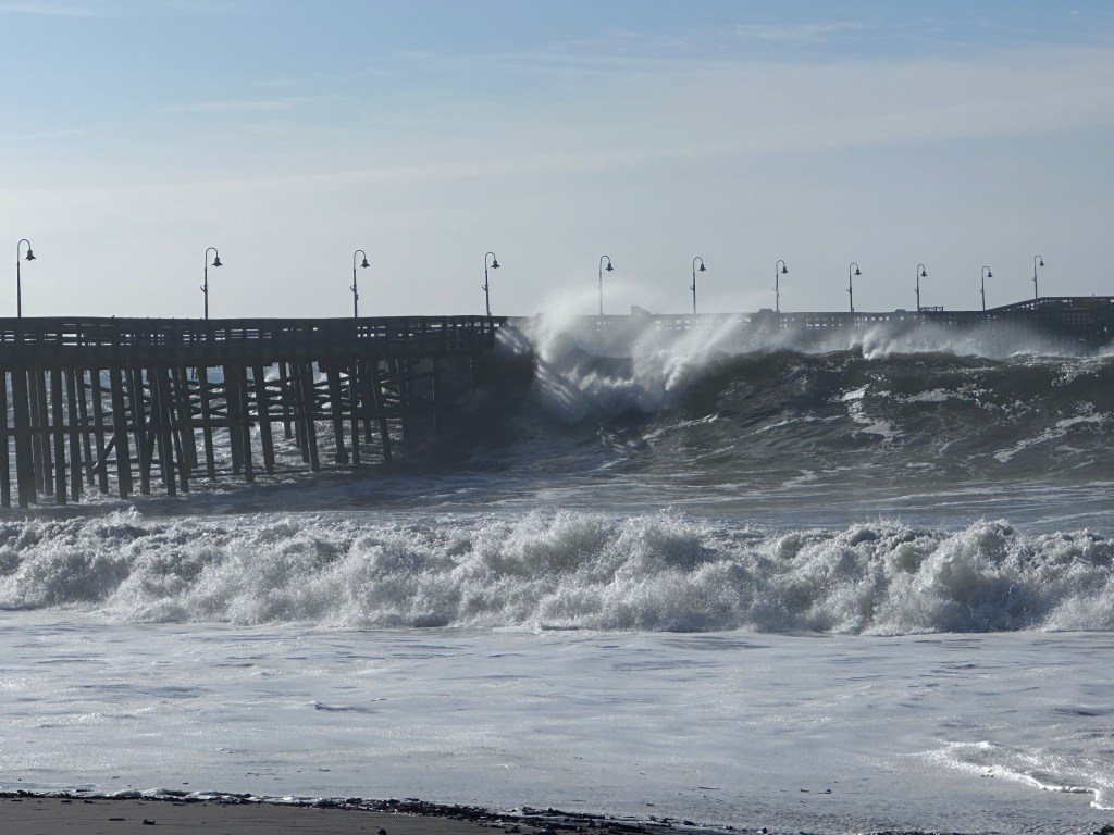
An enormous pair of cyclones covering the entirety of the Northern Pacific are sending 40-foot waves toward the Central Coast, but after the 400 miles of travel, the waves calm to mere 20-footers, as recorded by the buoys in the Santa Barbara Channel today. Surfers at Rincon are reporting double-overhead waves, and tourists at the breakwater in the Santa Barbara Harbor were being washed down the walkway back toward Brophy’s.
“The parking lot by the café was completely flooded,” said Guidance Moon, who was working at the harbor this morning and sent images she’d taken of the flooded lot.
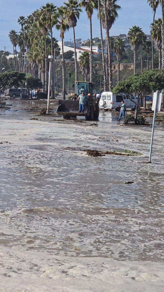
Harbor Way, the road that leads to the Fish Market and the Yacht Club, is closed through Sunday, said Mike Wiltshire, who heads the harbor for the city. The six-foot-high tide this morning, added to the six-to-10-foot swells, sent the ocean into the West Parking Lot and the business areas. The second cyclone’s effects are expected this weekend, and the harbor crews will need the time to clean away the sand and sea wrack, Wiltshire said. He added that the main parking lot remains open but that the breakwater is closed to pedestrians.
“Depending on the swells in the coming days, there is the potential of closing Stearns Wharf if needed,” Wiltshire said.
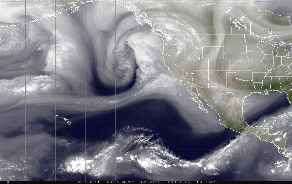
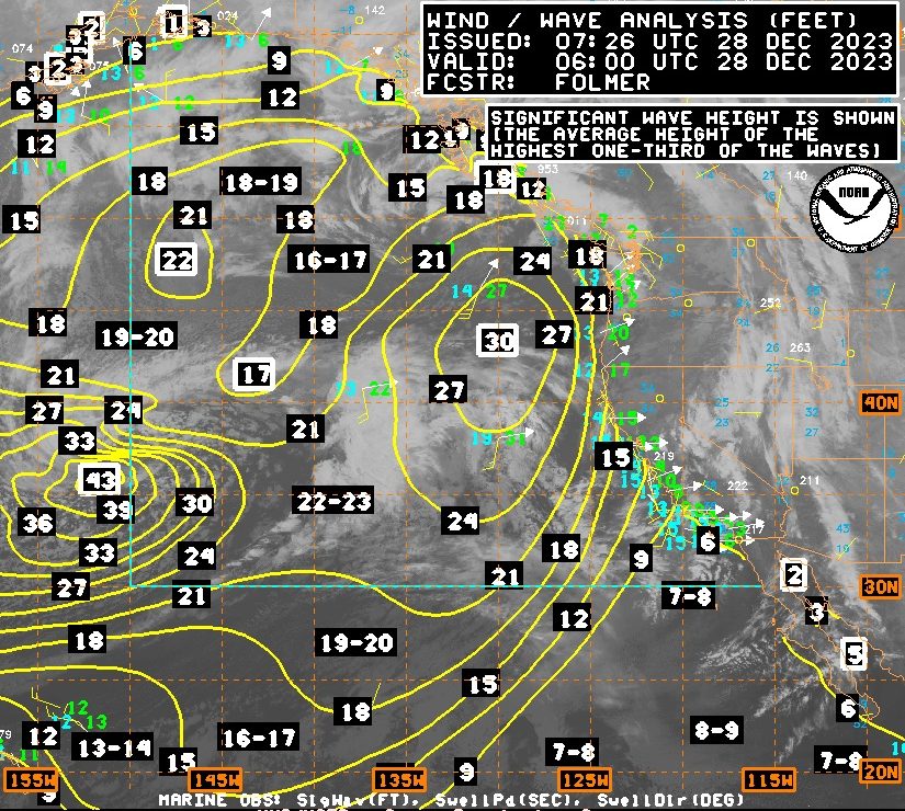
The two cyclones — which would be called hurricanes if they reached 74 mph — are farther south than usual, explained Dave Gomberg, a meteorologist with the National Weather Service. They stretch from Alaska and the Aleutian Islands to the waters off the Central Coast. The waves generated by one of the huge storms took about 12 hours to reach the California coast, with the buoy in the east S.B. Channel — roughly 15 miles south of Goleta — peaking at 21 feet around noon today.
“Tomorrow there’s a break in the activity, but another wave front comes on Saturday,” Gomberg said. “It looks just as strong,” he added.
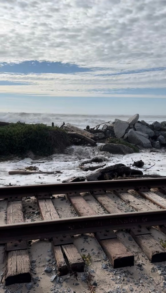
Waves are pushing the ocean into the railroad tracks at Padaro Beach above Carpinteria — rail workers were inspecting them; Amtrak service is unaffected — while up toward Vandenberg Space Force Base in Lompoc, a buoy about five miles offshore was registering 23-foot swells at 17-second intervals. All the beaches at Vandenberg Space Force Base are closed, said Jennifer Green-Lanchoney, Chief of Public Affairs, as they are expecting surf as high as 25 feet on occasion during the next three days.
Various surf websites are reporting triple-overhead waves of 18 feet off Jalama, where the lower campground was being closed for flooding, County Parks’ Jeff Lindgren said. Ocean Beach near Lompoc had the same issues, he said. Coastal flood alerts are in effect through Saturday night, which include warnings of rip tides, strong ocean currents, and large waves dangerous to novice surfers and unwary beach-goers.

You must be logged in to post a comment.