

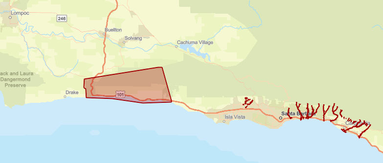
Ahead of the incoming major storm system, evacuation orders have been issued for properties along waterways in the Thomas, Cave, and Alisal burn scar areas; properties near Sycamore Creek, from Stanwood Drive down to parts of Ninos Drive, in the city of Santa Barbara; and all state campgrounds, including Gaviota, Refugio, El Capitan, and Carpinteria, effective immediately.
The storm is arriving Saturday evening, February 3, and will continue through Tuesday, February 6, with the potential to produce flash flooding, debris flows, and landslides.
Roadways are expected to be “exceedingly dangerous,” said County Sheriff Bill Brown during an emergency press conference Saturday afternoon. Residents are encouraged to avoid travel unless necessary.
According to Brown, the storm will be one of the biggest and “most significant” in Santa Barbara County’s history. The evacuation order will be lifted when the danger of the storm has passed, said Brown.

Residents are encouraged to register for emergency updates on ReadySBC.org, and can use the county’s interactive incident map to check whether they are in an evacuation zone. Door-to-door evacuation notices will be completed by early Saturday evening.
Saturday morning’s update from the National Weather Service said the storm remains as previously forecast, with “potentially life-threatening” amounts of rain. High wind gusts of 60 miles per hour or more are expected. All in-county state beaches are closed until further notice.
In addition, all schools throughout the county will be closed on Monday. Workplaces are also encouraged to allow staff to work from home on Monday.
Montecito Fire Chief David Neels said that the inbound weather system will surpass the effects of the unprecedented storm on January 9, 2023, which caused significant flooding, the closure of Highway 101, and the evacuation of residents and schools. “The likelihood of sediment mobilization is real” in the case of the current storm, Neels said.
He continued, “With that information, we are sharing with our citizens across multiple jurisdictions that they will be impacted, and we need the public to heed evacuation directives.”
Santa Barbara County Deputy Fire Chief Anthony Stornetta said they are prepping their incident management team made up of specialized personnel from multiple departments throughout the county. They are preparing “for the biggest thing to come,” Stornetta said.
They have over 120 firefighters stationed throughout the county daily, Stornetta continued, which will be increased by 60 additional firefighters during the storm. They expect that certain highways will be closed, so they organized strategic placements for resources in case of blocked roadways, he added.
Water rescue teams will be staged in the Santa Maria Valley, Santa Ynez Valley, and the Gaviota/Santa Barbara area. Fire engines will be stationed throughout the county. On standby will be a helicopter for special hoist rescue and other equipment to deal with potential flooding and debris impacts.
Shortly before the conference, Brown said he received a call from Congressmember Salud Carbajal, who expressed concern about the storm and his readiness to provide federal assistance when needed.
Kelly Hubbard, director of the Santa Barbara County Office of Emergency Management, encourages residents who are not evacuating to be ready with flashlights with batteries, food, and water in case of emergency.
Residents are also encouraged to check with their neighbors to help anyone who may need additional assistance with sandbags or emergency supplies in these times.
Sandbags are available around the county: in Santa Barbara (4568 County Rd., Goleta), Santa Maria (912 W. Foster Rd), and Buellton (761 McMurray Rd.). In the City of Santa Barbara, sand and bags are at 401 East Yanonali Street and City Fire Station 7, 2411 Stanwood Drive. The City of Goleta has sand and bags set up at Fire Station 11 (6901 Frey Wy. and Storke Rd.) and Fire Station 14 (320 Los Carneros Rd.).
Additionally, the county released the following advisories in preparation for the storm:
Residents should:
- Evacuate TODAY, February 3, if in an evacuation area, and please pay close attention to emergency alerts.
- Do not attempt to drive while it is dark or raining as roads may be damaged or your car may be swept away by moving water or debris.
- Expect strong winds, which can cause debris to fall onto roadways and power outages.
- Be prepared to sustain yourself and your household for multiple days if you choose not to evacuate, as you may not be able to leave the area and emergency responders may not be able to access your property in the event of road damage, flooding, or debris.
The EVACUATION ORDER will remain in effect until further notice.
- An Evacuation Shelter has been opened at the Wake Center, 300 N. Turnpike Rd, Santa Barbara, CA, 93111.
- For evacuation assistance and additional information, contact the Santa Barbara County Call Center at 833-688-5551.
- For small animal shelter information, call Santa Barbara County Animal Services at 805-681-4332.
- For large animal evacuation assistance, please call 805-892-4484.
- For status of highways, visit Caltrans: https://roads.dot.ca.gov/roadscell.php
- For status of county roadways, visit County Public Works: https://www.countyofsb.org/2116/Road-Closures
- For additional information, contact the Santa Barbara County Call Center at 833-688-5551 or visit ReadySBC.org for more information.
Residents not living in evacuation warning areas are still advised to do the following:
- Stay away from burn scars, rivers, creeks, and other low-lying and flood-prone locations. Those living in areas prone to flooding should stay aware of changing conditions and be prepared to take protective actions, such as evacuating and sheltering in place.
- Roads impacted during previous storms may experience flooding and mud and rock slides. Communities along these roads may become isolated.
- Beaches, bluffs and the Harbor area may be impacted. This storm may trigger coastal flooding and erosion along the bluffs throughout the county. Residents and visitors are advised to stay away from beach areas.
- Strong winds can cause power outages. Charge important electronic devices and be prepared in case an unexpected power outage occurs.
- Secure belongings that could get impacted by strong winds such as outdoor furniture.
REGISTER TO RECEIVE ReadySBC ALERTS: If you haven’t registered for emergency alerts, register now at ReadySBC.org. Receive local emergency alerts via text, phone call, and email.

You must be logged in to post a comment.