Mt. Pinos to Sawmill Peak
On the Vincent Tumamait Trail
Hike: from Chula Vista parking area below Mt. Pinos up to the summit, then take the Vincent Tumamait Trail over to Sawmill Peak and then down to Sheep Camp in the Chumash Wilderness
Mileage: 10.2 mile roundtrip, all above 8000 ft. elevation (see driving instructions at end of column)
Time: hiking steadily with two-hour lunch at Sheep Camp, about 7 hours
Maps: “Map 17” in Craig Carey’s Hiking and Backpacking Santa Barbara and Ventura, pp. 284-284, and cf. his Route 17, Pinos to Abel

July 29th marked yet another intense search for true wildeor — wilderness — as my two trail compañeros and I hiked from sacred Mt. Pinos to lofty Sawmill Peak and back in the Chumash Wilderness.
Only created in 1992, the fairly small but enchanting Chumash Wilderness encompasses 38,000 arid acres spanning the spectacular ridge between Mt. Pinos and Mt. Abel (aka Cerro Noroeste) and stretching north to San Emigdiano Canyon.
While on this traverse ridge, and climbing up and over barren Sawmill Peak, you drop down just a half-mile to shimmering Sheep Camp. Sheep is the highest trail camp in Los Padres National Forest, at 8,200 feet. It boasts a cold spring and a rusty-orange pine-needle floor beneath tall conifers.
Native American tribes believed and still believe Iwihinmu (Mt. Pinos) forms the center of the Chumash cosmos. In Chumash Ethnobotany, Jan Timbrook tells us the coastal bands traveled far inland to Cuyama, San Emigdiano (also in Chumash Wilderness), and Iwihinmu to collect the especially tasty piñon nuts from their favorite conifer, Pinus monophylla. The one-leaf piñon pine also supplies the best wood for constructing a small bow.
You motor the two-and-one-half hours from Santa Barbara almost to Mt. Pinos along the dusty I-5 corridor heading north out of Los Angeles and drive through Frazier Park, where you notice the three tall summits. They float above the much more arid badlands below.
Mesmerized, the hiking band softly chanted, “Pinos, Sawmill, Abel.”
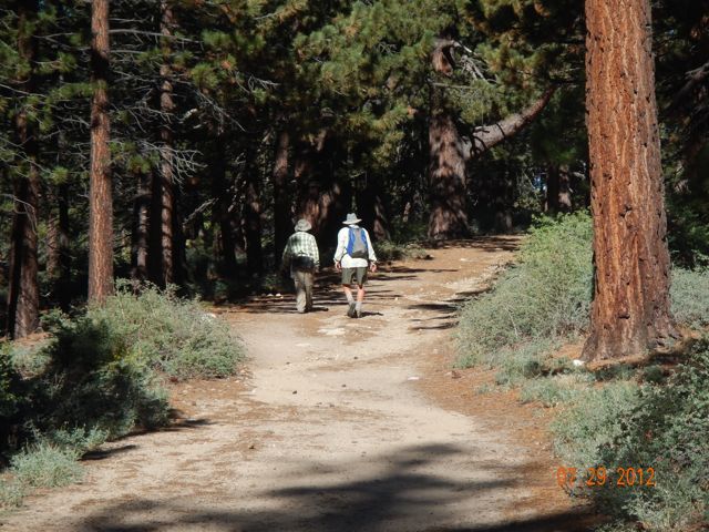
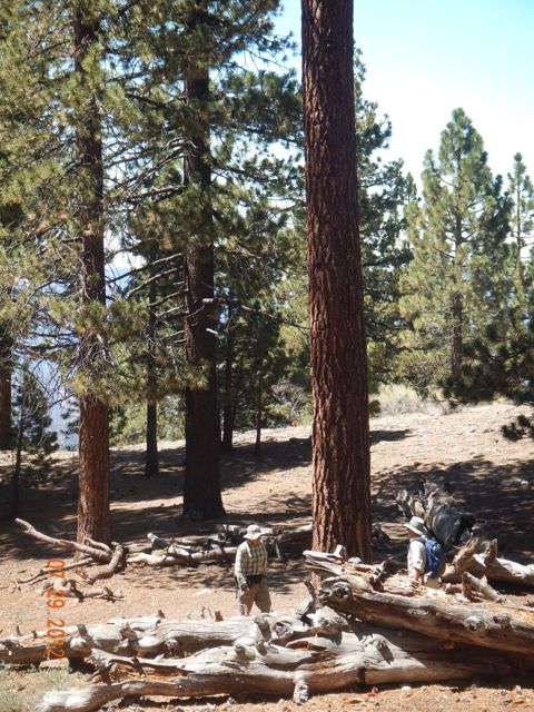
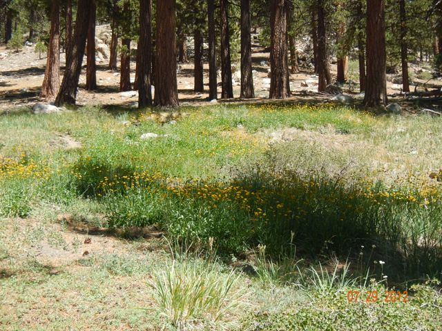
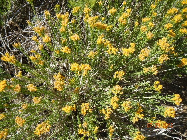
We began the hike at 8:30 a.m. from the 8,300-foot Chula Vista parking area and immediately enjoyed ideal temperatures and wonderfully clean air, while sauntering through widely spaced Jeffrey and ponderosa pines and Douglas fir giants. For almost two miles, you ascend gently on the old now-closed road, and cross two or three wide, alpine-like meadows (alms) showcasing expanses of dying wildflowers; but some color still hangs on, including acres of yellow gorse. We met one returning backpacker, and three hikers at the end of the very long day, but they were the only other humans we saw.
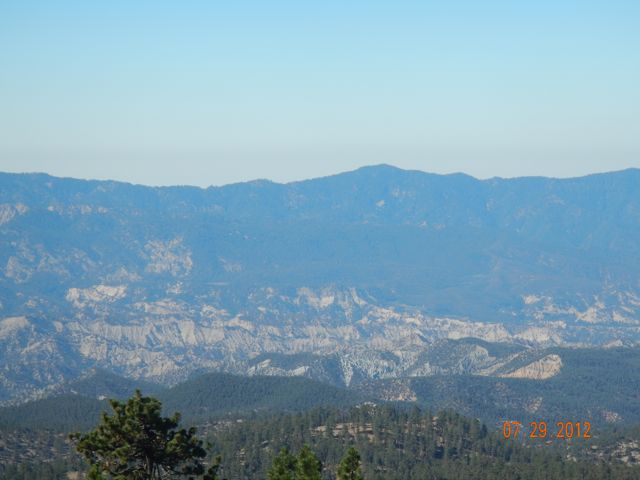
Once you have climbed atop 8,830-foot Mt. Pinos, and are at the old parking area, formerly a condor observation post, you’re stunned by the amazing views all around, including the tricky Transverse Ranges and Reyes Peak, the San Joaquin Valley, the dry Cuyama River and awesome Cuyama badlands. Then, to the north, you spy San Emigdiano, where some of the finest Chumash pictographs have been located.
I have to believe that it was these magnificent vistas, the serrated ridges of the purple Transverse Ranges behind Santa Barbara and Ventura, the sheer enormity of the 9,000-foot triple-headed mountain itself, as well as the piñon seeds that drew the coastal bands here on a regular and ritual basis. “Pinos, Sawmill, Abel.”
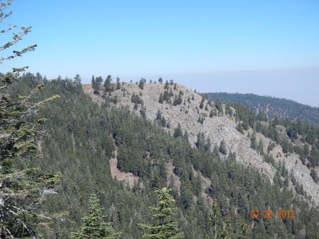
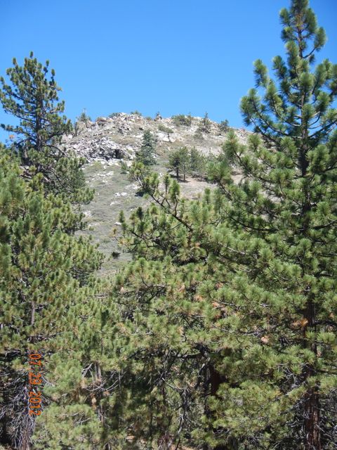
From Pinos, we entered the actual Chumash Wilderness along the Vincent Tumamait Trail, through glorious pine forest, down hundreds of feet, and then clambered right back up to towering Sawmill Peak, which at 8,818 feet practically twins Mt. Pinos.
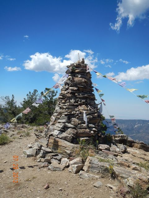
According to Guru Franko, there has always been some sort of spiritual marker on Sawmill Peak, and this time we spotted a sort of gigantic stone cairn there — stupa, menhir, chorten, chaitya, obelisk, lithic monument ? — this time replete with Buddhist prayer flags! To this schoolteacher, the imposing ten-foot-tall cairn symbolized a blend of world religions and tolerance for diversity. The stone tower was already there when some wandering Tibetans attached these prayer flags. The writing on the colorful small flags was definitely some form of Sanskrit.
We strode on and encountered the North Fork Trail, marked by a wooden sign and showing us it was just another half-mile down to Sheep Camp, which at 8,200 feet is literally the highest trail camp in Los Padres National Forest.
If you fancy a high-altitude overnight camping site, but don’t want to drive to the eastern Sierra, scramble over to Sheep Camp, but carry water. Of my three trips here, this was the only time we discovered that the camp’s spring had failed. However, with some investigation we found the source, and in a pinch could have extracted some life-giving water from it to filter. You can see from the flower-strewn hillside that water is seeping out from the Sheep spring.
For most of the history of Europeans in America, “West” has symbolized the wilderness, and wildeor typically is seen as the polar opposite of, and antidote to, the evils of “civilization.” In 1895, President Woodrow Wilson wrote, “The West has been the great word of our history. The westerner has been the type and master of our American life.” But many Americans knew that the frontier had disappeared by the 1890s (the Turner thesis), and slowly some began to worry about the disappearance of wilderness itself (not simply loss of nature).
I ended the last column by contending that our five nearby federal wilderness zones comprise islands of almost “true” wilderness. The scarcity of humans on Mt. Pinos on a temperate, glorious 29th of July speaks to the solitude and silence available in the Chumash Wilderness – important facets of wildeor. The Chumash Wilderness is little-visited and retains an exhilarating wild quality.
Although pioneers slaughtered the last of the native Grizzly bears around Reyes Peak in the 1870s, condors still fly and wild deer and mountain lion still roam this Chumash Wilderness. Desolate as they seem, these wilderness islands call out to some 21st century humans, and remain holy places of restoration. We humans are hard-wired psychologically and physiologically to need some wilderness, at least alternated with longer spells of civilization. I’m suggesting that these intense searches for remaining areas of wildeor, and immersing body and soul in them, is much more significant than simply enjoying cool “scenery” or “natural beauty” – this is to confuse nature with wildness.
“Civilization” and “wilderness” require each other, conceptually. Devising a lifestyle for oneself and for one’s children that alternates between both worlds is one way to sustain healthy and creative lives.
Study the driving directions: It’s a 2-hour and 20-minute drive to the Chula Vista parking area. From there, you may wend your wilderness way up to Mt. Pinos and then enter the sacred, silent, shimmering Chumash Wilderness.
Leave only footprints, but haul your wilderness memories home and ponder them in civilization.
Driving directions: Drive south to Ventura on the 101, take the 126 east to the I-5, and head north to Frazier Park (exit 205); then go west on “Frazier Mtn. Park Rd” which later becomes “Cuddy Valley Rd.” After about 12 miles you meet the Y with “Mil Potrero Hwy.” Go left at this Y, continuing up “Mt. Pinos Hwy” (9N24) past McGill Campground to the Chula Vista Parking Area. This took us two hours, 20 minutes. You can return the same way, or complete a driving loop by going out into the Lockwood Valley, taking the 33 to Ojai, and rejoining the 101 at Ventura, and so home to balmy Santa Barbara.