Playing Craps with Sea-Level Rise in Santa Barbara
It Will Most Likely Be Between 3.3 Feet and 8.2 Feet By 2050
How much the sea rises over the next few decades remains very much a crapshoot, but the latest numbers released this year by the Ocean Protection Council (OPC) suggest that for Santa Barbara it will most likely be between 3.3 feet and 8.2 feet by 2050. By the year 2100, it could be as much as 15 feet. Every five years, the OPC — a California state agency — revises estimates based on the latest emissions data combined with new modeling. What’s certain in all this is that coastal communities are under orders by the state to craft emergency response and adaptation plans.
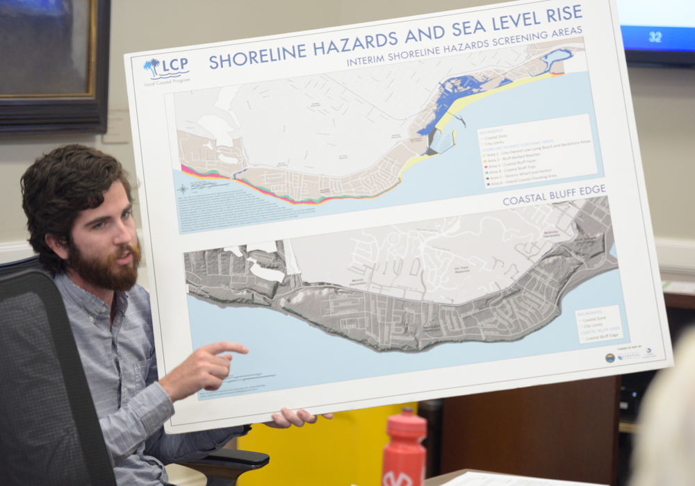
The City of Santa Barbara is in the early stages of developing such plans, targeting a 6.5-foot increase by century’s end. This week marked the third meeting on the subject; involved are three city councilmembers, one planning commissioner, one harbor commissioner, one water commissioner, and a host of planners. Later this month, that task force should get a clearer idea of the assets — publicly and privately owned — that could be in harm’s way should such projections come true. In October and November, the group will have a more comprehensive “vulnerability assessment,” and by March some specific plans for adaptation.
“Initially there will be millions of ideas for us,” warned Melissa Hetrick, a city planner. “That’s just the way it is.” Hetrick noted the new predictive models — put out by the United States Geological Survey — offer a range of outcomes based on probability, not just absolute worst-case scenarios as in years past. At most obvious risk is the stretch of waterfront along Cabrillo Boulevard, as well as the bluffs along the Mesa and Hope Ranch. City planning policies dating back to the 1960s discourage seawalls and other forms of coastal armor unless absolutely necessary. For private property owners living on sea bluffs, allowable building footprints could be seriously shrunk in anticipation of accelerated erosion rates. The majority of the area of concern — 70 percent — however, is publicly owned.