

Fire is one of the most fearsome forces threatening residents on Santa Barbara’s South Coast and even for me, living in the Santa Ynez Valley. I have twice been evacuated. Quickly gathering up a few valuables and struggling to get my animals out as fierce winds whipped flames on the horizon has made fire a haunting concern.
As with any fear, the best strategy is to confront it. So I joined the board of Santa Barbara County’s Fire Safe Council, whose mission is to promote wildfire safety through education and action. The Fire Safe Council is sponsoring a two-day exposition on Saturday, October 14 and Sunday, October 15 at Direct Relief’s Goleta headquarters so that all of us can learn more about the state-of-the-art fire mitigation work being done along the South Coast.
The Fire Safe Council has a key role in one of the most cutting-edge efforts underway anywhere in the country, the Regional Wildfire Mitigation Program Santa Barbara (RWMP), which is focused on the entire South Coast front country and the brainchild of council board member and UC Santa Barbara Professor of Fire Ecology and Management Max Moritz. The RWMP is an ongoing program with $5.5 million in start-up funds from the National Fish and Wildlife Foundation to create a framework to transform the front country into a fire adapted region. The RWMP targets three areas for increased resilience — the community, built environment, and landscape. The Fire Safe Council leads the community work, the Community Wildfire Planning Center leads on the built environment, and the Spatial Informatics Group leads the landscape work, the most innovative and custom-built for our particular region.
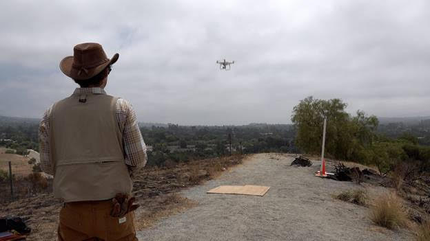
The Spatial Informatics Group starts by describing the different levels of fire hazard across the region using existing maps based on topography, fuels, and weather. But they greatly refine these relatively coarse maps by incorporating new research, such as the UCSB Sundowner Study, and by using remote sensing, drones, spatial data mining, and dynamic spatial modeling, along with some ground-truthing to create a highly detailed picture.
Next, they map data about population density, infrastructure, cultural and natural resources, including species of concern, that are at greatest risk from wildfire. This creates a risk profile for the region. And all of this is rendered at a much finer level of detail than has ever been done before here, or possibly anywhere.
Then it gets really interesting: What mosaic of wildfire-resistant green space, working lands, and habitats coupled with selective, regenerative fire could reduce risk? What kinds of management actions can we take and where? The Spatial Informatics Group expands beyond the traditional fuel reduction mindset and instead identifies areas best matched for a variety of other risk mitigation strategies including grazing, planting oak woodlands, establishing and maintaining water-wise orchards, and more.
Sheep and goat grazing, “planned herbivory,” is an important landscape strategy. Grazing is suited to reducing fine fuels on grasslands. The historic adobe at the Arroyo Hondo Preserve was saved from the Alisal Fire because the neighboring grassy slope had been grazed by sheep to reduce fire risk only a few weeks before. Grazing can also support post-fire recovery, helping prevent fire-prone exotics from gaining a foothold. Sheep and goats can be purged so that they don’t introduce exotic seeds into a wild area, and their hoofs work their droppings into the soil, creating a spongier surface to soak in water and support seedlings when the rains come.
Planting oak woodlands is another promising fire mitigation strategy. The June 2022 Bridge Fire, for instance, was limited to a mere 10 acres because it was checked by a stand of mature oaks. If taller plants don’t form a ladder that fire can use to climb to the oak’s crown, the oak trunks can survive and even stop fire. So, the Spatial Informatics Group is mapping where habitat suitable for oaks — not-too-steep north slopes with some soil moisture — intersect with the areas at greatest risk from fire. Next the Fire Safe Council helps pinpoint communities with a demonstrated interest in working together to reduce fire risk, such as becoming a Fire Wise Community. Then projects to plant oak woodlands for fire protection will get underway in some of the communities that commit to helping to plant and maintain these grant-funded oak woodland installation projects.
Orchards are another fire mitigation strategy, one that has already benefitted Goleta but has played a lesser role for Santa Barbara and Montecito where fewer orchards now exist. More orchards could be planted, but we must also be mindful of drought. One project idea is to convert thirsty Haas avocados to more water-wise Gem varieties, using the water savings to create natural buffer strips. Young, natural chaparral with soft leaves, in contrast to the dry, woody stems that accumulate over the years, is quite fire resistant and could be planted in the buffer strip. If need be, such buffer strips could be used to set backfires if a fire were threatening.
We are moving toward a very different, regional approach to reducing wildfire risk. It seeks to respect the natural role fire plays in our area while working with native plant palettes to provide a range of ecosystem services, including fire management. This gives me a great sense of anticipation about the future of living with wildfire. If you want to learn more about the Fire Safe Council, the Regional Wildfire Mitigation Program, becoming a Fire Wise Community, the latest local research in wildfire science, and about the equipment used to fight fire, don’t miss the October 14 and 15 Exposition, and bring the whole family.
Joan Hartmann is county supervisor for the 3rd District and 2022 chair of the board of the Fire Safe Council.
To register for the Friday, October 14, 4:30 p.m. talk by hydroclimatologist Park Williams, visit Upcoming Events at https://sbfiresafecouncil.org/. The Wildfire Preparedness Exposition is Saturday, October 15, 11 a.m.-4 p.m. Both events take place at Direct Relief, 6100 Wallace Becknell Road, Goleta.


