
Sun shone through the dewdrop-covered windows of Santa Barbara County residents on Wednesday morning, signifying the end of Tuesday’s downpour that brought out the sandbags, closed schools, moved meetings online, flooded roads, and downed trees.
Hundreds of people in burn scar areas had to evacuate their homes, but this week’s storm system ended up being much calmer than originally expected. Downed trees were really the worst impact the county saw in terms of debris, and the minor flooding was nowhere near what the region had to deal with in January.
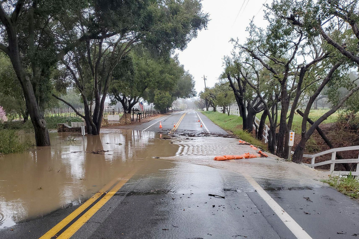
In short, the crisis was averted; the storm was not as bad as the National Weather Service had predicted. In the past 48 hours, most areas in the county received about two to three inches of rain, with the highest rainfall totals just exceeding four inches. Over the duration of the storm, San Marcos Pass only got a little over four inches of rain, compared to the max of 10 inches meteorologists had predicted. County reservoirs are not looking too bad, either — Gibraltar and Jameson reservoirs are just a little over 100 percent capacity, and Twitchell and Cachuma reservoirs are nearing but not yet exceeding their spillway elevation.
“The best way of looking at it was all the ingredients were there, but they did not come together for the perfect recipe,” said meteorologist Eric Boldt with the National Weather Service out of Oxnard. “The first part of the storm raced out ahead of the rest, so it split apart into two segments.”
Boldt said that the steady precipitation Tuesday morning fractured over the Central Coast, then regenerated later in the afternoon and evening. “Also, the south winds were anticipated to enhance rainfall across the foothills and mountains,” he said. “Normally this would result in rain amounts doubling at higher elevations, but this storm was relatively uniform from coasts to mountains with only about an inch difference.”
However, he did note that some areas, including Ventura and Oxnard, did see the overall strength of this storm, receiving more than three inches of rainfall.
Santa Barbara County Fire spokesperson Scott Safechuck said County Fire was prepared for the worst and had increased resources and staff funded by the California Office of Emergency Services prepositioned across the county to assist with any incidents that arose due to the storm.
“Most of our involvement with prepositioning was waiting for things of significance to happen, but also surveying and constantly being aware of what was going on,” Safechuck said, “so we could transition to an incident command team running the incidents if necessary, and it just didn’t. Fortunately, it didn’t materialize to that point.”
He said the impact was consistent across communities; South County saw more isolated tree falls, and in North County, there was slight spillage over the Guadalupe River levee in Santa Maria as the river reached max capacity. But overall, the widespread, minor incidents were nothing that isn’t to be expected for Santa Barbara during storm events.
Sign up for Indy Today to receive fresh news from Independent.com, in your inbox, every morning.
“So, keeping eyes on that stuff, we were fortunate with this storm that the front — when it came in — usually will carry a lot of wind with it. And with the soil saturation, we’ll see a lot of trees starting to fall, down power lines, and isolated power outages,” Safechuck said. “But we were fortunate with the way that the rain came down during this storm that it just spread out throughout the duration of a timeframe versus all at once, and it just didn’t materialize to what the National Weather Service had originally predicted.”
County Flood Control did not note any damage by the end of the day on Tuesday, and many of the roads closed on Tuesday reopened Wednesday morning, said County Public Works’ public information officer Lael Wageneck. However, some flooding was expected Wednesday morning due to high levels of ground saturation and runoff, so Public Works was still monitoring low-lying and flood-prone areas across the county.
“Peak flows were anticipated in the early morning, so staff is currently assessing sites countywide,” Wageneck said on Wednesday morning. “Alamo Pintado between Santa Barbara Avenue and Baseline in Santa Ynez was closed last night due to flooding, and our crews are currently responding to the plugged culvert near the 2200 block of Alamo Pintado. There was also a downed eucalyptus tree on Ortega Hill Road in Summerland that crews will be removing today.”
County Fire is set to respond to any emergency storm happenings until Thursday morning. “We will continue to monitor the area, check the rivers and creeks as that water is shedding out of the mountains and going into our creeks and river systems,” Safechuck said Wednesday. “And with the soil saturation, a lot of that water is not being absorbed into the ground, so it runs into our rivers.”
Since the resources offered by the Office of Emergency services are funded by the state, Safechuck said, those resources can be repositioned when other counties experience greater flooding or have greater emergency needs, as was the case in this storm.
Communities across California were pummeled by the statewide atmospheric river, but the scenes in Northern California made flooding in Santa Barbara County seem more like a puddle in comparison. In Monterey County, floodwaters breached Pajaro River’s levee and inundated a nearby agricultural community, submerging cars and forcing roughly 1,700 people to evacuate their homes.


