
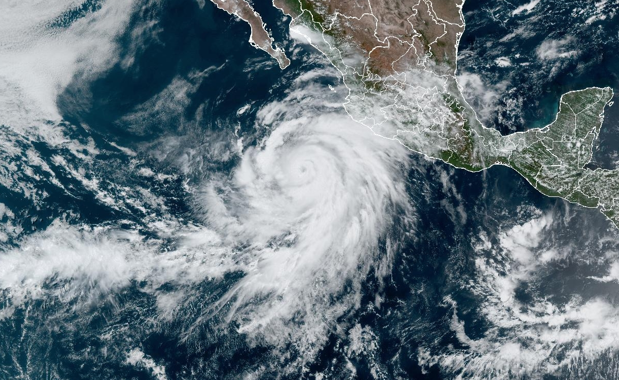
Hurricane Hilary is very likely to bring rain to Santa Barbara County this Sunday and Monday. This morning, the cyclone was twirling off the coast of Jalisco, Mexico, moving in a west-northwest direction at about 14mph but generating winds of about 100mph. By the time it reaches Southern California, the Category 3 or 4 hurricane should have blown itself into a weaker tropical storm again.
“By Saturday, we’ll know more details as it gets closer,” said Eric Boldt of the National Weather Service (NWS) office in Oxnard. “There’s still a lot of uncertainty as to the exact track that Hilary will take.”
On the weather satellite imagery, Hilary can be seen spreading clouds across 600 miles of ocean and land in the eastern Pacific off Manzanillo. According to the NWS forecast, it’s still too early to know where the eye of the storm will head after reaching Baja California — offshore or inland. Those clouds, however, are rich with moisture that will translate into 3-4 inches in Los Angeles and Ventura counties. Santa Barbara County may get 1-2 inches in an unusually rainy August.
A number of conditions could accompany Hilary as the storm reaches Southern California, including dense fog, high seas, surf, and wind. According to Boldt, the National Weather Service is watching for possible heavy downpours that could lead to flash flooding.
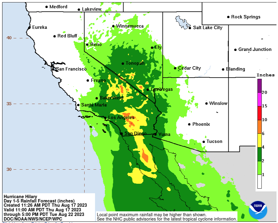
| Credit: NOAA National Hurricane Center


You must be logged in to post a comment.