
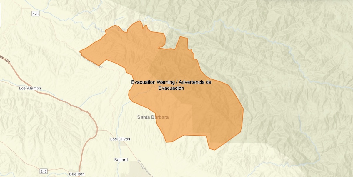
The rainstorm predicted during the past several days is tracking slightly to the north, the National Weather Service stated in its update this morning. San Luis Obispo County is likely to get the brunt of Wednesday’s rain and also Thursday’s atmospheric river. In Santa Barbara County, however, areas around this summer’s Lake Fire in the Santa Ynez Valley are under an evacuation warning as of 1:30 p.m. Tuesday.
Residents within and near the Lake Fire burn scar are advised to get ready to leave should an evacuation order be called. Now is the time to fill the car with gas or electricity; and gather important papers, medications, and necessities. If you know your area or situation is complicated, have large animals, or need assistance with transportation, safety officials advise going ahead and leaving now.
The storm is expected to drop between three and six inches of rain in the mountains and foothills of Santa Barbara County by Friday, when the rain is expected to diminish. The heaviest rain comes on Thursday as an atmospheric river of clouds and rain passes overhead for most of the day. Coast and valleys may see one to three inches of rain.
High winds are forecast to accompany the storm, as is snow, though snow levels are 6,000 feet and above.
This is the strongest storm to hit the Central Coast so far this rain season, with no others in sight for the next couple of weeks, said Ryan Kittell of the National Weather Service in Oxnard. The Pacific Northwest and Northern California can still anticipate receiving more rain and snow in the coming weeks, he said.


You must be logged in to post a comment.