
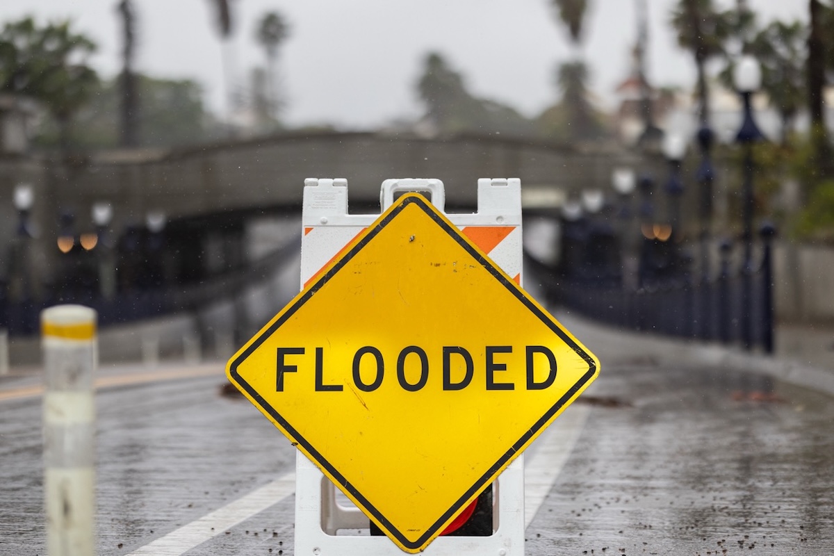
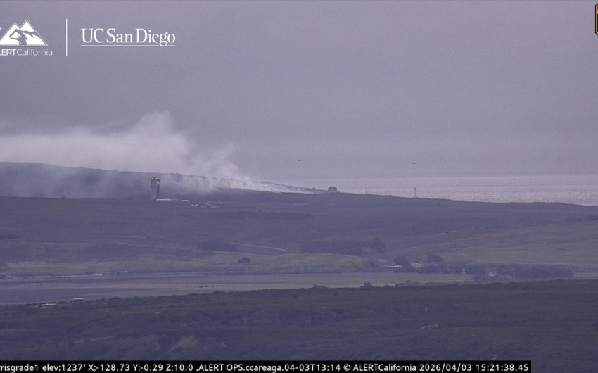
Another round of heavy rain and gusty winds is forecast to move through Santa Barbara County starting this Wednesday night, bringing the risk of flooding, coastal erosion, and power outages just in time for New Year’s celebrations.
The National Weather Service has issued a flood watch for the South Coast and Santa Ynez Mountains, in effect from 10 p.m. on December 31, through 10 p.m. on January 1. A wind advisory also remains in effect from 4 p.m. today through 3 p.m. on Monday, with gusts expected up to 25 mph.
“This means flooding is possible in the area,” warned Santa Barbara County’s Office of Emergency Services in a public advisory. “Stay away from rivers, creeks, streams, and other low-lying and flood-prone locations.”
Tonight’s storm is expected to bring one to two inches of rain, with thunderstorms possible after 10 p.m. “Chance of precipitation is 100 percent,” the National Weather Service reported Wednesday morning, noting that more rain is likely into next weekend. High surf and dangerous rip currents are also expected through Sunday, January 4, under an active beach hazards statement.
The storm follows a week of on-and-off wet weather that saturated soils, filled creeks, and strained storm drains throughout the region. On Christmas Eve, between three and seven inches of rain fell across Santa Barbara, prompting a temporary flash flood warning, road closures, and debris washouts along beaches. The Santa Barbara Airport shut down overnight into Christmas morning due to flooding on the airfield. “As of 1:15 a.m., Santa Barbara Airport is temporarily closed due to flooding on the airfield,” airport officials posted to Facebook on Dec 25th. By 9:15 a.m., operations had resumed.
The heavy rainfall also pushed Lake Cachuma near capacity for the first December since the 1980s, prompting proactive water releases from the reservoir into the Santa Ynez river to prevent uncontrolled overflow. As of three days ago, the reservoir stood at 98 percent capacity. With more rain coming, officials say they are continuing to monitor both the lake and downstream flow areas — a balancing act between preserving water supply and minimizing flood risks.
As for the coastline, one boat washed ashore at East Beach amid wind and rough surf on Christmas Eve. Additionally, the area remains off-limits to beachgoers nearly a week later due to a sewage spill. Officials closed part of East Beach — from a quarter-mile east to an eighth-mile west of Mission Creek’s outfall — and posted signs warning the public to avoid contact with the water.
Health officials continue to caution residents against swimming in the ocean or creeks during and after storms due to elevated risks of illness and exposure to storm runoff. “Storm water is untreated rainwater,” Santa Barbara County Environmental Health Services said in a statement, “and contact while swimming or surfing may increase the risk for certain types of illnesses such as rashes, fever, chills, ear infections, vomiting, and diarrhea.”
Though that system passed without major damage, the residual moisture in the ground now sets the stage for more serious impacts. “Because of recent storms, storm drains may be slower to clear and hillside soils are more prone to instability,” said public safety officials. That said, officials say they do not expect the same level of intensity as last week’s storms.
A landslide advisory also remains in effect for La Conchita, the small seaside community along Highway 101 in Ventura County, just south of the Santa Barbara County line. The area is historically unstable, and recent rain has renewed warnings from officials. In 2005, a catastrophic slide sent 400,000 tons of mud down the hillside, killing 10 people and destroying more than a dozen homes.
Given this context, it goes without saying hazards may also extend to the beach and ocean. “Due to increased creek flows, debris such as logs may be present in the ocean and other waterways,” officials added. Coastal flooding and bluff erosion are possible throughout the county, especially in Isla Vista and along the East Beach area.
Santa Barbara residents are urged to stay off the roads during peak rainfall and avoid flood-prone intersections, especially near Calle Cesar Chavez and lower Milpas Street, both of which were impacted last week. Roads near past burn scars and along canyon routes may be subject to rockslides or closures.
For the most up-to-date storm information, emergency officials recommend visiting ReadySBC.org and signing up for local alerts.
Helpful Resources:
Weather Forecasts: weather.gov/lox
Storm Readiness Tips: readysbc.org/StormReadiness
Sandbag Info: SantaBarbaraCA.gov/Sandbags
Road Closures: countyofsb.org/2116/Road-Closures
Rainfall Data: rain.cosbpw.net
Highway Conditions: roads.dot.ca.gov
Related Posts


Premier Events
Thu, Apr 02
5:00 PM
Santa Barbara
Paintings by Michael Vilkin at ART & SOUL GALLERY

Thu, Apr 09
7:00 PM
Santa Barbara
POSTPONED – Journey Within: Wisdom & Meditation with Gurudev – POSTPONED

Fri, Apr 10
2:00 PM
Santa Barbara
Music & Meditation SB – Concert April 10, 2026

Sun, Apr 12
11:00 AM
Solvang
Santa Ynez Valley Home + Build Showcase

Sat, Apr 04
9:00 AM
Santa Barbara
Passport Fair, hosted by Congressman Salud Carbajal

Sat, Apr 04
9:00 AM
Santa Barbara
Mesa Harmony Garden Spring Plant Sale

Sat, Apr 04
9:30 AM
Santa Barbara
The Great Egg Hunt

Sat, Apr 04
5:00 PM
Santa Barbara
Classical Guitar at Art & Soul

Sun, Apr 05
10:00 AM
Santa Barbara
Easter Brunch at Brass Bear

Tue, Apr 07
7:30 PM
Solvang
ABRA Cadabra – ABBA Tribute Band

Wed, Apr 08
11:00 AM
Santa Barbara
True Story of Fremont Foxen & the San Marcos Pass

Wed, Apr 08
1:00 PM
Santa Barbara
Día de los Niños

Wed, Apr 08
2:00 PM
Santa Barbara
Online Talk: The Work of a Fashion Curator w/ ASU FIDM Director

Thu, Apr 09
6:00 PM
Santa Barbara
Chaucer’s Books – Poetry Night
Thu, Apr 02 5:00 PM
Santa Barbara
Paintings by Michael Vilkin at ART & SOUL GALLERY
Thu, Apr 09 7:00 PM
Santa Barbara
POSTPONED – Journey Within: Wisdom & Meditation with Gurudev – POSTPONED
Fri, Apr 10 2:00 PM
Santa Barbara
Music & Meditation SB – Concert April 10, 2026
Sun, Apr 12 11:00 AM
Solvang
Santa Ynez Valley Home + Build Showcase
Sat, Apr 04 9:00 AM
Santa Barbara
Passport Fair, hosted by Congressman Salud Carbajal
Sat, Apr 04 9:00 AM
Santa Barbara
Mesa Harmony Garden Spring Plant Sale
Sat, Apr 04 9:30 AM
Santa Barbara
The Great Egg Hunt
Sat, Apr 04 5:00 PM
Santa Barbara
Classical Guitar at Art & Soul
Sun, Apr 05 10:00 AM
Santa Barbara
Easter Brunch at Brass Bear
Tue, Apr 07 7:30 PM
Solvang
ABRA Cadabra – ABBA Tribute Band
Wed, Apr 08 11:00 AM
Santa Barbara
True Story of Fremont Foxen & the San Marcos Pass
Wed, Apr 08 1:00 PM
Santa Barbara
Día de los Niños
Wed, Apr 08 2:00 PM
Santa Barbara
Online Talk: The Work of a Fashion Curator w/ ASU FIDM Director
Thu, Apr 09 6:00 PM
Santa Barbara
