While I sat with Branch Director Mark von Tillow on the Sierra Madre crest watching the final “button up” operations on the Sisquoc end of the fire, the backfire operations along Highway 33 provided fire fighters with lots of drama and plenty of fireworks.
Throughout the week efforts to burn out a quarter-to-half mile band along Highway 33 from Pine Mountain summit down into the Cuyama Valley to Ventucopa has gone exceedingly well. On Wednesday, I watched as the helicopters moved slowly north from Ozena Station to Rancho Nuevo Canyon lighting strips of brush on fire, I thought this part of the fire line would be secured by Friday.
Wind conditions had been perfect, the fire line was moved slowly north, and with only two more miles to the point where the containment line veers northwest up Brubaker Canyon, the fire almost seemed over.
It turned out, as a safety officer told me on Wednesday, that this last section would be a tough two miles. “The canyon is really narrow,” he explained.
“Then not too far beyond is a series of twists and turns in the canyon and switchbacks beyond that. And the winds get really squirrelly too. There’s a side canyon on the south side we need to burn out and when the wind gets into the bowl up there it can go every-which-way.”
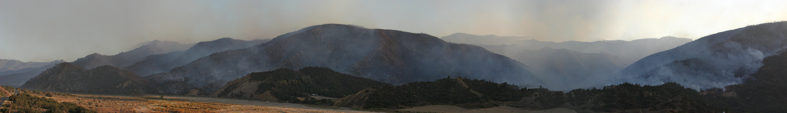
In addition, the hills on both side are very steep, with the ridge on the south side more than 1,000 feet above the canyon and on the north side the elevation gain exceeds 2,000 feet where it rises up to the 5,878′ Cuyama Peak. “There are plenty of opportunities for the fire to spot across canyon,” the officer added.
Of those I talked with on Wednesday, the split was pretty much 50-50 between those who thought they could pull the burn off and those who thought they’d lose it.
By Friday, the winds had changed. “While the overall wind pattern shifted from a southerly direction to the northwest, the local winds pushing up the Cuyama River caused the winds to get really unpredictable,” Planning Operations Chief Rich Olsen told me this morning. “We now had winds pushing against where we wanted the fire to go and with single digit relative humidity everything wanted to burn.”
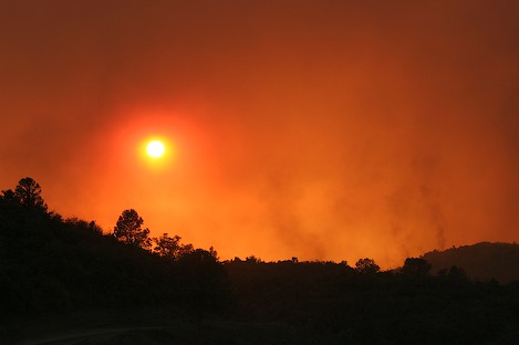
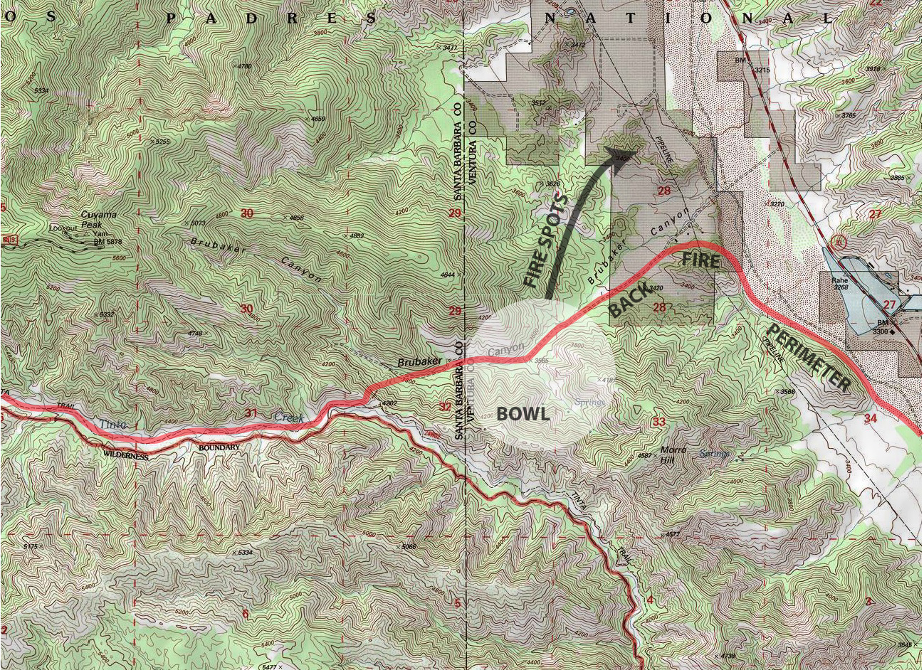
By midday on Friday chatter on the radios started in increase in the Brubaker area signaling that things were heating up. From the Sierra Madres all von Tillow and I could see was smoke.
‘We’ve got a spot fire on the east side,’ was the word. At first it seemed like the fire must have jumped Highway 33. Later we discovered, due to our unusual geography, that he actually meant to the north. This was not good news; it meant the fire had crossed Brubaker Canyon.
“Everything got burned up a little too well,” Olsen added. “We had a few spots across Highway 33 which we got to quickly and in a few places the fire burned right into the riverbed – but except for that corner in Brubaker – we got almost everything else done.”
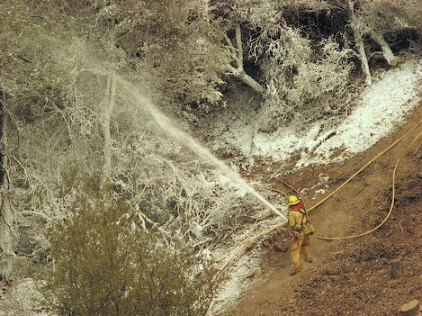
Driving back home on Highway 33 last night I could see evidence of the day’s activity. Fire retardant lay across sections of the river in a number of places and at one location near the Lockwood Valley turnoff the telltale red Phos-Chek was splattered the highway.
Tomorrow [Sunday] had been the day fire command hoped would be containment day, the point at which they had a line all the way around the Richardson side of the fire. Instead, with the fire spotting across Brubaker Canyon, containment will need to be put off for another few days.
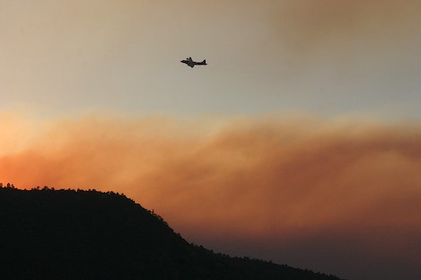
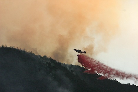
“We’re hitting it with everything we’ve got today,” Planning Ops Chief Rich Olsen interjected, “We’ve got maximum aircraft, lots of hand crews, and will go as direct as we can right on the fire line.
“Unfortunately,” he added, “We’ve got the same weather as yesterday.”
Regardless of yesterday’s setback, Zaca Fire’s days are numbered. Today is Day 51; far more than any fire in Santa Barbara’s wildfire history. It seems as if the September 7 date set for containment will easily be met.
On the Sisquoc side of the fire, it appears the hand line built down into the Sisquoc and tied in to the Hurricane Deck area has been secured. Late in the afternoon, von Tillow began requesting helicopter support to bring the hot shot crews out of the canyon.
“I still want to see that there’s no activity on the line or near it for at least another 24 hours,” von Tillow explained, “but we’re looking good.”