
Old Romero Road
Closed to through traffic in the 70s, a trail everyone can enjoy.

TRAIL INFORMATION
Distance-2 miles to saddle where road narrows to become a trail; 3.5 miles to the upper canyon trail intersection
Elevation Gain-875′ to the saddle; 1100′ to the upper trail intersection
Difficulty– Easy to moderate
Topo– Santa Barbara and Carpinteria
View Photo Gallery
HIGHLIGHTS
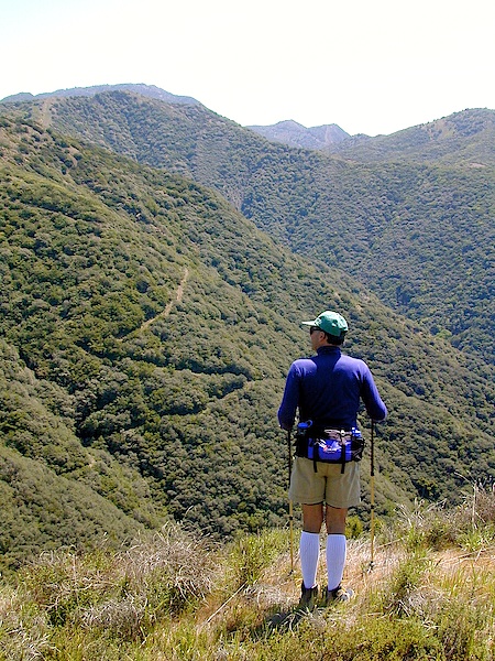
The Romero Road leads up and around a large peak and provides views of the entire coastline. The road is steep in parts but well maintained and easy to walk on. At the halfway point, as you finish rounding the peak there are very nice views of the upper canyon. It is also possible to continue along the road, which becomes more of a trail after the power lines, until you reach the intersection of the canyon trail and loop back down it.
Prior to 1978, Romero Road was the last remaining vestige of the primitive system of roads leading up to the top of the Santa Ynez Mountains. Built in the early part of the century, it was the only automobile route to the mountain crest that hadn’t been paved.
This summer (2007) because of the proximity of the Zaca Fire, the road was once again bulldozed and the trail no longer exists. There is discussion among fire officials about keeping the road open but we won’t have a decision on this until some time later in the year.
DIRECTIONS
From Highway 101 take the Sheffield Drive exit. Follow it 1.5 miles to East Valley Road. Turn left, then almost immediately to the right on Romero Canyon Road and continue another 1.5 miles to Buena Vista and turn right on it. The trailhead is about .3 miles. You will find a locked red steel gate marking the trail’s beginning.
THE HIKE
For hikers who would like to experience the feeling of a walk up the historic Romero Road, following it up as far as you feel like walking is a very nice alternative to the canyon hike. The road is wide, easy to walk on, and the views are spectacular.
From the locked gate the route finding is easy-just continue to follow the dirt road. Just beyond the concrete bridge a secondary road splits off to the left. Continue to curve to the right, cross the creek and follow the main road along a very pretty oak-lined section to a second creek crossing. The canyon trail cuts off to the left just beyond this crossing. The road continues to curve to the right and begins to head more steeply uphill.
The road is also very popular with mountain bikers so be on the lookout for them and you wind your way up and around a large peak. Within a few minutes you will find yourself high enough above Buena Vista to enjoy spectacular views of the coastline.
Gradually, the road curves back to the left, winding counterclockwise around the peak. As you round each turn you’ll spot another section of road leading upward to the next turn and you will wonder when you will finally reach the high point. Eventually you do. At one particular turn in the road there is a small turnout which provides great views of the Carpinteria valley, and if it is clear, you can see all the way to Point Mugu.
Beyond here the hiking is relatively much more mellow. A half mile of the easier hiking leads to a saddle and a series of powerlines. On the right side of the saddle a power line road drops down into Toro Canyon and it is possible to follow this across the canyon and over another ridge to upper Toro Canyon Road.
If you continue through the saddle area you will find yourself looking back down on Romero Canyon. The road crosses under the power lines and winds around several steep hillsides, bringing you back into Romero Canyon. Then suddenly, just as you round one more turn and you can see all of the way up into the canyon. This marks the end of the maintained section of Romero Road.
Beyond this point, because the road hasn’t been maintained, the chaparral has moved back in, until now what is left of the roadway is a trail. The next mile and a half of hiking takes you along the right side of the canyon, winding in and out of several small side canyons and the hiking is very pleasant. There is almost no elevation gain and the views are great. Before you know it you will reach the point where the canyon trail intersects with the road. It is 1.5 miles return trip via the shaded canyon and a very pretty way to loop back down to your car.
If you want to continue on the road all the way to the crest it is 1.5 miles up to Romero Saddle. If you are extremely adventurous, it is possible to head east straight up onto the top of Romero Ridge from the saddle and continue along it until you come to the top of the Romero Canyon Trail and drop back down this.


