National Park Service’s Channel Islands Plans
Rundown of What’s to Come for Each Island in the Park’s Archipelago

Though within sight of the mainland, the Channel Islands National Park often proves out of reach for would-be visitors. To grant greater access — while at the same time preserving the islands’ delicate ecosystems and historic ranches — the National Park Service recently released a 550-page plan to guide how the islands are developed and protected over the next few decades. Here we outline how each island would become more user-friendly once the plan is finalized in the coming months and funded to the tune of $62 million, with an estimated $14 million a year in operational costs. For more info, visit nps.gov/chis.

Anacapa Island
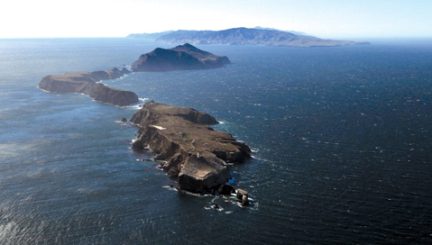
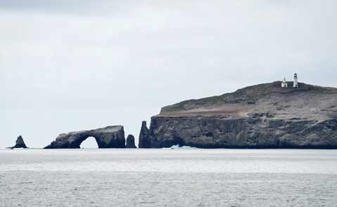
Almost nothing would change about the Anacapa Island visitor experience. The East Anacapa islet’s two miles of scenery-stocked trails and bare-bones campground would remain open. Swimming, snorkeling, diving, and kayaking would continue in the landing cove — though no anchoring is permitted — and the island’s lighthouse with exhibits would stay open. The Park Service has proposed building an additional staff house nearby, and it wants to replace the landing cove crane.
There are no trails or campgrounds on Middle and West Anacapa, and no plans to make any. Middle Anacapa would stay closed to all landings unless accompanied by Park Service escort, and land access to West Anacapa would remain restricted to Frenchy’s Cove, where a limited number of tide-pooling trips are allowed. The Park Service has recommended wilderness designation for the two islets, where large colonies of nesting brown pelicans come to roost.
Santa Barbara Island
Wilderness designation is proposed for the entire island, but the six miles of trails (seasonally closed now to protect nesting pelicans) would stay, as would restrictions on beach landings and aquatic activities to give lounging seals and sea lions their space. Like now, no more than 100 visitors (not including a maximum 30 campers) would be allowed on the island a day. The visitor station, one-bedroom housing complex, and bunkhouse would remain in use, and the small exhibit areas would be maintained.

Santa Cruz Island
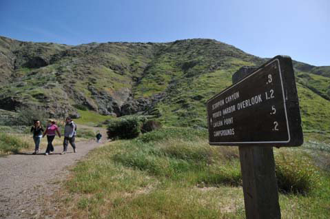
Long the park’s most popular destination, Santa Cruz Island would see an expansion of the eastside trail system as well as more potable water faucets and toilets. Also proposed is a 24-person campground and education camp for school groups above Prisoners Harbor, where a portion of the historic warehouse would be restored and converted into a visitors’ center. Another 16- to 20-person campground would be set up at Smugglers Cove.
Kayak tours in the Scorpion Valley area would be dramatically beefed up, but the Park Service wants a single company to do so; housing could be built for that company’s staff. A central pavilion with food, changing rooms, and showers would be built, as well as a storage facility and barn-like structure for interpretive exhibits and programs. The Scorpion Valley kayak contract could also expand to a satellite operation at Prisoners Harbor so visitors could paddle between the two locations.
The six temporary housing units for NPS staff in Scorpion Valley would be replaced with permanent structures, along with new housing at Prisoners Harbor. Under the plan, 14,476 acres of Santa Cruz Island Park Service land — three-quarters of the island remains managed by the Nature Conservancy — would be proposed for wilderness designation. Congress must sign off on any such wilderness requests. Around 12 miles of road would be removed and restored to natural landscape or converted to trails.

Santa Rosa Island
Santa Rosa Island is set to open up in a big way. A commercial vehicle transport system would shuttle visitors along 16 miles of existing road between Lobo Canyon on the north side of the island, Torrey Pines on the northeast, and Johnsons Lee to the south. Historic line camps along the routes, used during the island’s ranching days, may be converted to primitive campgrounds with small corrals, toilets, and cooking/eating shelters, and a 30-person campground would be created at Johnsons Lee, complete with a group area, wind shelters, and toilets. A new 75-person campground is slated for the marine terrace at Water Canyon.
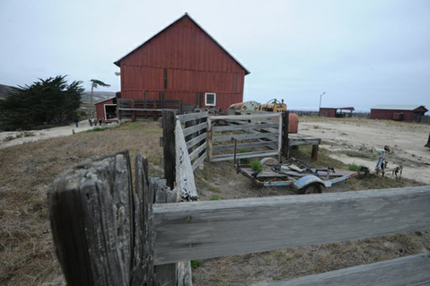
For less-mobile visitors, the Park Service would like to develop “rustic, economy-scale” lodging out of old ranch structures on Bechers Bay. The lodge would hold a maximum of 40 guests per night. Nearby buildings would be renovated to house concessionaire and Park Service employees, who would also staff a new nearby field station for researchers and school groups. “Food and beverage services” would be available to all visitors, even those not staying overnight. A small visitor center would be set up in place of the site’s old foreman’s house.
To support these new operations, the Park Service would build two eight-person bunkhouses in Cherry Canyon and a new ranger station at Johnsons Lee. A new well would be dug at Bechers Bay, wastewater facilities improved, and a solar power system installed. More than 50,800 acres of the island — all of it, except for the Bechers Bay and Johnsons Lee areas — would be proposed for wilderness designation.
San Miguel Island
Anything new on San Miguel Island will have to wait until the navy is done sweeping it for unexploded bombs dropped when the island was a military test range. Fully closed in April last year, sections of San Miguel are scheduled to open as soon as this fall.
Once it’s cleaned up, the Park Service would allow guided, multiday trips (no longer than four days) for especially adventurous and physically fit visitors looking for pinnipeds at Point Bennett. They’d hike to a temporary camp at or near the dry lake bed on the island’s west end and be escorted at all times by a Park Service ranger or approved commercial guide. The Park Service would also allow, on a trial basis, permitted commercial operators to fly visitors to the island via its small airstrip.


