

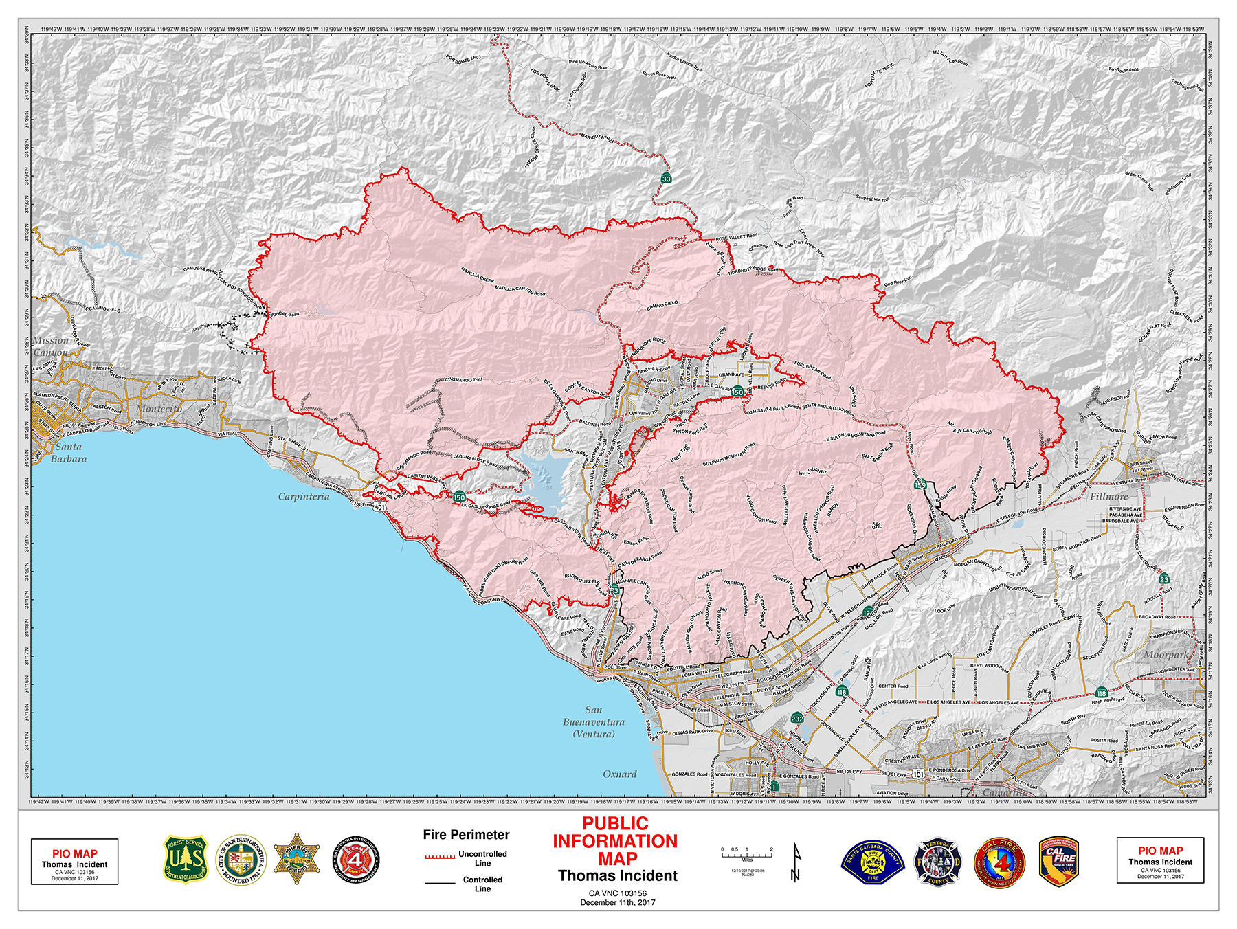
The good news is that the Thomas Fire grew by maybe 1,200 acres Monday, as compared to the 50,000-acre-growth spurt it experienced the day before, bringing the inferno’s total shoeprint to 231,700 acres. It’s also 20 percent contained, as measured by the fire’s Incident Command.
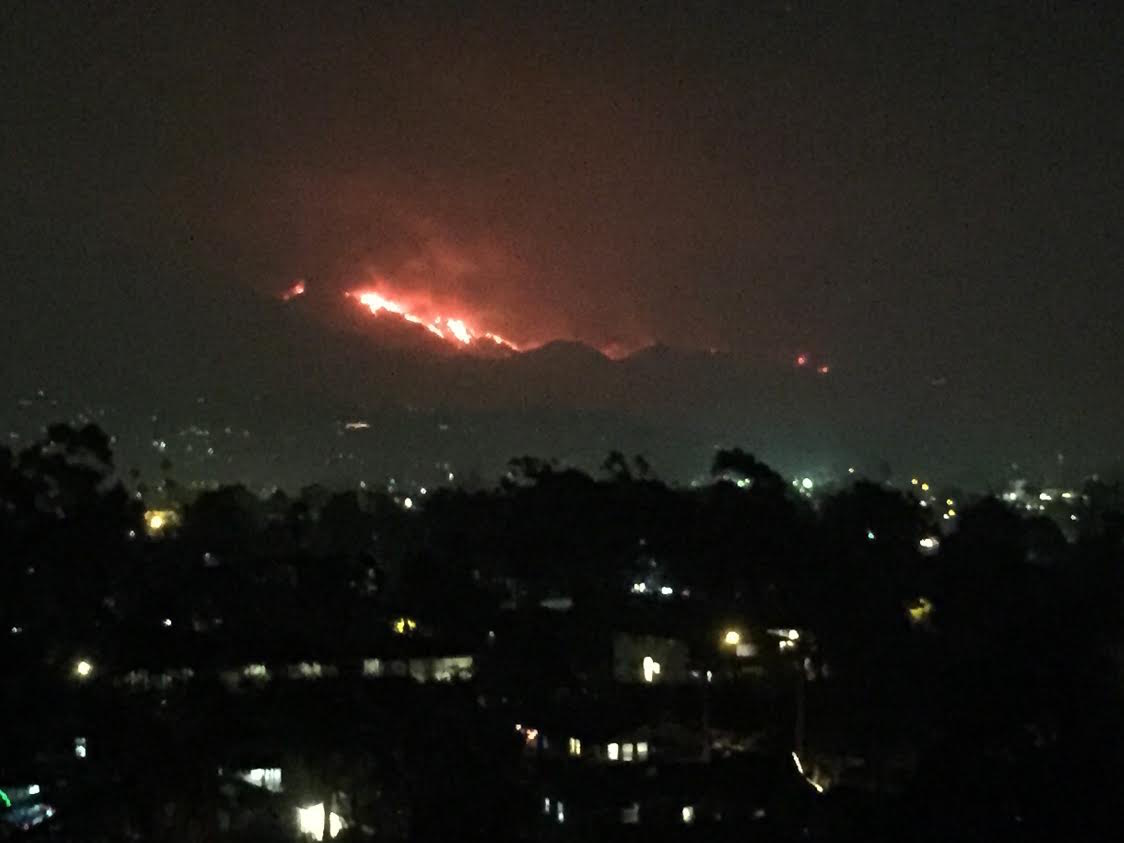
The bad news is that for the first time, the fire is now — as of nightfall — visible to City of Santa Barbara residents. While the visual impact is decidedly unnerving, Santa Barbara City Fire Department Public Information Officer Amber Anderson said, “The fire is moving up the slope. It’s moving as expected.” She added, “I understand it’s causing concern, but we have a lot of resources on it.” Her boss, City Fire Chief Pat McElroy added,” It’s going exactly where we want it to go — back up the hill to patches that have already burned.” As for resources, he said Carpinteria, Montecito, and Summerland had 15-20 strike teams, which translates to about 80 engines.” McElroy said one reason the fire is so visible now is because much of the smoke has cleared.
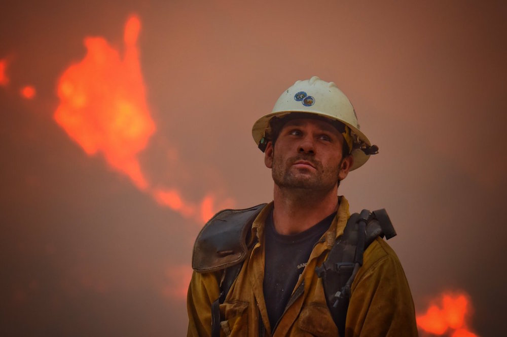
As of this writing, about half the involved acreage is located in Los Padres National Forest, but the part of the fire backing up against the fuel-laden backyards off Toro Canyon is still giving fire commanders gray hair and keeping them and the 6,400 assembled firefighters up late at night.
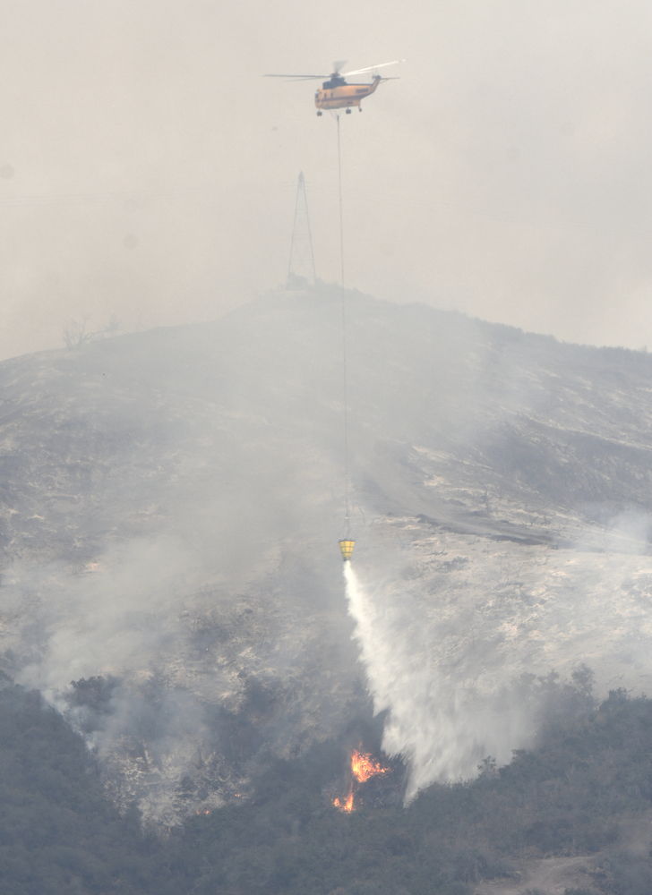
Toro Canyon — just up above Highway 192 — was the real point of attack today, with a DC-10 and a 747 aerial tanker dumping retardant when smoke allowed and about 28 helicopters dropping water. Keeping the fire contained to Toro Canyon is Plan A and B. Today’s winds were less forceful in pushing the fire westward, and tonight’s winds are predicted to be mild, said Santa Barbara County Battalion Commander Chris Childers. “We had some success putting it out and holding it in its place,” said Childers at a community forum held Monday afternoon at the San Marcos High School auditorium. “I’m optimistic and hopeful we’re going to stop it today.” Childers then added, “Optimistically, I’m hopeful, but don’t count on it.” At a previous forum, Childers had stated, “Hope is not a plan.”
Should the fire get past Incident Command’s clutches in Toro Canyon — and some unconfirmed Facebook posts indicate that might have taken place, with flames showering down Romero Canyon — Childers outlines a succession of backup plans. The ultimate line in the sand is Highway 154, but that’s still a long way away. A phalanx of eight divisions has been assembled along the front-country interface between human habitation and undeveloped wildland. Each division has four to eight strike teams, and each strike team has five engines, each with three to five firefighters. They are prepared to engage the fire in house-to-house combat as much as possible. The hope, however, is either to contain the Thomas Fire where it is, or to funnel it into the pathway of fires that burned in the past decade, where the fuel load is notably lighter.
Of the six major fires in Southern California, the Thomas Fire is by far the biggest and has been declared the top priority for state and federal firefighting agencies. Although Thomas started in Ventura County, the real action is now taking place in Santa Barbara County. To date, 100,000 people have been evacuated because of the fire. Of those, 7,200 are in Santa Barbara County, though another 34,000 county residents have been placed on warning they could soon be evacuated. No new evacuation notices have been sent out today, though rumors to the contrary have popped up.
County Undersheriff Bernard Malekian announced that one would-be looting suspect was arrested near Highway 192 and San Ysidro Road, an evacuated zone. “That person has now been evacuated to the main jail,” Malekian told the crowd. He also announced that the sheriff and the district attorney were putting price gougers on notice they will be arrested and prosecuted if they try to take unfair advantage of the fire. That, he said, constitutes raising prices more than 10 percent.
For those seeking a statistical smorgasbord, Monday’s forum had plenty to graze on. To date, 1.7 million gallons of water has been dropped on the fire, and more than 200,000 air respirator masks have been passed out free of charge by Direct Relief and County Public Health officials. About 100 law enforcement officers have helped execute the evacuations, and the CHP has blocked off 26 roads heading up the hillside from Highway 192. No firm number, however has been released on structures destroyed or damaged in Santa Barbara County. The Thomas Fire total to date has claimed 798 structures — one reportedly the caretaker’s residence at the Juncal Reservoir — but the exact number of those in Santa Barbara County is something “less than 20” but more than a handful. That information should be released Tuesday.
In the question-and-answer portion of the forum, one attendee asked why any effort was spent saving the backcountry. “Why not just let it burn?” he asked. He was informed that Los Padres Forest was created by the federal government in the 1930s specifically to create a safe watershed for the emerging South Coast communities. If the forest were allowed to burn, he was told, the water supplies impounded in Lake Cachuma, Juncal Reservoir, and Gibraltar Dam would all be seriously compromised. As it is, the deposit of ash and mud will compromise all three to extents still unknown.
Another attendee asked about satellite mapping that seemed to indicate the fire had spread down San Ysidro Road south of Highway 192 in one location and in another close to Cold Spring School in Montecito. If true, he stated, the fire would have spread four or five miles from the rest of the fire. “Is there something burning there?” he asked. The answer, he was told, was no. While fire agencies also subscribe to the same satellite imaging services, the results are not always reliable, and false positives have proven problematic. “No. There is no fire by Cold Spring School,” he was told.


