

In the September 1900 issue of the Santa Barbara Chamber of Commerce newsletter, Joseph J. Perkins writes about “Suburban Drives and Mountain Trails.” In his article, he states:
“And no matter with how much else of Santa Barbara one may have become acquainted, until he has explored her bewitching canyons and climbed her rugged mountains, and seen El Montecito Valley from ‘El Contento’; Mission Canyon and La Goleta Valley from ‘El Reposo’; the valley and the bay from ‘Centinela del Abysmo’; refreshed himself at the mountain stream at ‘El Descanso’; lost his speech at ‘La Sorpresa’ and, finally seen ‘all the kingdoms of the world’ from ‘La Cumbre’, he cannot claim to have seen her grandest attractions.”
While the names of peaks, valleys, and towns have changed over the last century, the beauty of the Central Coast region has not. Santa Barbara still hosts well over 50 miles of trail across its mountain ranges and coastline, much of which was constructed between the 1860s and 1930s. The usage and maintenance of these trails declined during WWII, as leisure time decreased and funding resources were allocated to the war effort. Even after the Potsdam Agreement of 1945, public appetite for outdoor recreation failed to return to prewar levels, leaving little motivation for the federal government to restore trails in the Los Padres. For the next 40 years, they disappeared from maps and landscapes as wildfire, nature, and erosion reclaimed them. It wasn’t until the 1980s that local groups organized to begin more regular stewardship.
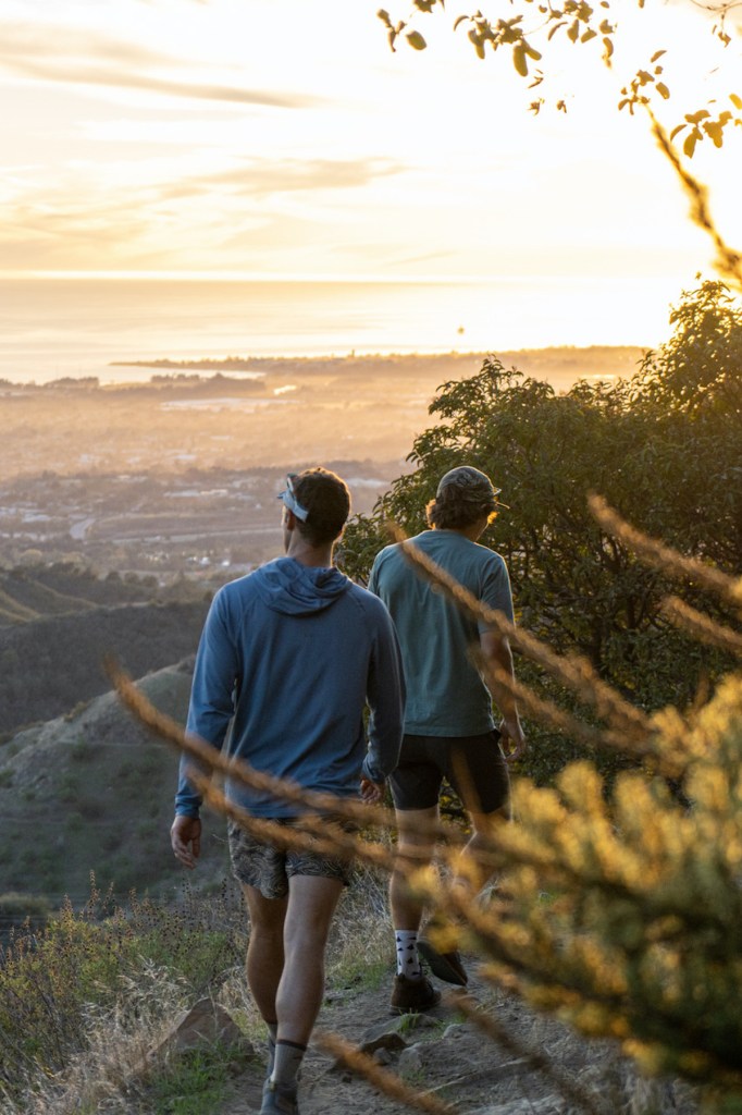
Today, more than 250,000 trips take place each year from individuals riding, hiking, and running the trails around Santa Barbara. Of these trips, the vast majority occur on three of the most popular routes: Jesusita, Cold Spring, and Romero. They traverse 15 miles of the Santa Ynez Mountains, providing stunning views of the coastline from western Goleta to eastern Montecito similar to those sought after in the early 1900s. What is clear, however, is that 250,000+ users on 15 miles of trail does not allow for the quiet communion with nature that many seek in their time outdoors. This overcrowding has only become exacerbated over COVID. With increased usage comes increased wear and tear and a greater need for maintenance, trash cleanup, and expansion of available options.
Sign up for Indy Today to receive fresh news from Independent.com, in your inbox, every morning.
As a local nonprofit, SAGE Trail Alliance has worked alongside dozens of partners, including the U.S. Forest Service, land trusts, and community nonprofits, to restore and maintain dozens of miles of trail. Leveraging public donations, government grants, and foundation contributions, SAGE has made it possible to hike from Santa Barbara to the Santa Ynez Valley via multiple pathways, providing views of the Santa Ynez River, the Los Padres National Forest, and the Pacific Ocean that all come together to make this area the unique place that it is.
All this work is only as valuable as the number of individuals who make use of it. As such, the Independent and SAGE will be highlighting different trails in upcoming articles to encourage the dispersion of user groups.
Alongside trail-based recreation, it is important that all users respect one another and practice proper etiquette. Bikes should use a bell and yield to all others in both uphill and downhill directions, all users should stay on the trail to avoid trampling plants, and patience after rain by equestrians and cyclists will reduce damage caused by tires and hooves in the mud.
Visit sagetrail.org for interactive maps, volunteer opportunities, and information about new projects.
Dillon Osleger is executive director of SAGE Trail Alliance.
Support the Santa Barbara Independent through a long-term or a single contribution.


You must be logged in to post a comment.