
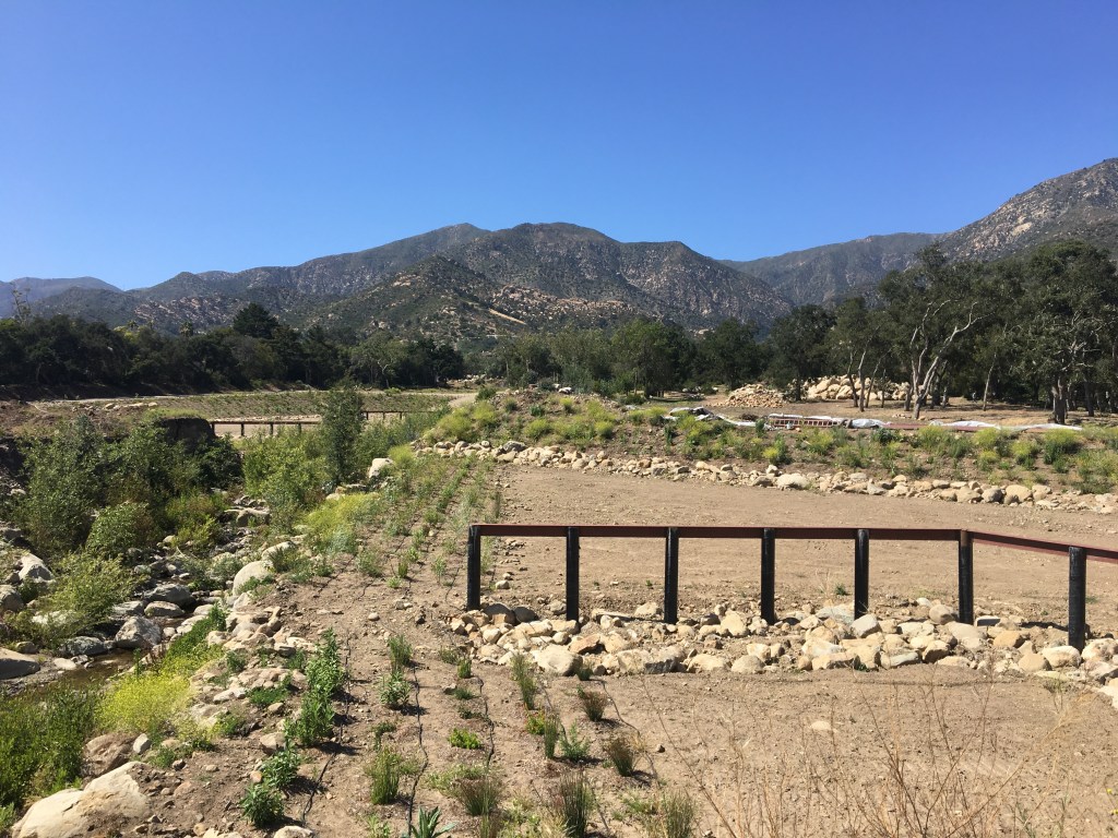
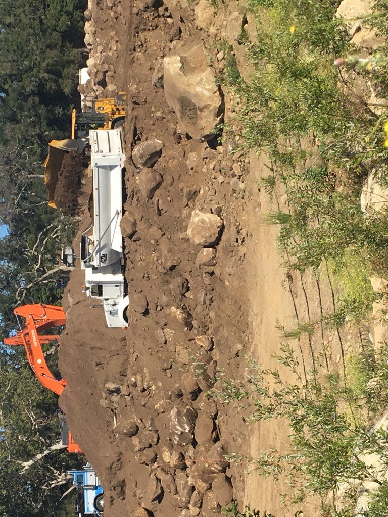
The bulldozers are back at Randall and East Valley roads this month, working on the final phase of the Montecito’s newest debris basin — a giant bowl designed to trap boulders and fallen trees and help protect the downstream homeowners on San Ysidro Creek from catastrophic debris flows.
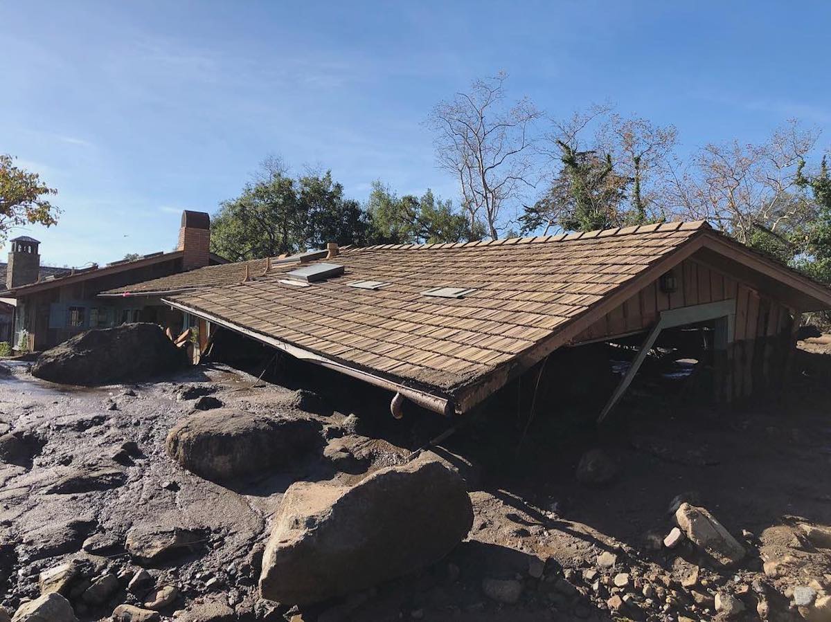
When it is finished in late August, the $10 million Randall Road basin will be the fifth on Montecito’s deadly creeks. The older basins on Cold Springs, San Ysidro, and Romero creeks were quickly overwhelmed after the pre-dawn deluge of January 9, 2018, and could not prevent the worst impacts of the raging rivers of mud, boulders, and fallen trees that engulfed whole neighborhoods: 23 fatalities, 500 structures damaged or destroyed, 1,000 rescues in the first 24 hours, closure of Highway 101 for 13 days, and $1 billion in economic losses.
Montecito will be somewhat better protected next time — and there will be a next time. To help get ready, the county has spent $800,000 expanding the Cold Springs basin by 50 percent. Next year, work will begin on a sixth debris basin on Buena Vista Creek, for $3 million.
Even against the backdrop of these and other public works, though, much of Montecito remains exposed to dangerous debris-charged flows and floods. According to a $600,000, 168-page study of the historical record (tprcsb.org) titled “Fire, Flood and Landslide Dam History: Community of Montecito and Vicinity,” released this spring by the Project for Resilient Communities (PRC), these events are far from rare.
“Nobody suffered more than the people who went through it,” Pat McElroy, PRC’s executive director and a former City of Santa Barbara fire chief, said of the 1/9 catastrophe. “It was scarring for firefighters as well. This was such a rough experience that trying to learn more about it is sometimes the only way you’re going to get better.”
The study shows that both Montecito and Carpinteria have been hit with four other debris-charged events during the past 200 years that were larger than the 1/9 debris flow — the debris flows of 1825, 1861-62, and 1914, and the debris-laden floods of 1995. That’s an average “return interval” of 48 years between massive debris-charged events here.
All of these events cleared out vast amounts of boulders and trees from the canyons and permanently altered the topography of Montecito and Carpinteria. The worst was called “The Great Floods of 1861-62,” when 50 inches of rain fell in Santa Barbara. It was a regional event — the entire Central Valley of California was under water — and remains the largest flood event in the recorded history of the western United States.
In all, the study shows, the South Coast from Gaviota to Carpinteria has experienced 36 debris flows and debris-laden floods since 1825. Twenty-two of them engulfed large portions of Montecito and Carpinteria — and that tally is likely on the low side because the 19th-century record is sparse, researchers say.
“This was astonishing news to me,” said Larry Gurrola, PRC’s lead scientist and a consulting geologist with 27 years of experience in the tri-counties, “The news reports didn’t call them debris flows, but they referred to them as tidal waves of boulders, trees, and water coming down the creeks and banks as a huge wave, destroying everything.”
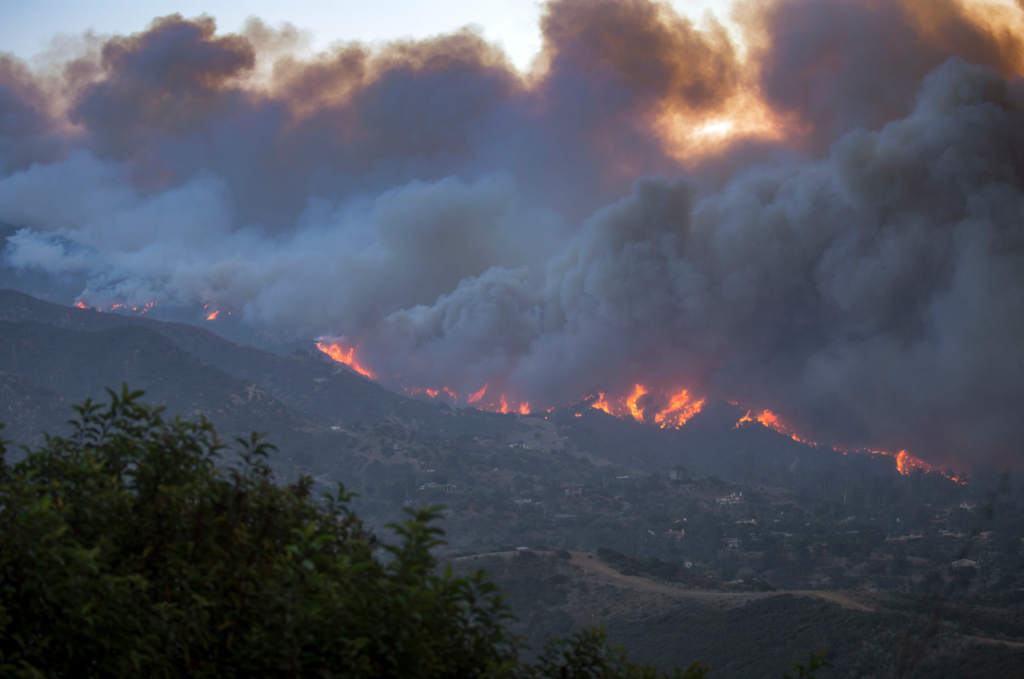
Two-thirds of the time, Gurrola found, these debris-charged events occurred in post-wildfire conditions — the critical five-year period after a fire has devastated the mountainside and heavy rains are most likely to trigger an avalanche of mud. On 1/9, the massive Thomas Fire was still smoldering as boulders and burned vegetation surged downhill on a sea of mud.
Gurrola scoured newspaper archives; property records; geological survey, fire insurance, topographic, and aerial maps; county, state, and federal flood reports; and books and scholarly papers on the fire and flood history of Montecito and Carpinteria. He sought to determine the size and frequency of debris flows and debris-laden floods in Montecito, and he mapped the paths they took on Montecito Creek and its tributaries, Cold Springs, and Hot Springs creeks.
Gurrola’s creek maps are reproduced in color in the study, along with dozens of historical photos in color and in black and white — a remarkable record of a community battered time and time again in many of the same places.
“The recent past is key to understanding the near future,” Gurrola said. “If you remove boulders and vegetation from the flows at the canyon mouths, then they cannot impact homes downstream, and the flows are more likely to stay in the creeks.”
PRC, a nonprofit group, now hopes to raise $2 million to map the debris flow paths for the rest of Montecito’s creeks. The goal is to help the county draw up a master plan for protecting the community, McElroy said.
“We’re trying to illuminate the problem and keep it in the public mind,” he said. “I think it makes some people nervous, but there’s no pretending it won’t happen again soon.”
PRC is best known for installing two steel “ring” nets each across Cold Springs, San Ysidro, and Buena Vista creeks to catch debris above the existing basins — a $5 million project that was funded with private donations and completed in 2019.
The 1914 Catastrophe
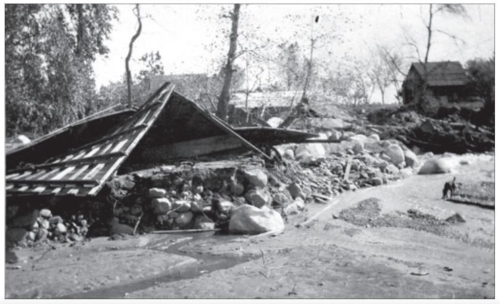
After 1/9, UCSB geologists identified what they said was the previous debris flow of that magnitude in what is now Montecito, at least 1,000 years ago. But Gurrola contends that the 1914 debris flow was the “penultimate” event. In both 1914 and 2018, boulders and trees came surging out of the canyons during extreme rains, riding walls of mud 20-30 feet high. And because it was regional, the 1914 event was worse than on 1/9, Gurrola said.
In 1914, the Mexican-American community of Old Spanish Town on Montecito Creek was wiped out. Out of 2,500 people then living in Montecito back then, six died from the debris flows and floods, roughly proportional to the 23 deaths on 1/9 out of a population of 8,600, Gurrola found. Of the 23 who died in 2018, 11 lived in what used to be Old Spanish Town, below the East Valley Road bridge across Montecito Creek.
Gurrola began the fire and flood study in 2018 under the auspices of Partners in Community Renewal, a Montecito nonprofit group, then switched over to PRC in 2020, along with the principal donor, an anonymous Montecitan. The Partners was founded by Curtis Skene, the East Valley Road resident who conceived the idea for the Randall Road basin and organized his neighbors on Randall to sell their destroyed properties to the county. Two residents of Randall and two people living just below East Valley in the Glen Oaks neighborhood were killed.
In the course of his review of the historical record, Gurrola found that after wildfires, the creeks sometimes produced multiple debris flows within just a few years or even months — a consequence of heavy rains, steep slopes, soft rock, and vast amounts of vegetation on the mountainside. These findings contradicted a 2020 UCSB study that said it would probably take “hundreds to thousands of years” to build up enough material in the canyons to produce another large debris flow.
“That’s just not true, and it does give people the wrong impression,” Gurrola said. “The watersheds of Montecito and Carpinteria are capable of quickly regenerating ample boulder and vegetation debris.”
The Coyote Fire of 1964, for example, was followed by a debris flow in Montecito within two months, a debris-laden flood in Santa Barbara in 1967, and debris flows in Montecito and Carpinteria in early 1969, Gurrola said.
The debris flow deposits underlying Montecito have been shown to be up to 650 deep, and they go back 120,000 years. Geologists have been able to identify some of them, Gurrola said, but the historical record, cross-checked from multiple sources, provides a more accurate account of recent debris flows that have largely been covered up by urban development.
Ed Keller, a chief author of the UCSB studies and Gurrola’s former PhD geology advisor, declined to comment. Gurrola’s work was reviewed by his mentor and co-author, J. David Rogers, a geological engineer at the Missouri University of Science and Technology and an expert in landslide hazards and levee failures.
In newspaper accounts of the 1914 debris flow, one eyewitness, Jose Graviel Hernandez of the Fithian Ranch in Carpinteria, compared it to the events of 1825 and 1862. He recommended adopting the practices of the Indigenous people and settlers who kept the lower canyons clear of trees in the early 1800s and let the flood waters radiate out onto the coastal plain.
Gurrola cited Richard Henry Dana’s Two Years Before the Mast, the 1840 classic from early California, to bolster Hernandez’s recollections of the 1825 debris flow, a regional event that flooded the Los Angeles, Santa Ana, and San Diego rivers. In the book, Dana arrives in Santa Barbara to find that the beauty of the town has been diminished by the absence of large trees on the hillsides. He later learns that a great fire swept them off the hills in 1823, a fire so large that residents fled to the beach for several days to escape the heat of the blaze.
One of Gurrola’s more startling findings was his discovery of 10 debris flows and debris-laden floods that were caused by the collapse of landslide dams from Santa Barbara to Carpinteria during the past 200 years. A landslide would block a creek after heavy rains, forming a temporary lake. Then, within 24 hours, the dam would break, triggering a potentially deadly debris flow.
In March 1995, even as the floodwaters were receding, Gurrola found, an administrative law judge was killed on Sycamore Creek when a wall of water from a landslide dam outbreak crashed through his home and swept him downstream.
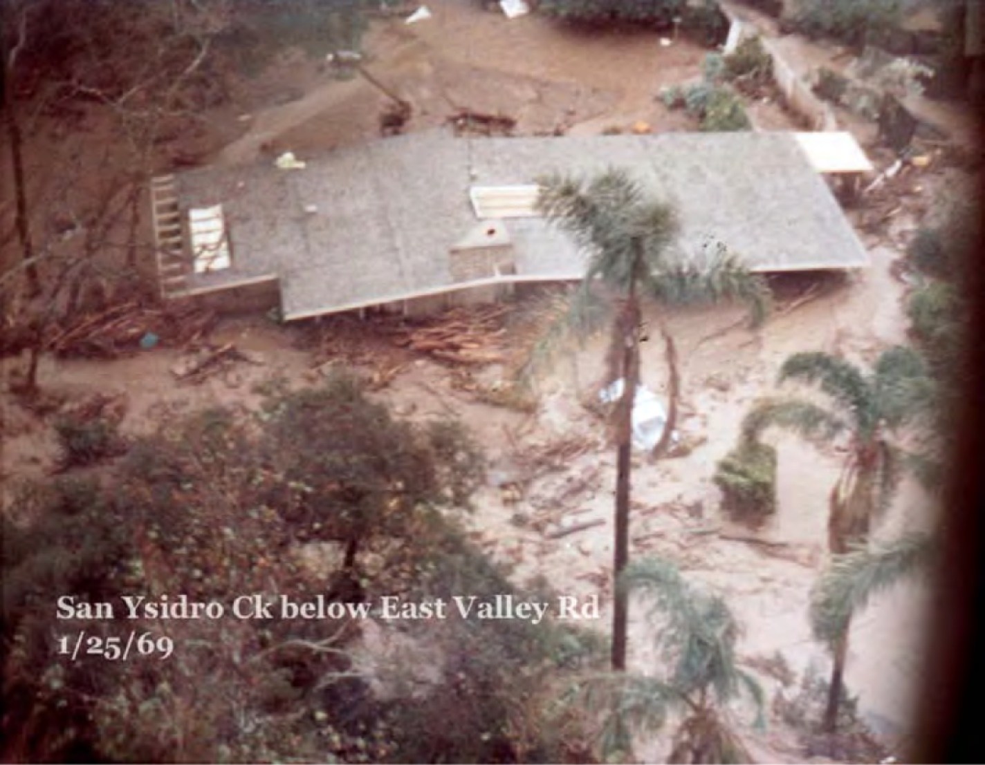
Debris flows and debris-laden floods during the winter of 1969 inundated this home near San Ysidro Creek. In Carpinteria, 1,000 residents were evacuated. | Credit: Santa Barbara County Flood Control 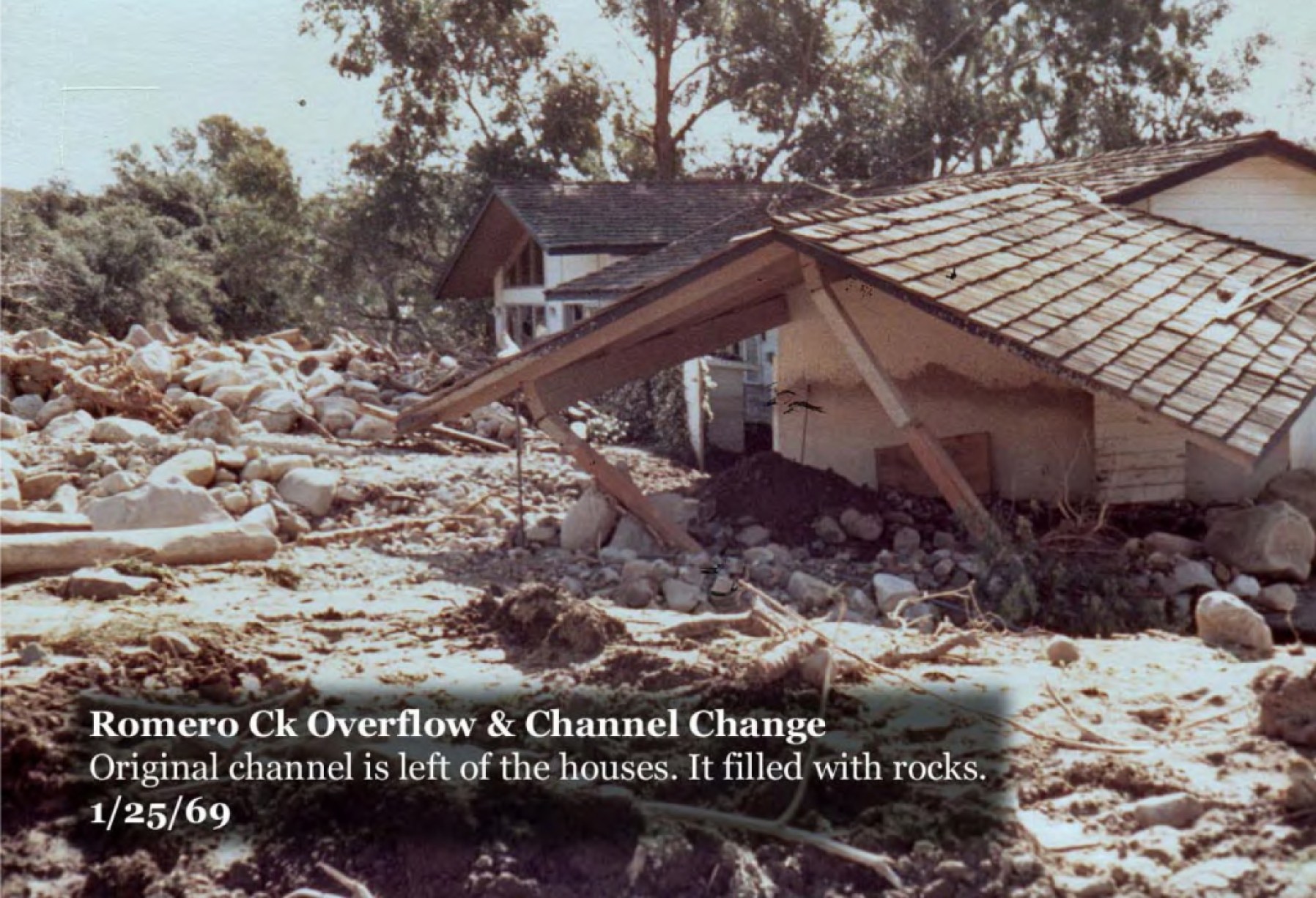
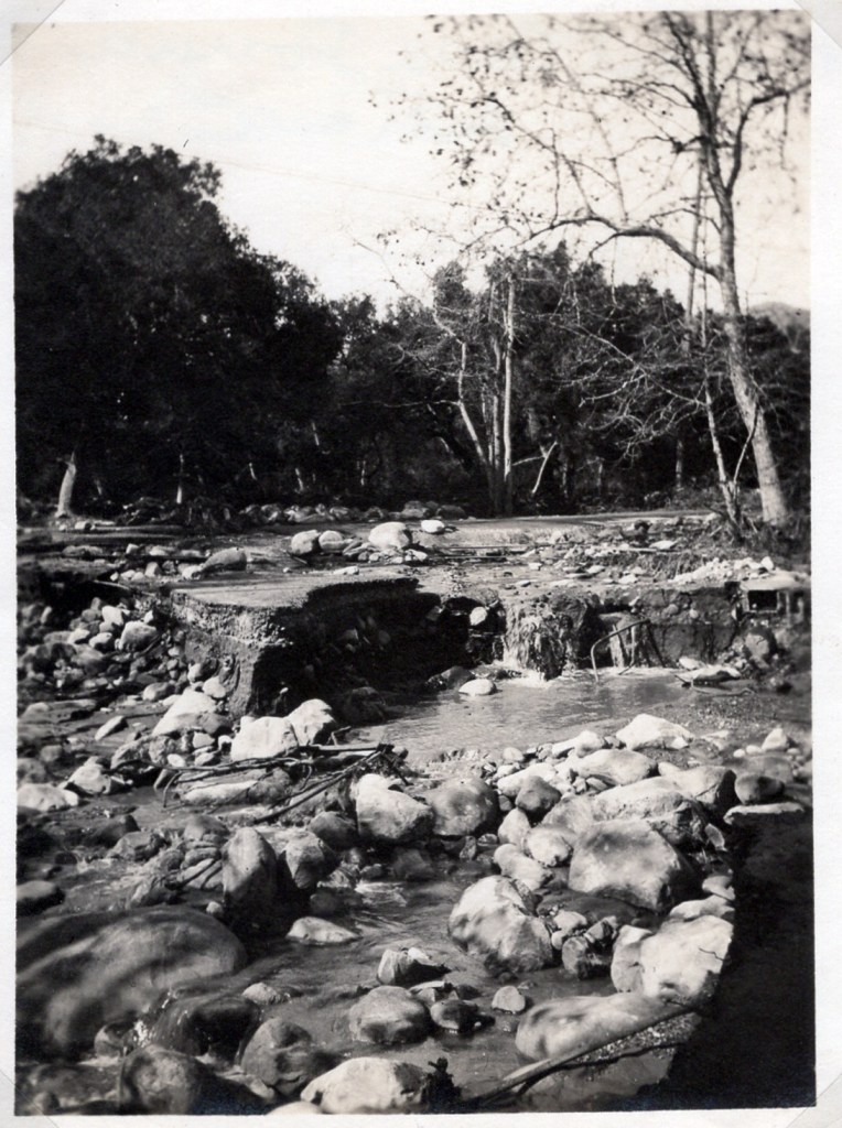
When Romero Creek filled with debris and mud in January, 1969, the flow was diverted down Featherhill Road. | Credit: Santa Barbara County Food Control 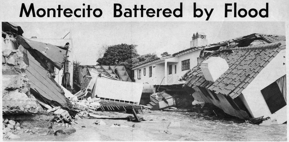
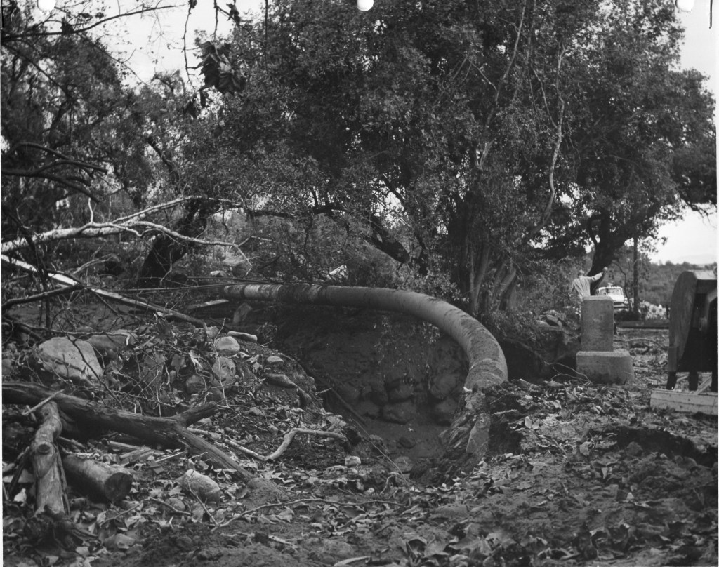
During the debris-charged events of January, 1969, beachfront properties at the mouth of San Ysidro Creek in Montecito collapsed into the creek bed. | Credit: Santa Barbara County Flood Control and Santa Barbara News-Press 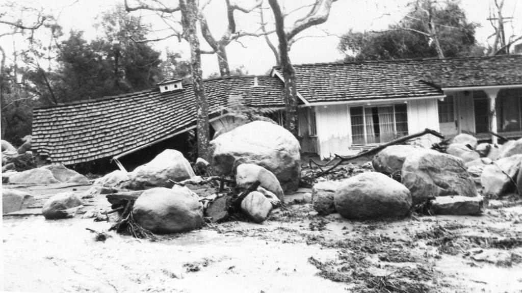
In the winter of 1969, giant boulders surged into the Glen Oaks neighborhood next to San Ysidro. During the 1/9 debris flow, two people died in the neighborhood. | Credit: Montecito Association History Committee 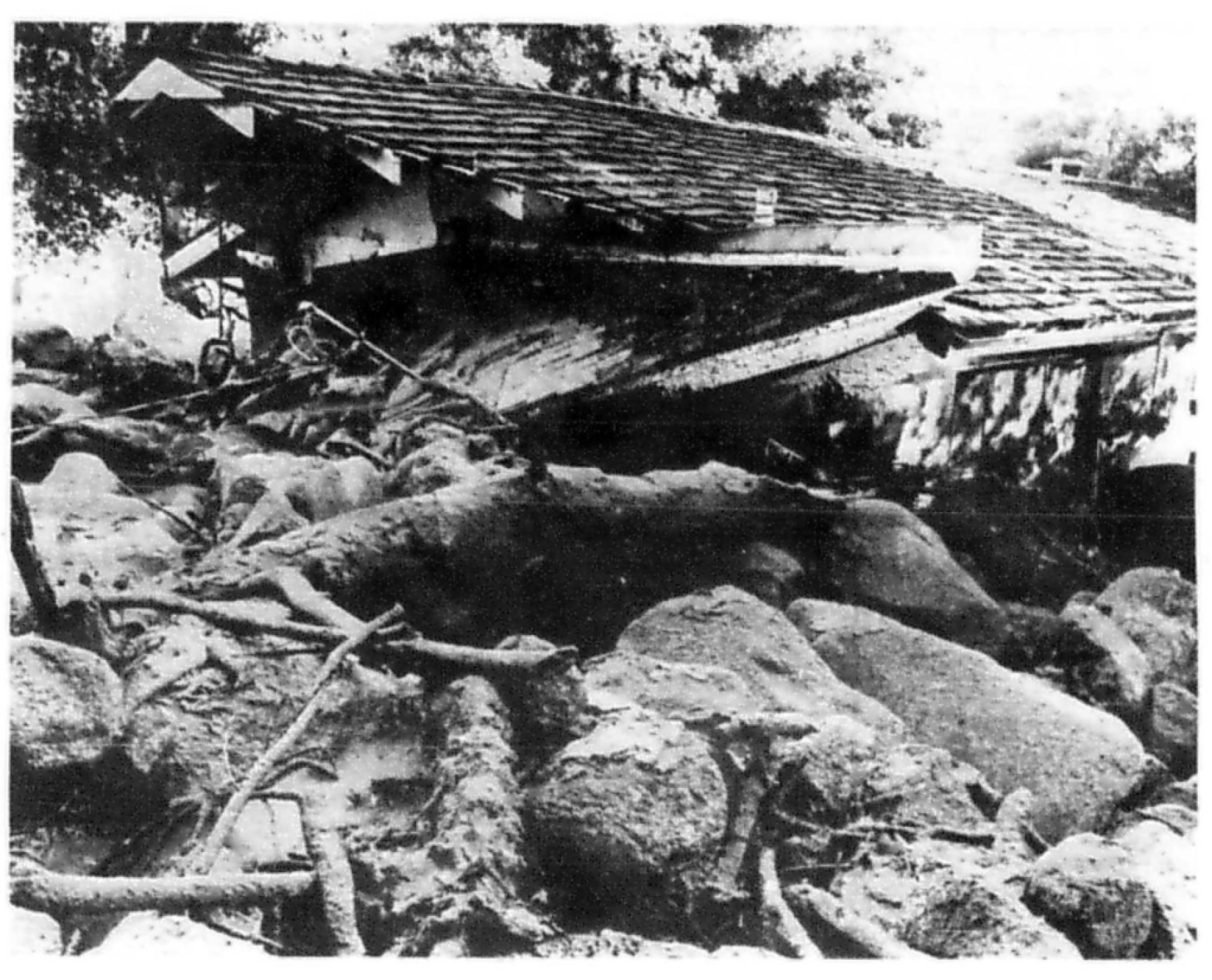
A home near the Toro Creek bridge on East Valley Road was severely damaged by debris flows in December, 1971. | Santa Barbara News-Press 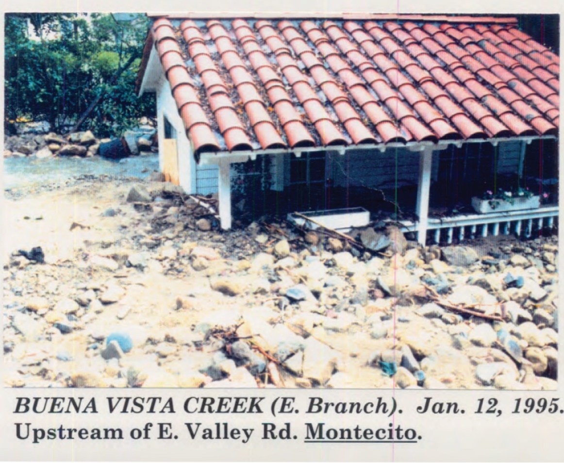
A home near the east branch of Buena Vista Creek was damaged by boulders during the debris-laden floods of 1995. | Credit: Santa Barbara County Flood Control 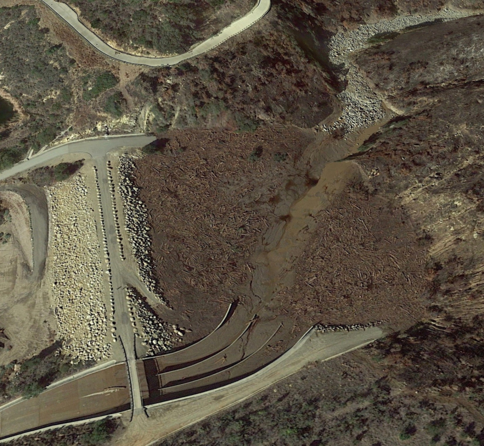
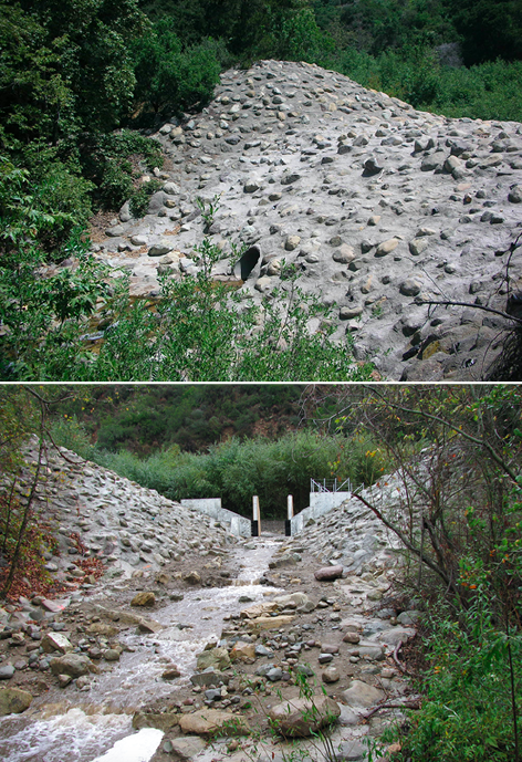
The Santa Monica debris basin, the largest on the South Coast, filled with mud, boulders and fallen trees during the 1/9 debris flow, saving the City of Carpinteria below. The spillway, choked with mud, is at the lower left. | Credit: Santa Barbara County Flood Control 
The Santa Monica basin captured vast amounts of vegetation on 1/9. It is roughly twice the size of the Randall Road basin now under construction on San Ysidro Creek in Montecito. | Credit: Santa Barbara County Flood Control
Sign up for Indy Today to receive fresh news from Independent.com, in your inbox, every morning.
‘Fire Weather’
In recent weeks, instead of the usual “May gray” pattern of overcast clouds, the South Coast was whipped with unseasonably strong winds under clear skies. Unlike the “sundowners” that intensify at sunset, these winds blew furiously down the canyons all night and for days on end. At the Montecito Fire Protection District, Chief Kevin Taylor kept a close eye on the unusual “fire weather” — 60-mile-per-hour winds with gusts of 70 miles per hour in the Montecito foothills. He called up an extra engine crew, just in case.
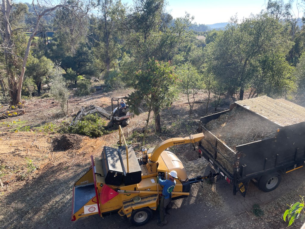
With help from a Cal Fire grant, Taylor said, the district has boosted its yearly budget for clearing roadside vegetation and thinning out brush in the foothills from $250,000 in 2020 to $435,000 this year.
“This is a very high priority for our board of directors,” he said. “Our community must be prepared for wildfire year-round.”
The hotter, drier, windier conditions created by climate change are expected to increase the frequency and intensity of extreme wildfires in the western United States. Simultaneously, scientists say, the frequency and volume of mid-sized heavy rainfall events will likely increase; and, in California, extreme wet and dry years will alternate more rapidly.
A study published last month in Science Advances concludes that by 2100, the number of extreme wildfires followed within one year by at least one extreme rainfall will increase by 50 percent in Southern California.
“Fires are happening more frequently; already, we have seen almost a doubling of the weather conditions that lead to wildfire since the 1980s in Southern California,” said Samantha Stevenson, a UCSB climate scientist who participated in the study. “At the same time, heavy precipitation rates are becoming more common.”
There are no easy answers for how or even whether to try to “build out of” the fire-flood cycle in Montecito, even as it becomes more dire. The vast debris basin that was built by the federal government in 1977 on Santa Monica Creek above Carpinteria is twice as big as the Randall Road project. In January 2018, it filled once with debris and saved the city, leading county officials to call it “the hero” of the day. During the debris-laden floods of 1995, this basin filled twice.
But a basin the size of Carpinteria’s is not contemplated for Montecito, where the foothills are dotted with homes. Much of the mountainside, moreover, is not accessible by road.
In the wake of the damaging debris flows that followed the Coyote and Romero fires of 1964 and 1971, respectively, the county Flood Control director concluded that land near the mouths of creeks and along creek banks in Montecito “should probably not be built on at all.”
Unpredictable Flow Paths
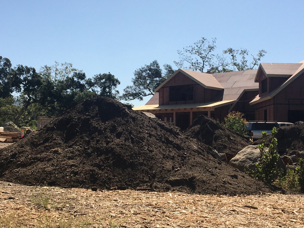
To date, records show, the county has approved 111 building permits for Montecito properties that were badly damaged on 1/9, including homes, guest houses, and garages. Many of the new structures must be elevated to comply with post-1/9 federal flood maps; some property owners are stockpiling dirt and rock from the Randall Road debris basin excavation for that purpose.
The county has no immediate plans to construct additional new basins beyond the one on Buena Vista Creek next year, but officials say the U.S. Army Corps of Engineers is drawing up some recommendations. In the meantime, the county will launch a $7 million project this spring to modify the outlets on the Cold Springs, San Ysidro, and Romero basins so that mud will flow through and more boulders can be captured. The work will continue through next year.
History shows that the paths of debris flows are unpredictable from one event to the next. On 1/9, for example, the surging river of mud and rocks jumped out of the lower Montecito Creek bed, bypassed the debris basin near Casa Dorinda, and flowed down Olive Mill Road.
Since 1861, the mouth of Montecito Creek, once located at what is now the Rosewood Miramar Beach hotel, has moved half a mile west. Before 1860, debris flows along San Ysidro Creek surged down what is now El Bosque Road, and future flows could take that path again, bypassing Randall Road, Gurrola said.
“Living a considerable distance from a creek in Montecito does not necessarily mean that a property is not at risk for inundation from mud,” he said. “No place is really safe.”
PRC installed its ring nets on stretches of creek well upstream from the county’s debris basins, obtaining five-year emergency permits. These are set to expire in December 2023. Gurrola recommends that the permits be renewed and the nets be left in place to complement the basins.
“Based on the flood history of Montecito, I think they serve a purpose,” he said. “They are on the smaller side, but they can act as a check dam once they fill up, to reduce the momentum of a debris flow. We absolutely need more of them.”
Any plans to construct a series of basins at the canyon mouths high above Montecito would likely be controversial, as are the ring nets themselves; because of drought, they haven’t been put to the test in storm conditions. Kevin Cooper, a consulting fire ecologist with Montecito Fire and a former U.S. Forest Service biologist who coordinated the pre-1/9 study on the potential impacts of the Thomas Fire, contends that the nets “haven’t been proven in their ability to help Montecito.”
“The number of existing nets is not big enough to make a difference, especially since the vegetation has grown back and the debris basins have been cleared out,” Cooper said. “And this may not be the proper place for them because there are no roads up there.”
In the event of a debris flow, a helicopter would have to drop in a bulldozer so that the rocks and trees trapped in the nets could be redistributed immediately downstream. This would be a difficult and expensive proposition, especially in back-to-back storms, Cooper said, whereas dump trucks can reach the county basins by road and haul away the piled-up debris.
PRC’s study provides “a good wake-up call” by revealing the frequency of debris flows in Montecito, Cooper said. As a next step, he said, the community should consider creating more public space along its creeks “to break out of the destruction-construction cycle.”
“I think people rely too much on the idea that some kind of miraculous engineering is going to save everything,” Cooper said. “One of the most difficult decisions communities must make as climate change worsens flooding is moving part or all of the town away from dangerous areas.
“Is someone brave enough to start this conversation here?”
Melinda Burns is an investigative journalist with 40 years of experience covering immigration, water, science, and the environment. As a community service, she offers her report to multiple publications in Santa Barbara County, at the same time, for free.
Support the Santa Barbara Independent through a long-term or a single contribution.


You must be logged in to post a comment.