
This article originally appeared in UCSB’s The Current.
The deluge Santa Barbara county received on January 9 occurred exactly five years after devastating debris flows smothered Montecito in 2018. While downtown Santa Barbara saw flooding as Mission Creek surged forth, the storm didn’t trigger similarly destructive landslides.
Still, with more rain in the forecast this winter, residents are justifiably concerned that the hills may come rushing down to the sea, yet again, especially in areas still recovering from recent fires.
It’s difficult to determine when a burned area recovers enough that it’s no longer at heightened risk of landslides. “I will say that substantial hydrologic recovery occurs within two to five years following fire,” said Naomi Tague, an ecohydrology professor at UC Santa Barbara.
“It’s worth noting, though, that recovery times can vary substantially with how severe the fire was and with post-fire climate,” she continued. “Drought following a fire tends to slow recovery.” And complete recovery of vegetation can take more than a decade.
“Recent fire scars — such as the Alisal Fire scar (Oct 2021) — represent very dangerous conditions because the vegetation burned less than a year ago, followed by a really dry winter and spring,” explained Professor Dar Roberts, in the Department of Geography. “However, it does help that we received enough rain to get a healthy growth of annual vegetation prior to this set of storms.”
The Cave Fire was farther back, in November 2019, but was followed by poor rainfall from 2020 through 2022, so conditions there are likely fairly dangerous too. “The Thomas Fire scar is probably less dangerous,” Roberts continued, “but Montecito did receive a huge amount of rain, so even if it had not burned, it would still be a concern.”
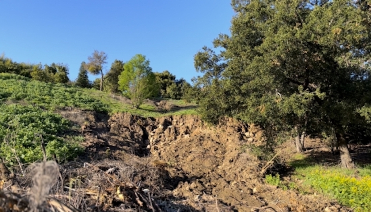
Soil stability in a burn scar hinges on many factors, but it all comes down to one thing: how much material can be mobilized on the hillsides. “The less erodible the hillside is, the lower the potential for a mudslide,” said Assistant Professor Vamsi Ganti, who studies river morphology in the Department of Geography. Mud can act as a lubricant for rocks and boulders, initiating a landslide. And just after a fire, a hydrophobic layer can form causing water to rush off unprotected slopes.
“When the Montecito Debris Flow occurred, the conditions were about as bad as possible,” said Roberts. “A very high rain rate falling on a landscape striped of vegetation on recently burned soils that were likely hydrophobic.”
Vegetation plays a huge role in stabilizing sediment. For instance, plants protect the soil and reduce runoff by intercepting rainfall and helping water soak into soils. “More extreme fires typically strip away this vegetation, exposing bare soil to erosion by the elements,” Roberts said. “And over longer timeframes, fire can remove many of the roots that help hold the soil in place.”
The extent of regeneration after a fire has a large impact on soil stability. As a burn scar recovers, grasses and herbaceous plants can dissipate some of the force from rain drops, and a shrub will do an even better job. Shrubs and trees also have more extensive root systems, especially those that re-sprout after fires.
“That said, decades of research suggests that up to 10 years post-fire there’s still elevated risk for landslides and debris flows below burn scars,” explained ecosystems scientist Marc Mayes, at UCSB’s Earth Research Institute. As climate change progresses, extreme storms in close sequence to one another may occur more often. Under this regime, debris flows can happen even in areas without recent burns once soils are saturated.
Sign up for Indy Today to receive fresh news from Independent.com, in your inbox, every morning.
The intensity and duration of the rainfall matters. If more rain falls faster, soil erosion increases. “Think of the difference between using a watering can for gardening, or dumping all the water out of a 5-gallon bucket,” said postdoctoral researcher Paul Alessio, who studies hydrology and slope stability.
Indeed, strong storms can create hazards on their own. “Given the rain rates we have seen, even an unburned landscape could still produce landslides, rock falls and mudflows,” Roberts said. “There were quite a few of these in grasslands during the 1998 El Niño.”
In 2018, graduate students at the Bren School of Environmental Science & Management penned a report on the flood risks of the Mission Creek watershed. The authors found that “flood discharge associated with the 100-year storm is four times more likely after fire, and even small storms will flood areas of downtown Santa Barbara.”
These floods indeed came to pass on January 9. And there were landslides and debris-choked waterways throughout the region. Fortunately, measures like debris basins and debris flow barriers prevented major destruction.
Our monitoring systems are also improving. “I think an important, optimistic part to the story of these 2023 winter rains is how much more available real-time hydrological data is, even compared to 2018,” Mayes said. This includes information on streamflows, flooding, and debris basins. The data enables scientists and public officials to evaluate risks and make informed decisions promptly to prevent loss of life and property.
“Even with great strides since 2018, more investment is needed in real-time hydrologic monitoring infrastructure across more front-country watersheds,” Mayes added.
Santa Barbara County Flood Control now has a real-time data dashboard. Anyone can log on and see photos updated every 5-10 minutes of what’s going on at the debris basins protecting their communities downstream during storms or through their post-storm cleanup. “During these recent storms, I spoke with at least three family and friend groups whose decisions to evacuate were solidified by prompt emergency communication from Santa Barbara County Office of Emergency Management, and by being able to log onto a data dashboard and see real-time debris basin conditions from their kitchen tables,” Mayes said.
“But regardless of what danger may or may not be apparent on dashboards, it is critically important to take emergency officials’ warnings seriously,” he added. More information about disaster preparedness is available on the county website and the campus emergency website.
Support the Santa Barbara Independent through a long-term or a single contribution.


