
High winds blew through Santa Barbara County early this week. People saw bursts of downpour and strikes of lightning that were followed by rumbling thunder. On Monday, a eucalyptus tree toppled across southbound Highway 101 in Goleta, closing it for several hours. Early Tuesday morning, Santa Ynez Valley residents received a National Weather Service warning of tornado risk.

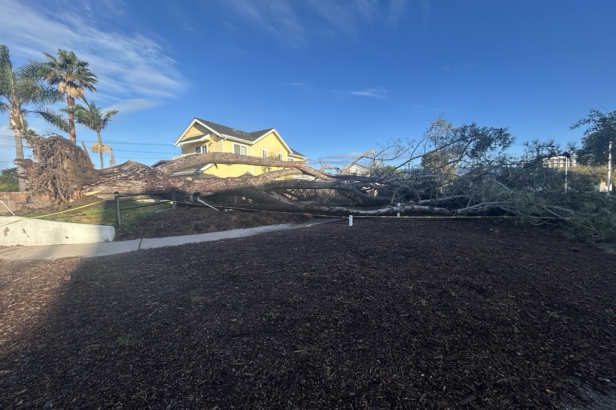
On Wednesday morning, remnants of the storm were apparent on roads and in yards. The City of Santa Barbara’s police department sent a notification asking people to avoid the 400 block of Garden Street due to extensive downed debris from the stormy night previous — debris that included scaffolding from the nearby housing project at 425 Garden Street, according to KEYT News. KEYT also reports a snapped power pole at Flora Vista on the Mesa, with power lines lying in back yards. And in Isla Vista, wind uprooted a tree at the end of Del Playa Drive. The tree, approximately 30 feet tall, missed a house by a few yards.
Check out a breakdown of this week’s storms by the numbers.
Wind
Around 12:40 a.m. Tuesday morning, residents of the Santa Ynez Valley receive a tornado warning. Residents were warned to take shelter in the basement or in an interior room on the ground floor of a structure. The National Weather Service said that radar showed a thunderstorm spinning, with the risk of becoming a tornado. The warning was lifted at 1:15 a.m.
Still, high winds blew throughout the county on Tuesday. Wind speeds hit 50 miles per hour at Ledbetter Beach on Tuesday night — at that speed the National Weather Service considers it “severe gale force.” At the historic Point Conception lighthouse farther north, winds reached 65 mph.
In North County, the National Weather Service recorded wind speed at 53 mph near Santa Maria.
Rain
It’s been a rainy “water year.” Santa Barbara County’s Flood Control District records its water year from September 1 to August 31. The district reports that countywide, the “normal-to-date” rainfall for the 2025–2026 year as of February 18 is 194 percent.
The storms earlier this week contributed to that percentage. In the past five days, the National Weather Service reports, Santa Barbara saw 1.56 inches of rain. Nearly two inches of rain fell in the Montecito foothills, and more than 3.5 inches in San Marcos Pass. Some mountain spots saw even more rain, with Tecolote Canyon recording 3.84 inches.
In the Santa Ynez Valley, Solvang recorded 2.6 inches of rain in the past five days and in North County, Santa Maria experienced 2.41 inches.
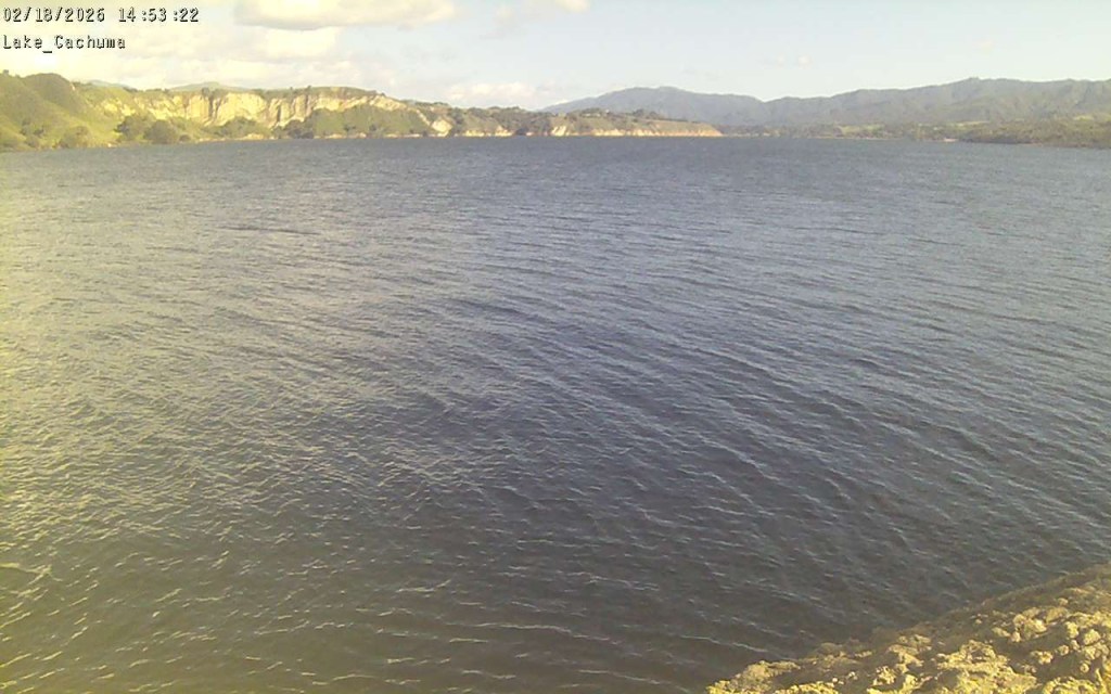
Reservoirs are full. Cachuma Reservoir, Gibraltar Reservoir, and Jameson Reservoir are all at or exceeding capacity, according to data from the county’s public works department. Public works does not provide capacity data for Alisal Reservoir.
What’s Ahead:
The National Weather Service said it expects more rain late Wednesday through Thursday with winds and brief, heavy downpours, but about a “notch” down in severity.


You must be logged in to post a comment.