
Zaca Fire Update
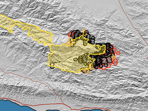
58% contained - 105,231 acres

Last Updated: August 15, 2007 8:00 am
Date/Time Started: July 4, 2007 10:53 am
Administrative Unit: Los Padres National Forest / Santa Barbara County Fire
County: Santa Barbara
Location: 15 miles NE of Buellton
Acres Burned: 105,231 acres
Containment: 58% contained – 105,231 acres. Full containment expected on September 7, 2007.
Structures Destroyed: 1 outbuilding destroyed
Threatened: 483 homes and 112 outbuildings threatened
Evacuations: Please call 805-961-5770 for current information on evacuations.
Injuries: 27
Cause: Human
Cooperating Agencies: Santa Barbara County Fire, Los Angeles County Fire, Ventura County Fire, California Highway Patrol, American Red Cross
Total Fire Personnel: 2,888 (846 CAL FIRE)
Fire crews: 73 (31 CAL FIRE)
Engines: 124 (15 CAL FIRE)
Airtankers: 10 (10 CAL FIRE)
Helicopters: 21
Dozers: 35 (8 CAL FIRE)
Water tenders: 71
Costs to date: $71.6 million
Major Incident Command Team: Unified Command
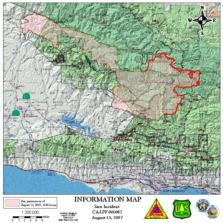
Conditions: The Paradise Road is under an evacuation warning, open to residents only. The Santa Ynez River Recreation Area remains under an evacuation order.
People looking north from the Santa Barbara area will see a huge towering column of smoke. This column results from active burning on the Zaca Fire. The actively burning area is in the Judell and Logan Canyon area, approximately 25 miles from the South Coast communities. The fire is burning away from the South Coast and represents no threat to these communities. Citizens can expect to see more of these columns as the interior of this fire continues to burn for the next week or more. There has been no movement toward the Santa Barbara area for several days and the southern edge of the fire is currently secure.
The evacuation order for residents of the Paradise Road community, Los Prietos Boys Camp, Paradise Store and the Rancho Oso Guest Ranch has been downgraded to an evacuation warning effective Sunday, August 12 at 7:00 p.m. The Lower Santa Ynez River Recreation Area campgrounds, day use areas and trailheads will remain closed.
PLEASE CALL 805-961-5770 FOR THE MOST CURRENT EVACUATION AND FIRE INFORMATION.
Phone Numbers: (805) 961-5770 (Zaca Fire Information)


