• CREATE AN ACCOUNT
  • LOG.IN
  • CONTENTS
  • CLASSIFIEDS
  • ARCHIVE
  • INFO | ADVERTISING | CONTACT US

  • Home
  • News
    • News Main Page
    • NewsFlash
  • A&E
    • A&E Main Page
    • Movie Times
    • TV Listings
    • A&E Blog
    • Art Galleries
    • Best Bets
  • Opinion
    • Opinion Main Page
    • Endorsements
    • Blogs
    • Columns
    • Voices
    • Letters
    • In Memoriam
    • Obituaries
  • Events
    • Today
    • Search
    • Submit
    • Best Bets
  • Living
    • Living Main Page
    • Outdoors
    • Travel
    • Sports
    • Peeps
  • Food & Drink
    • Food & Drink Main Page
    • All Restaurants
    • Delivery
    • All Bars & Clubs
    • Drink Specials
    • Open Now
  • Sports
  • Outdoors
    • Outdoors Main Page
    • Outside Insider
    • Spotlight On
    • Features
  • Classifieds
    • Real Estate
    • Jobs
    • Autos
  • Obits

    Ray Ford

    El Cap


    El Capitan State Park

    Though a state park, the beaches offer a secluded walk in either direction.


    Monday, November 19, 2007
    By Ray Ford (Contact)
    Article Tools
    Print friendly
    E-mail story
    Tip Us Off
    iPod friendly
    Comments
    Bookmark This
    del.icio.us. del.icio.us.
    Digg! Digg!
    furl furl
    google google
    newsvine newsvine
    reddit reddit
    technorati technorati
    Facebook Facebook
    Yahoo! My Web 2.0 Yahoo!

    BEACH WALK INFORMATION

    Distance—6 miles east to Haskell's Beach; 1.5 miles west to Corral Beach; 2.5 miles west to Refugio Beach

    Topo— Dos Pueblos Canyon & Tajiguas

    View Photo Gallery

    DIRECTIONS

    From Fairview Avenue in Goleta, follow Highway 101 west for 11 miles (20 miles from downtown Santa Barbara) to the El Capitan turnoff. A winding road leads down under the freeway to the beach. There are no parking areas outside the park so you’ll have to pay for day use.

    THE WALK

    There is ample area at the beach for picnicking and frolicking on the beach, as well as scores of overnight campsites. A bike path leads along the bluff tops from El Capitan to Refugio, providing a nice way to enjoy the coastline from above, either by bike or on foot.

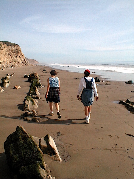
    The walk on the beach to Refugio is one of the most enjoyable you can do, with lots of quiet beach and secluded coves. To the east you’ll find El Cap Point, a favorite of surfers when the swell is strong enough for the waves to break here, and beyond the point, a mile long stretch of beach that is wonderful to explore.

    The beach front at El Capitan is so pleasant it is difficult to think of going anywhere else, but if you do you will find the beaches in either direction a wonderful treat. To the west you'll notice a half-mile long stretch of very inviting sand. It is a mile to Corral Beach and another to Refugio State Park. Along the way, there are several points which can be very tricky to get around when the tide is up (and fun too!). It is a four mile round trip if you follow the beach one way and return via the bike path, a very nice length for an extended walk.

    Down the coast is one of Santa Barbara's best beach walks, a six-mile trek which will take you along one of the most remote sections of coast you will find in Southern California. With a shuttle car left at Haskell's beach beforehand, this is the perfect walk. For a taste of what the walk is like, follow the path across El Capitan Creek and past the surfing area. A hundred yards of rocks lead to the bottom of the cove and from there you'll have nearly a mile of great walking to the next point.

    Story Help (Click-ability)
    Double-clicking on any word or phrase in this story will open a reference window with definitions and links to other reference material.

    Comments

    Discussion Guidelines

    Post a comment

    Username:
    Password: (Forgotten your password?)

    Comment:

    EVENT CALENDAR

    Previous Month | Next Month

    Today's Events Best Bets Submit an Event

    Local Weather

    Currently:
    Broken Clouds
    Temperature:
    55.0°
    Wind:
    5 ENE

    Surf Report
    • Specials
    • InPrint
    • Top Emails
    • Best Of 2009
    • 2009 Election Coverage
    • Wedding Guide 2009
    • Blue Green Guide 2009
    • SBIFF 2009
    • Tea Fire 2008
    • Local Heroes 2008
    • Calendar of Fundraisers
    • Local Bands
    • Within the Syuxtun Story Circle
    • Camellia Sasanqua
    • Whole New Ballgame
    • Gratuitous Gore on Highway 154
    • Saul Williams Brings Afro-Punk Tour to Velvet Jones
    • Where There’s a Dill, There’s a Way
    1. Travis Armstrong Is Outta There
    2. S.B. Bank & Trust's Rocky Year
    3. UC Campuses Dominate Rankings
    4. What buildings did architect Julia Morgan design in Santa Barbara?
    5. Rattlesnake and San Roque Side of Jesusita Trails to Re-Open Friday
    6. Sexile
    • CREATE AN ACCOUNT
    • LOG.IN
    • CONTENTS
    • CLASSIFIEDS
    • ARCHIVE
    • INFO | ADVERTISING | CONTACT US
    Google
     
    Independent.com Web
    Copyright ©2009 Santa Barbara Independent, Inc. Reproduction of material from any Independent.com pages without written permission is strictly prohibited. If you believe an Independent.com user or any material appearing on Independent.com is copyrighted material used without proper permission, please click here.
    This is our Privacy Policy.