Montecito Debris Flow Devastation Concentrated Along Creeks

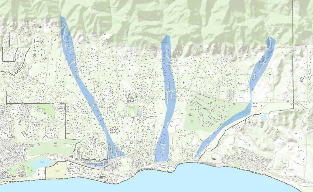
A new map created internally by emergency assessment teams and obtained by the Independent reveals where the worst of the devastation and death wrought by the Montecito mudslides was concentrated.
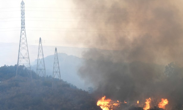
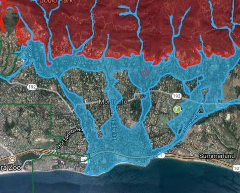
The bulk of the flash flooding and debris flows that killed at least 20 people and destroyed dozens of homes barreled along Montecito, San Ysidro, and Romero creeks. The map’s highlighted pathways ― which begin in the foothills just north of the community, snake all the way through town, and terminate at Highway 101 ― closely mirror those featured in a forecast map drawn last week that predicted where flash flooding and mudslides would occur.
Tom Fayram, Santa Barbara County’s deputy public works director, explained Saturday that debris flows tend to form over a large swath of upland terrain before tributaries focus them into narrower lanes. They then look for paths of least resistance, such as roads and creek beds, gathering volume and momentum along the way. The avalanches of mud and rock can steam downhill as fast as 35-40 miles per hour.
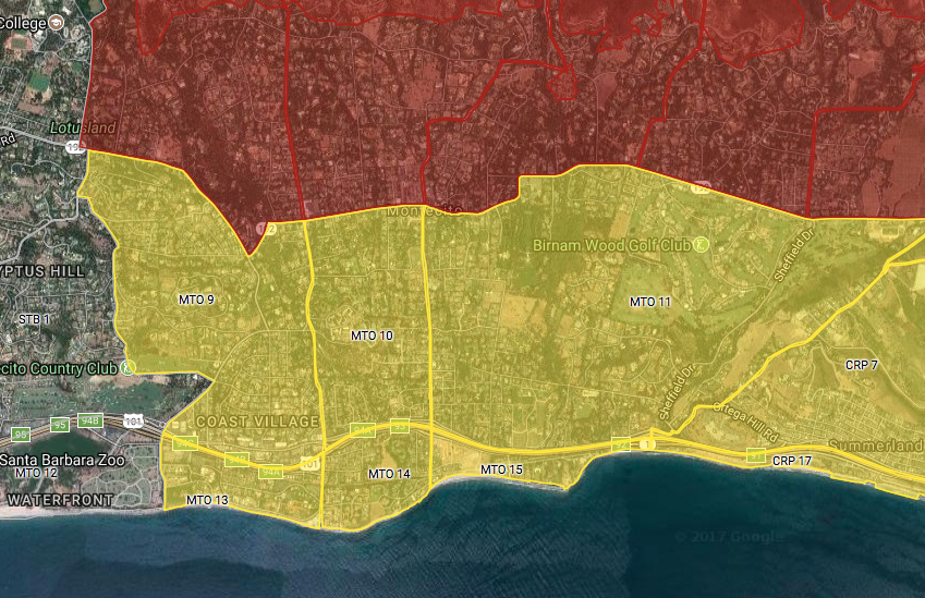
The Sunday before Tuesday’s storm, county officials announced mandatory evacuation orders for Montecito neighborhoods north of Highway 192. Voluntary evacuation advisories were issued south of the 192. The area’s topography and creek corridors did not appear to be reflected in the final evacuation zone mapping, which closely resembled evacuation maps created during the Thomas Fire.
Some of the homes and streets hit hardest in the mudslides lie below the highway, and several deaths occured in the voluntary areas near Montecito, San Ysidro, and Romero creeks. The family of Josie Gower, who lived in a voluntary zone on East Valley Road, wondered in a Los Angeles Times article why she wasn’t told to leave. “She lived next to a creek,” her son-in-law told Times reporters. “It must be hard for them to predict what’s going to happen, but it does seem like there’s been a huge mistake.”
Evacuation areas are created and enforced by the Santa Barbara Sheriff’s Office, which consults with scientists, emergency planners, and flood control experts to draw the final boundaries. All questions about the information and decision making that went into creating the maps used to protect Montecito residents from Tuesday’s storm are being referred to the department. No responses have been provided.