

For the first time in a week, with the marine layer over most of southern Santa Barbara County, it is almost possible to pretend that there really isn’t a fire above us in the mountains.
At this morning’s briefing at Dos Pueblos High School, however, incident commanders told the assembled troops that today would be a critical day on the west end of the fire. “We have a Haines Index of 6,” meteorologist Rich Thompson explained, “and we haven’t seen that on the Gap Fire yet.”
The Haines Index was developed in the 1980s as a measure of atmospheric stability for use in predicting the potential for wildfire growth. The index ranges from a low of “2,” which indicates moist, stable atmospheric conditions, to a high of “6,” indicating unstable conditions.
“It’s going to be a burn day,” another official said. “This fire has a lot of potential. Every fire is different, every day is different and today, every hour may be different. The quicker you can interpret any change in the fire behavior the safer you’ll be.”
Though activity on the fire line was minimal last night and almost all of the evacuations were lifted, by noon today firefighters expect the fire to turn to what one person termed “explosive conditions” with the potential for major uphill runs. Despite the cool temperatures along the coast, the marine layer extends just to the 1,500 foot level and above that highs in the upper 90s and low 100s will be the norm in the mountains today with the relative humidity dropping below 20 percent.
This translates to fuels that will be extremely dry, burn more easily, and possibly lead to runs that can overtake fire crews if they are not extremely vigilant. Safety Officer Rick Trembath reminded everyone of the Rattlesnake Fire in Northern California (1955) where 15 firefighters died when they were caught in a sundowner similar to what we have here. “They were taught to head downhill but they couldn’t outrun the flames that were being pushed downhill by the wind.”
While the number one priority on every fire is always firefighter safety, today’s emphasis is the result of a number of conditions: The fire is heading into rugged, steep terrain that is taking the crews further and further out into areas with fewer safe zones and escape routes; temperatures will be the hottest since the fire started; unstable atmospheric conditions mean shifting winds, much hotter burning, and the potential for major plume development; and spot fires may develop from one-third to one-half mile out from the fire activity.
It appears possible that many of the hard-fought gains of the past five days could be lost if today’s weather proves to be as potent as the forecasts predict. While there is no danger of the fire turning back and threatening those parts of Goleta that were evacuated earlier, should the fire breach the West Camino Cielo fuel break and move onto the north side of the mountains, this would expand the fire line dramatically.
Firefighters are looking at executing three plans today, all simultaneously.
First, they plan on going direct on the area near Condor Point. By late last night the fire had burned within a quarter mile of the point and was advancing into the upper end of Tecolote Canyon. With today’s hot weather and unstable air, if conditions are favorable they will attempt to fire out from the dozer line constructed in recent days out to the Point and from the West Camino Cielo fuel break.
This operation is considered critical because of the potential for the development of a massive plume that could send embers thousands of feet into the air and begin spot fires in all directions.
If needed, the crews along West Camino Cielo may shadow the fire west if it continues into upper Dos Pueblos Canyon and burn out toward the ocean as necessary.
Second, crews are out further west looking for what they call a “fallback plan” should the fire escape past Condor Point and head into Dos Pueblos Canyon. One potential is a ridge that drops down into Dos Pueblos Canyon just west of the Condor Point ridgeline. This might allow the dozers to cut a containment line down into Dos Pueblos Creek and then across the lower part of a historic footpath known as the Gato Trail and tie into crews in the lower foothills.
This is not what one would consider an optimal route, but given the sheer headwalls on the front side of the Santa Ynez Mountains just west of the Gato Trail, it may be the only option for their fallback plan.
Third, as their ultimate contingency line, crews are up in the Refugio area beginning the initial scouting, planning, and construction work needed for containing the fire at Refugio Road.
Additional hand crews and dozers are busy in the Dos Pueblos and Las Varas Canyon areas west of Goleta adding containment line along the upper parts of the canyons to protect structures in those areas.
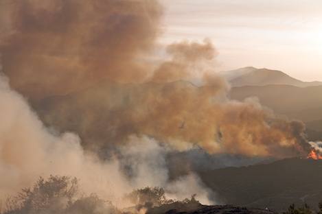
Currently, the fire is stalled out on the slopes leading up to Condor Point and in upper Eagle Canyon. Over the past few days, with relatively cool temperatures, favorable winds and moderate humidity, the fire has taken its time moving uphill.
Today with conditions that may be the worst since the start of the fire on July 1, firefighters will have their hands full.


