

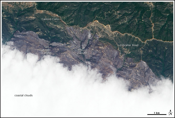
The Jesusita Fire had an stratospheric photo op, and that day was May 10, when the scientists at NASA snapped a picture of the Jesusita smoke and fire damage.
The Earth Observatory, a project of NASA sees its “mission is to share with the public the images, stories, and discoveries about climate and the environment that emerge from NASA research, including its satellite missions, in-the-field research, and climate models. Here is the link to the entire article (and fascinating website).
NASA image created by Jesse Allen, using EO-1 ALI data provided courtesy of the NASA EO-1 Team, and is described by team member Rebecca Lindsey:
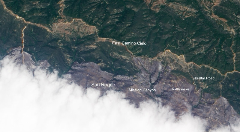
“This natural-color image from the Advanced Land Imager on the Earth Observing-1 (EO-1) satellite on May 10 shows the northern part of the burned area, which stretches from the outskirts of Santa Barbara (hidden beneath clouds) into Los Padres National Forest.
The image is roughly centered on Mission Canyon; investigators think the fire was started from power tools being used along the Jesusita Trail, between Mission Canyon and Roque Canyon, to the west. The burn scar appears grayish purple, and it stretches northward to the Camino Cielo highway that runs west to east across the top of the scene. Many valleys throughout the burned area appear to have been spared; green vegetation lines them like the veins in a leaf.”


