

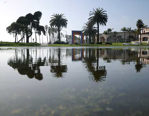
As you read this, the clouds have parted and that standard brand Santa Barbara sunshine has returned. After back-to-back-to-back El Niño flavored low pressure systems (riding a remarkably swift-moving and low-riding jet stream) slammed the south coast — basically making life for area residents either soggy or soaked or somewhere in between for the past six days straight — our reservoirs are near full, average annual rainfall totals have been surpassed from Goleta to Carpinteria with winter not even half over, and untold numbers of sandbags now weigh five times more than they did when people started filling them up at various city and county run stations late last week.
“Fun, wasn’t it?” quipped National Oceanic and Atmospheric (NOAA) weather specialist Bonnie Bartling as the rain began to sputter out on Friday. “That was the first weeklong event we have had for awhile. I think January 2005 was the last time we have seen anything like it.”
Luckily, unlike the tragic mudslides in La Conchita during the last full workweek washout, this series of rainmakers was mild when it came to damage. According to both city and county officials, no major mudslides, washouts, or debris flows were reported. Power outages were kept to a minimum, and there was never a need for evacuations despite the wildfire ravaged hillsides above much of Santa Barbara, Montecito, and Goleta; no serious weather-related injuries or fatalities were reported either.
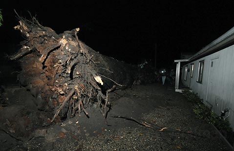
That being said, there were more than a few close calls, including a tornado touching down in Goleta on Tuesday, six large eucalyptus trees crashing down in rapid-fire succession along West Haley Street, more than a dozen boats washing up on beaches in Santa Barbara and Goleta, numerous fender benders, and one massive eucalyptus tree dropping in the night along the 1600 block of Sycamore Canyon Road that miraculously missed a home by only a few feet.
Other highlights of the storm include a dusting of snow on and around Figueroa Mountain and Painted Cave, several days straight of big waves for surfers (though often stormy and polluted), more than a few brilliant thunder and lightning shows, and an eight-inch pipe break at the city’s Sheffield Reservoir on Friday afternoon that sent a small wave of water flowing down toward nearby homes.
As far as rain totals go, the storms dropped more than five inches in downtown Santa Barbara, nearly nine inches in the Santa Ynez Valley, eight inches or so on San Marcos Pass, and about 10 inches at the Gibralter Reservoir. Speaking of reservoirs — according to Santa Barbara County statistics — after the recent run of rain, Gibralter is now 100% full, Cachuma and Jameson are both well over 70% capacity, and the Twitchell Reservoir has even started to fill. As an interesting aside, as wet and wild as this week was, just a few months ago on October 14 a one day rain event dropped 9.8 inches of rain on San Marcos Pass.
According to the National Weather Service, the high pressure responsible for our clear skies today should stick around for the weekend and into Monday. However, sometime after midnight on Monday, the chance of rain returns for at least a day or two, before clear skies prevail once again come mid-week. Though not expected to be anywhere near the rain we have seen in the past six days, the storm should be enough to make you bust out the umbrellas once again on Tuesday.


