


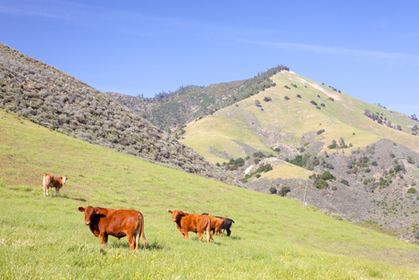
It is no accident that the Midland School area has a hike known as the Lover’s Loop. The foothills are grass-covered and studded with stately oak trees to stroll through, the ridges opening onto magnificent views over the Santa Ynez Valley and no matter where you hike at Midland there is always the ever-present backdrop of Grass Mountain to soothe the soul.
Highlights
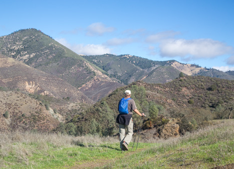
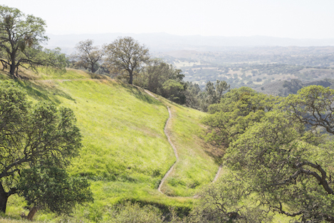
Lover’s Loop is a four mile hike that takes you through miles of lovely grass and oak-covered hillsides to views out over the lower valley, Grass Mountain, Zaca Peak and Figueroa Mountain. It is one of the best loop hikes you’ll find in Santa Barbara County. An excellent trail for hiker’s, trail runners and equestrians, with options to extend the loop by adding the upper trails on the west side of the ranch via Maple Canyon. Also serves as a nice out-and-back route to any one of the many viewpoints on the upper parts of the trail.
The Details
Difficulty: Moderate.
Length: 4 miles for the loop. Two miles to the high point on the trail out and back the way you went in.
Path: Good tread 2-3 feet wide with some narrow spots. Grasses along the trail may be high during the springtime.
Canine: Dog friendly. Be sure your dog interacts well with equestrians and consider keeping it on leash to avoid any issues.
Use: Hiking, Trail Running, Horseback riding, Photography. Mountain bikes are not allowed on any of the Midland School trails.
Requirements: Parking off of the paved road is on Midland School property. Please stop by the School to obtain a use permit (good for the season) before parking or pick one up at the trailhead. The permit should be visible on the dashboard of you vehicle.
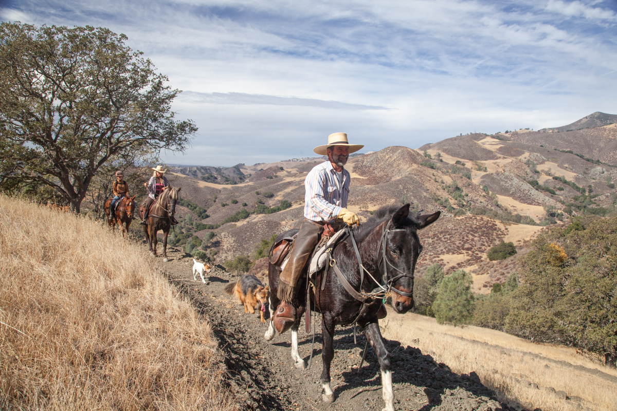
Equestrians: Must get your permit ahead of time and call in the day of your ride to get the combo for the gate if you would like to ride from the Green Gate parking lot.

On First Sight
When I first visited Midland School to talk about developing a network of trails for the school that would be open to the public, the ranch manager, Ben Munger, told me about one particular trail he wanted to see get built. “There’s this small side canyon we call Lover’s Lane that is really, really pretty,” he said. “There’s more or less a trail near it, mostly old cow paths, but no way to access it from the main trailhead.”
The first hike along what would become Lover’s Loop took me on starts from the main trailhead near Birabent Creek. This is the route most hiker’s use for access to Grass Mountain in the springtime when the steep, triangular-shaped peak is covered with golden poppies and blue-eyed lupines. Grass Mountain has always been open for hikes up the canyon to Grass Mountain if you register with the school first, but not much else in the way of trails for the public to use.
The Way to Lover’s Lane
We get on the trail as the light is coming up over the ridge above us. We’ve barely gotten a hundred yards up the trail to Grass Mountain when Ben pauses for a second. He points off to the right and up along a section of hillside and says, “If we can follow this old cow trail along the hill and continue above the road for a few hundred yards, I think we can connect in to a few other of the cow trails and make it to Lover’s Lane.” Thus begins an adventure that will take us half the day as we work our way across the hillside, through a series of incredibly beautiful grass and oak-covered slopes and eventually up to a ridgeline with expansive views leading right to the Lover’s Lane area.
For those of you who’ve traveled the Figueroa Mountain Road and gazed over as you pass by the entrance to Michael Jackson’s Neverland, more-than-likely you missed the turnoff to Midland School and probably didn’t realize that of the 1700+ acres the school owns, almost half of that is on the north side of the road, out of sight. Once you cross the creek and begin climbing towards Figueroa Mountain, everything on your left for the next three miles is owned by Midland School, including the small side canyon area Ben calls Lover’s Lane.
Over Hill and Dale
For the next hour past the Lover’s turnoff, Ben leads me through an absolutely wonderful selection of open meadows, oak forests, small side drainages and high country, ups and downs and ins and outs to a point where we reach an open area directly across from Grass Mountain. Magic. At times we follow cow trails; at others we work our way through chaparral thickets and or meandered off trail through the acres of grassy hillsides. Amazingly, through we are paralleling Figueroa Mountain Road perhaps a hundred feet of elevation below it, there is never a sense that we were near the road.
Just about the point that I wonder how we’d ever be able to loop down into the canyon and make our way back to the trailhead via Birabent Canyon, Ben points down into the bottom of a wide canyon filled with grass, a number of interesting looking rock formations and a possible way down to the creek, which was at least 400’ below us. “The cows know how to get down to the water,” Ben tells me and I begin following him down the side of the hill into the grasses and then a series of chaparral and pine forests where Ben picks up one of the trails the cows have used.
The way down is steep but passable. “The cows can smell the water,” Ben shouts back at me as he continues down one of the spots where they’ve obviously busted their way through the brush. After a quarter mile of working our way down into the canyon, the grade lessens and the trail begins to cut though more of the pine trees and eventually back into clusters of oak trees on the lower slopes.
Then one finally downhill section and we find ourselves walking along the edge of Birabent Creek. The flow in slow but steady and the sound very pleasant. Ben points out a small camp area that the school uses occasionally for overnights. Two hundred yards later we come to the intersection of Birabent Creek and Oak Creek, another small drainage coming in from the north. Inbetween is the route leading directly up to the face of Grassy Mountain and below a last half mile of easy hiking back to the trailhead.
What do you think?” Ben asks me when we get back to the trailhead. “Can we take these old cow trails and turn them into a trail?” “Thought you’d never ask,” I replied. “When can we start?”
From Dream to Reality
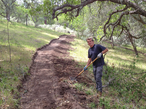
Work on the Lover’s Loop Trail began in April 2012. Thanks to the Santa Barbara County Trails Council, which had received a grant to support equestrian access to trails, the trail was opened a few months later, thanks to Ben, Midland School and a generous grant from the WWW Foundation for the trail construction.
4•1•1
For more detailed information about the Lover’s Loop Trail, including maps, KML files and photo galleries, check out the Santa Barbara Outdoors (SBO) website. Created by long-time outdoor expert and Indy Outdoor Editor Ray Ford, SBO is the place to go for information about where to hike, bike, ride or walk in Santa Barbara County.


