Rediscovering the Franklin Trail
Mountain Access Soon After a Half Century
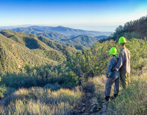

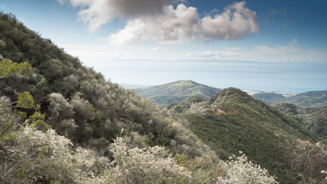
At the beginning of the 20th Century, as the newly-created Santa Barbara National Forest began to extend its influence, forest rangers began to work with local communities to connect them via trail into the backcountry. By 1910-20 a great number of trails had been constructed that linked the front country to the top of the mountain wall, including one very rugged route up a steep ridgeline behind the Carpinteria Valley called the Franklin Trail. Closed to the public in the 1970s, thanks to the help of a group of hard-working volunteers the trail may be open once again.
Background
The Franklin Trail provided access for decades for many an outdoor adventurer, hunter, fisherman and backcountry explorer for many decades until things began to change after World War II, especially as avocado ranching became more and more prominent. About the same time Carpinterians were first venturing over the Santa Ynez Mountains to explore the mysteries of the backcountry, Santa Barbara Judge R.B. Ord introduced the Mexican avocado to the area. By the 1950s a number of varieties were becoming commercially successful, among them the Fuerte and the Hass.
In Carpinteria, ranches such as those owned by the Franklin families and others began to change hands and this shift in ownership accelerated in the early 1970s when the Carpinteria Valley became a mecca for commercial flower growing. Over time a wide swath of valley land stretching along the base of the mountains from Santa Monica Canyon east to the County were developed either for avocados or nursery related businesses. By the mid 70s public access to the mountains ground to a halt and after the Romero Fire in 1971, brush rapidly closed in what was left of the upper parts of the Franklin Trail.

Discovering the Franklin Trail
“Let’s me crawl up through the brush and see if I can find the trail,” Gordon yells back at us as he scrambles up ahead, bear like for forty yards. I bend over and push the branches apart, to get a look myself. I can barely see him in the distance and can’t really see if we are still on the old trail or not.
Then I hear a shout. “Got it!” Gordon yells. “I can see the backslope up ahead.” Then he pushes some of the dirt aside and shouts back that he’s spotted the tread as well. “Yes!” I yell and motion to the sawyers to follow Gordon’s route up through the tangled ceanothus, chamise, chaparral pea and other brush that is so thick it has almost obliterated the trail.
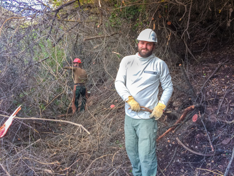
Gordon Jenkins is one of eight volunteers out with us today and he’s got the savvy to keep us locked on a historic trail — the Franklin — that a handful of Forest Rangers and hired crews from the Carpinteria area busted their butts to build just over a century ago. It’s been close to fifty years since anyone has hiked or ridden this trail and with no maintenance in between there are plenty of places like this where the only way through is on your belly.
Once I signal I’m OK with the route, the chainsaws come alive. We’ve got two hard-core young guys, Andy and Nicky Culbertson, on the saws — big ones with 28” bars and loads of power but in this tangled brush the going is still slow. By 10am we’ve gotten an hour’s work in, everyone’s warmed up and we’ve developed a slow-but-steady rhythm, with Gordon on the lead, Andy working the lead saw and Nicky following. After that come the rest of us. Our job is a simple one: get the brush out of the way and off the trail.
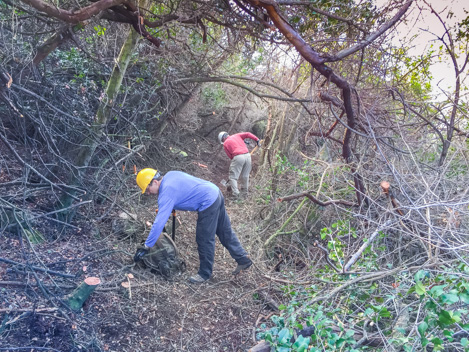
Fortunately we’ve got a great group with us today — most of us are old timers but still capable of putting in a good day’s effort. Besides Gordon, our other “animal,” as we like to call the guys who can pull the big branches out of the cut piles and toss them like matchsticks, is Nick. He’s an environmental planner with the City of Carpinteria and strong as an ox. While Nick and Gordon take turns pulling and tossing, the rest of us work on cleaning up the small stuff, cutting a bit of a tread to make it safe to walk through what was just cut. It’s a team effort all the way.
Slow Progress
Though we may still be on the historic route, brushing it out is a slow process. Overall, the Forest Service portion of the trail is 2.7 miles long and almost all of it is choked with brush, some live, some dead, most of it tilted across the trail corridor as gravity has caused it to lean over on the steep hillsides to the point that quite a bit of it creates a horizontal barrier that Nick and Andy must cut through.
The upper Franklin Trail is an interesting one in that of its 2.7 miles, almost 2.3 of that follow the west side of a major ridge with nary a switchback. Apparently those who built it were more concerned about getting to the top than in designing the trail to more sustainable standards. The result is a trail that is steeper in places than you’d want but the good news is that being on the west side of the ridge for the most part the sun doesn’t hit us until well past noon. That means cool mornings and a more enjoyable work environment.
Today is our 9th volunteer day working the Franklin Trail. There are days we move at what I’d call a brisk pace, cleaning out 300-400 yards of trail but on a typical day two hundred yards of progress is a really good day. On average, Andy and Nicky are up here with me several days a week, meaning that overall we’re close to having put in 20 days. Finally we’ve gotten to the point where we’re looking straight across at the final wall we’ll have to work our way up to get to the top. In terms of distance we’ve gained two miles and a thousand feet. But from here the last section seems almost vertical: .7 miles on the trail but another thousand feet in gain to reach the crest.
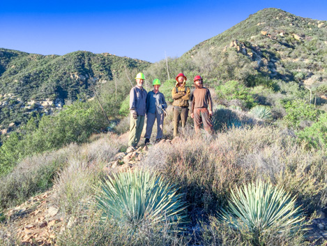
Along this section of the trail it has been difficult to know if we’re on it or gotten sidetracked a bit. The hillside here has slumped enough that spotting tread is a bit tricky. Finally, a yelp from Gordon tells us he’s found something. “Got it!” he shouts and we continue on. Towards the end of the day we reach a saddle that is overgrown enough that we decide to call it a day. Then someone spots a metal post entrenched in the hillside almost exactly along the route we’ve been cutting, evidence we are indeed still on the trail. It’s a good feeling we all have as we trudge back down the trail, a good day put in and another three hundred yards closer to the top.
On the Crest
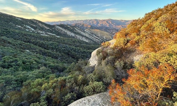
Over the next week Andy and Nick continue their assault on the crest and we creep along, working our way past the saddle up to the next corner, then the next and the next to the point that we are almost at the base of the last vertical section. The trail by now is obvious: cut through a series of sandstone layers jutting out of the ground, it’s clear that a large amount of dynamite has been used to blast out the path.
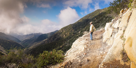
At one point we get to a massive rock outcropping the size of the Gibraltar climbing area. We’ve been wondering how we’d get around that and when we reach it we discover they’ve blasted out a 4-6’ wide section of solid sandstone to create the trail. Steping off the edge in places means a 40’ drop straight down; in others where the ledge slopes a bit more sloping would mean a 100’+ free fall. There are stories of horses that have been lost along here many years ago.
Above this is a series of switchbacks. Other than a short switchback just below us, these are the first we’ve encountered. According to the map there are seven of them and then the top. This seems a good place to stop, sit back and rest against the rock and enjoy the moment before we head back down.
On January 31st there are eleven of us volunteers heading up, our plan to make it to East Camino Cielo. By this point it is an hour and a half hike just to get to work site but by 10am we are at it once again, cutting, pulling, cleaning and then moving ahead. The switchbacks, it turns out, are easy pickings. The combination of steep hillside, rocky ground and poor soil have resulted in much thinner vegetation and best of all, much more chamise, which is much easier to brush out than the taller ceanothus.
By lunch time we’re close to the 6th switchback, which means if we’re right there’s only one last corner to turn and then one long straight away to the top. We make it by 2:30pm, with still enough energy left to celebrate the moment. Yes! It may not be ready for use yet but the goal of re-opening the historic Franklin Trail, once a major route into the upper regions of the Santa Barbara backcountry, is now much closer to becoming a reality.
Next Steps
Though the preliminary route along the upper Franklin Trail has finally been opened up, there is quite a bit that still needs to be done before it can be opened to the public. Next steps include environmental review, fund raising and then re-construction. All of these require support from the community. If you would like to contribute to the cause, please visit the Trails Council or Friends of the Franklin Trail websites to see how you can become involved or how to make a contribution.
4•1•1
For more detailed information about the Franklin Trail including links to additional information, photo galleries, maps, KML downloads and lots more, check out the trail blog on the Santa Barbara Outdoors (SBO) website. Created by long-time outdoor expert and Indy Outdoor Editor Ray Ford, SBO is the place to go for information about where to hike, bike, ride or walk in Santa Barbara County.
