

Many Santa Barbarans love the high country of the Sierra Nevada mountains, with its world-famous glacial valleys and otherworldly tall peaks, but far fewer have enjoyed the trail riches nestled in the slightly closer foothills. There, great backpacking opportunities open up just as the high country is closing down.
Two of the best trails in the Sierra foothills can be found less than four hours’ drive from Santa Barbara, along two major river corridors: the Wishon Trail along the Tule River in Sequoia National Forest, and the Ladybug Trail along the South Fork Kaweah River in Sequoia National Park. Both offer relatively easy, relatively under-the-radar hiking to rushing rivers, paradisiacal waterfalls, and towering sequoia redwood trees. What’s more, with thousands of dead trees now browning the landscape, the two watersheds also offer an unnerving but eye-opening education into the environmental stresses pressing upon our wildernesses, and the ambiguity of our role within them.
The Wishon Trail begins a quarter mile after a closed gate on Wishon Road east of Springville, just past Camp Wishon. Many flock to the natural water slides coursing down the river’s lower reaches, and access points can be found along this road. Thanks to these destinations, the Wishon Trail itself sits overlooked, with day-trippers venturing no further and other backpackers heading to the higher Summit and Maggie lakes trails on opposite sides of the Tule watershed. First traveled by the Tule river natives, the trail is a historical mining trail, used by prospectors in the mid-1800s to mine copper, galena, and limestone.
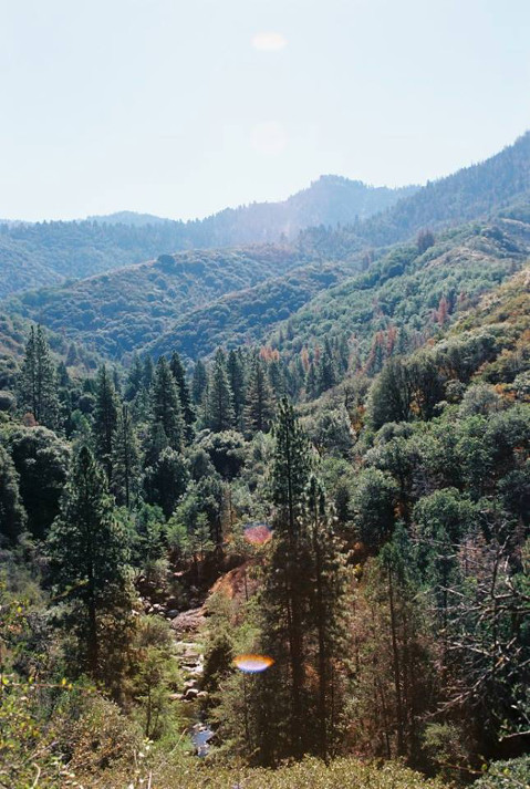
The hike begins from the pavement, switchbacking easily over some cabins below and entering pine forest. At 1.5 miles, the trail reaches a junction to Doyle Springs; continue toward the left, uphill. The trail proceeds with minor dips and gains in elevation but remains mostly level for its duration; the trail is hardly a climb. The path offers views into the Golden Trout Wilderness, where granite-topped peaks look down upon a vast forest of sequoia, ponderosa, sugar pine, and incense cedar, and below you, the last hints of the chaparral ecosystem transitions into a more coniferous one. The forest will be a mix of green and brown, living and dead, and the Wishon’s wide expanses offer sobering glimpses of a changing landscape.
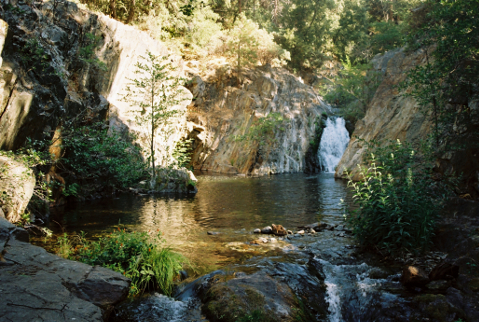
At around 2.5 miles, you reach Rose’s Grave, the first campsite and supposed burial site of William Rose, who died at his gold claim in 1879, according to historian Claud “Sonny” Rouch. Though his sons tried to transport him back home for a proper burial on the backs of burros, by day three his body had begun to decompose, and they selected this site, where a lovely swimming hole sits at a decently sized flat. However, hikers would do better to hike one more mile, where a pair of better sits overlook a sheltered nook along the river just south of an incredibly beautiful waterfall that spills out from jagged, multicolored cliffs. One can continue on for several more miles, entering the sequoia-stacked Mountain Home State Forest, and ever further up the Tule River; but for the purposes of our short trip, this waterfall location cannot be beat.
The Ladybug Trail in Sequoia National Park is similar to the Wishon Trail in that it is another relatively easy and short trip that moves from chaparral and blue oak woodland into pine-peaked waterfall worlds, but it’s slightly more difficult, and slightly more remote. Use caution on the rocky dirt road leading to the trailhead, which can be traversed by a two-wheel-drive sedan but not without some trepidation. Fourteen campsites make up the grounds of the South Fork Campground, and as far as trailhead camps go, this one is very nice, with easy access to the Kaweah River.
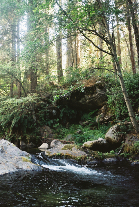
Beginning at 3,640 feet in elevation, you quickly cross a footbridge to neighboring nearby Clough Cave, which has been closed to prevent vandalism. You climb steadily and reach Bone Hill, a mountain not unlike the golden-grassed peaks of our own San Rafael Wilderness, and you may notice the landscape transitioning. Homer’s Nose, a massive rock dome perched above the South Fork Kaweah, shows itself for the first time at just over half a mile. In the summer and fall months, this can be an aggressively hot stretch, making Ladybug Camp’s arrival at 1.7 miles a very welcome site. Ladybug Camp sits next to a most gorgeous waterfall, where marbled metamorphic rock enshrines an emerald green pool. Most people end their journey here.
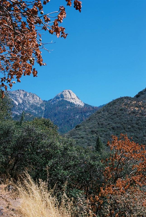
If you would like to continue on to a more secluded site, continue to either of the next two sites, Cedar Creek at 3.1 miles, or Whiskeylog Camp at 4. Following the Ladybug waterfall, you embark on one of the steeper climbs in the trip, first with a series of switchbacks and then a more gradual incline across grassy meadows. The mighty Kaweah River thunders below, and the views here are expansive, where in one vista you can see Homer’s Nose protruding gently skyward to the south, the marvelous Dennison Ridge bedecked with incoming autumnal colors, sequoia-strewn Garfield Creek merging with the Kaweah, and the vast river canyon leading eastward toward some of the Sierra’s highest peaks, just out of view. Once again, you get a sense of tree mortality, and the impermanence of the wilderness — before you lies an ecosystem undergoing dramatic shifts.
At 3.1 miles and 750 feet higher than Ladybug, you reach Cedar Creek, an idyllic and shady spot protected by the presence of massive sequoias with a lovely trickling stream. Depending on the season, this is also where you may get your first glimpse of the thousands of ladybugs that give the trail its name.
The last stretch of trail has a few ups and downs, descending just after Cedar Creek and regaining the elevation not long after — Cedar Creek and Whiskeylog are at more or less the same elevations. The extra effort feels a little annoying, but at just under a mile between the two camps, the last bit of push is not too much to bear. Soon, waterfalls and polished granite boulders come into view, and you arrive at the beautiful Whiskeylog Camp, where a stunning series of small waterfalls tumble like an unstrung jewel necklace underneath the girth of huge trees.
With only weeks left until the higher Sierra becomes impassable, these foothill and mid-elevation trails offer excellent escapes not too far from home, with abundant water and very few crowds. Though also a stark reminder of our planet’s fragile health, may they inspire you to pursue stewardship and preservation after you have soaked in waterfall solitude.


